Lake Macatawa facts for kids
Quick facts for kids Lake Macatawa |
|
|---|---|
 |
|
| Location | Ottawa County, Michigan |
| Coordinates | 42°46′44″N 86°10′47″W / 42.7788°N 86.1798°W |
| Primary inflows | Macatawa River |
| Primary outflows | Lake Michigan |
| Basin countries | United States |
| Max. length | 6 miles (9.7 km) |
| Max. width | 1.2 miles (1.9 km) |
| Surface area | 2.83 square miles (7.3 km2) |
| Average depth | 10 ft (3.0 m) |
| Max. depth | 34 ft (10 m) |
| Surface elevation | 581 ft (177 m) |
| Islands | None |
| Settlements | Holland, Michigan |

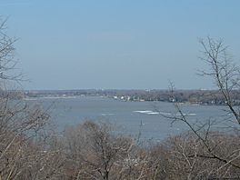
Lake Macatawa is a beautiful lake located in Ottawa County, in the U.S. state of Michigan. This lake is about 6 miles (9.7 km) long. It has a maximum width of 1.2 miles (1.9 km). The total surface area of the lake is about 1,700 acres (6.9 km²).
The average depth of Lake Macatawa is usually less than 10 feet (3 meters). However, there is a special navigation channel. This channel is much deeper. It allows large ships to travel across the lake. They can reach the docks in the City of Holland.
Contents
Discovering Lake Macatawa's Location
Lake Macatawa is found in a few different areas. It covers parts of Park Township. It also includes parts of Holland Township. Finally, a portion of the lake is within the City of Holland.
Exploring the Lake's Bays and Rivers
Lake Macatawa has two main bays. The largest one is called Big Bay. There is also a smaller bay named Pine Creek Bay. This smaller bay is located towards the eastern side of the lake.
The lake was formed from the mouth of the Macatawa River. This river used to be known as the Black River. The Macatawa River flows into the eastern end of the lake. Other smaller streams also feed into the lake. Pine Creek flows into Pine Creek Bay. Winstrom Creek flows into Big Bay.
How Water Leaves Lake Macatawa
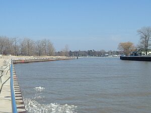
The water from Lake Macatawa eventually flows into Lake Michigan. This happens through a channel. The channel was built by the U.S. Army Corps of Engineers. This exit channel is located near Holland State Park. The lake and all the land that drains into it cover a huge area. This area is about 114,560 acres (463.6 km²). It includes parts of both Ottawa and Allegan counties.
What You Can Find Around the Lake
The eastern part of Lake Macatawa has some industrial areas. These are within the City of Holland. You might see a power plant there. There's also a place that recycles scrap metal. A research center owned by Michigan State University is also nearby. You can also find a dock where minerals are loaded. There's even a factory that makes pickles!
Most of the rest of the lake's shoreline is home to many houses. These are often large and beautiful homes. But there are also some public parks. Holland State Park is on the northern shore. It's located at the western end of the lake. Howard B. Dunton Park is on the north shore of the eastern end. Kollen Park is another park. It's close to the pickle factory. Kollen Park has a nice boardwalk. This boardwalk goes along the shoreline near the factory.
 | Percy Lavon Julian |
 | Katherine Johnson |
 | George Washington Carver |
 | Annie Easley |


