Lake Magog facts for kids
Quick facts for kids Lake MagogLac Magog |
|
|---|---|

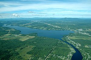
Aerial view of Lake Magog
|
|
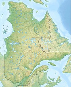
| Location | Memphrémagog Regional County Municipality, Estrie, Quebec |
| Coordinates | 45°18′11″N 72°02′35″W / 45.30306°N 72.04306°W |
| Lake type | Natural |
| Primary inflows | Magog River |
| Primary outflows | Magog River |
| Catchment area | 1,955.5 square kilometres (755.0 sq mi) |
| Basin countries | Canada |
| Max. length | 11.1 kilometres (6.9 mi) |
| Max. width | 2.09 kilometres (1.30 mi) |
| Surface area | 10.8 square kilometres (4.2 sq mi) |
| Average depth | 8.65 metres (28.4 ft) |
| Max. depth | 18.85 metres (61.8 ft) |
| Islands | 8 (all private), including 2 islets, as well as 2 shoals |
| Settlements | Sainte-Catherine-de-Hatley, Magog, Sherbrooke |
Lake Magog is a beautiful freshwater lake in the Estrie region of Quebec, Canada. It's surrounded by three towns: Sherbrooke, Magog, and Sainte-Catherine-de-Hatley. The lake sits in the Appalachian area. Its rocks are mostly sedimentary rock, like slate and sandstone. Lake Magog is part of a larger water system. Its water eventually flows into the St. Francois River, and then into the mighty St. Lawrence River.
Contents
How Lake Magog Works
This section explains how water moves in and out of Lake Magog. It also covers the lake's size and special features.
Lake Size and Water Flow
The area that collects water for the Magog River is huge, about 2,032 square kilometres (785 sq mi). Lake Magog itself is quite long, stretching about 11.1 kilometres (6.9 mi). It's also about 2.1 kilometres (1.3 mi) wide. The total surface area of the lake is 10.8 square kilometres (4.2 sq mi).
The deepest part of Lake Magog is 18.85 metres (61.8 ft) deep. On average, the lake is about 8.65 metres (28.4 ft) deep. Most of the water in Lake Magog comes from the Magog River. This river flows into Lake Magog from Lake Memphremagog. Several smaller streams also feed water into the river and the lake.
Dams and Water Control
There are four hydroelectric dams built near Lake Magog. These dams have two main jobs. First, they help create electricity for people to use. Second, they control the water level of the lake. Lake Magog is actually a reservoir, which means its water level is managed by these dams.
The most important dam is the one at Rock Forest, built in 1911. These dams change how quickly the water in the lake is replaced. They do this by controlling the flow of the Magog River.
Islands and Natural Areas
Lake Magog has eight islands, and they are all privately owned. Among these are two tiny islets. There are also two shoals, which were small islands in the past. Two of the islands were actually built by people. One is for a nautical club, and the other is the biggest island in the Marinier Archipelago. This group of islands is also known as the Odanak Islands.
At the southern end of the lake, there's a large marsh. It covers about 65 hectares (160 acres). This marsh is a great place for hikers to explore and enjoy nature.
 | William M. Jackson |
 | Juan E. Gilbert |
 | Neil deGrasse Tyson |


