Lake Monowai facts for kids
Quick facts for kids Lake Monowai |
|
|---|---|
 |
|
| Location | Southland District, Southland Region, South Island |
| Coordinates | 45°52′S 167°27′E / 45.867°S 167.450°E |
| Primary outflows | Monowai River |
| Basin countries | New Zealand |
| Surface area | 31 km2 (12 sq mi) |
| Surface elevation | 180 m (590 ft) |
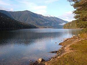
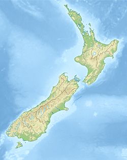
Lake Monowai is a big lake in the southern part of Fiordland National Park in New Zealand. It is officially called Monowai Lake. The Māori name for the lake is Manokīwai. The lake is about 120 kilometres northwest of Invercargill on the South Island.
Lake Monowai sits 180 metres above sea level. It is in a long, curved valley. On maps, the lake looks like the letter "U". The western side of the lake has beautiful mountains. The lake's water flows out through the short Monowai River in the northeast. This river then joins the Waiau River about eight kilometres away.
Powering Homes with Water
How the Monowai Power Station Works
The Monowai Power Station is one of the oldest hydroelectric power stations on the South Island. It uses the water from Lake Monowai to make electricity. Hydroelectric power means making electricity from moving water. The station opened in 1925. It is located where the Waiau and Monowai Rivers meet.
Protecting Lake Levels
In the 1970s, there were plans to make the lake level higher. This would have created even more hydroelectric power. However, a group of people started the "Save Manapouri campaign." They wanted to protect the natural beauty of the lakes. Because of this campaign, the New Zealand Labour government, led by Norman Kirk, stopped these plans.
An independent group was then created. It is called the Guardians of Lake Manapouri, Monowai, and Te Anau. Their job is to watch over and manage the water levels of these lakes. This helps to protect them for the future. You can find more information about this at Manapouri Power Station.
 | Ernest Everett Just |
 | Mary Jackson |
 | Emmett Chappelle |
 | Marie Maynard Daly |


