Lake Rotokawau (Aupouri Peninsula) facts for kids
Quick facts for kids Lake Rotokawau |
|
|---|---|
| Location | Northland Region, North Island |
| Coordinates | 35°01′07″S 173°12′20″E / 35.0187°S 173.2056°E |
| Type | peat |
| Catchment area | 46 hectares (110 acres) |
| Basin countries | New Zealand |
| Max. length | 430 metres (1,410 ft) |
| Max. width | 430 metres (1,410 ft) |
| Surface area | 17.2 hectares (43 acres) |
| Max. depth | 3.4 metres (11 ft) |
| Residence time | 18 months |
| Surface elevation | 39.6 metres (130 ft) |
Lake Rotokawau is a special type of lake found on the Aupouri Peninsula in the Far North area of New Zealand. It's known as a "dune lake" because it formed in the sandy hills (dunes) near the coast.
There are other lakes in New Zealand that also share the name Rotokawau. You can find them in places like the Kaipara District, the Chatham Islands, the Bay of Plenty, and near Lake Waikare in Waikato.
Contents
Where is Lake Rotokawau?
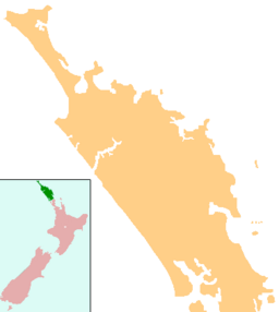
This particular Lake Rotokawau is located in the Northland Region. It's easy to find near Rotokawau Road, which is just off State Highway 1, north of the town of Kaitaia.
What's Around the Lake?
The land surrounding Lake Rotokawau is called its "catchment area." This is the area where rainwater flows into the lake. About 70% of this land is used for farming (pasture), and 30% is covered in scrub or planted forests.
Interestingly, Lake Rotokawau doesn't have any big rivers flowing into it or out of it. It mainly collects water from rainfall and groundwater.
Protecting the Lake
People are working hard to keep Lake Rotokawau healthy. The Bushland Trust, along with the Department of Conservation and the Northland Regional Council, are leading efforts to restore the lake.
"Restoration" means they are trying to bring the lake and its surroundings back to a more natural and healthy state. They are also doing this work for other nearby dune lakes, such as Lake Heather, Lake Rotoroa, Lake Ngatu, Lake Gem, and Lake Ngakapua.
What Does the Name Mean?
The name Rotokawau comes from the Māori people. In Māori, roto means "lake," and kawau means "cormorant." So, Rotokawau translates to "cormorant lake." Cormorants are a type of water bird often seen around lakes and rivers.
 | Victor J. Glover |
 | Yvonne Cagle |
 | Jeanette Epps |
 | Bernard A. Harris Jr. |


