Lanaken facts for kids
Quick facts for kids
Lanaken
|
|
|---|---|
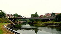
Zuid-Willemsvaart at Smeermaas
|
|
|
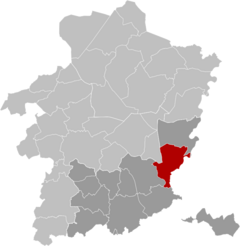
Location of Lanaken
|
|
| Coordinates: 50°53′N 05°39′E / 50.883°N 5.650°E | |
| Country | Belgium |
| Community | Flemish Community |
| Region | Flemish Region |
| Province | |
| Arrondissement | Tongeren |
| Government | |
| • Mayor | Marino Keulen (Open Vld) |
| • Governing party/ies | Open Vld, Vooruit-Groen |
| Area | |
|
• Total
|
58.95 km2 (22.76 sq mi) |
| Population
(2018-01-01)
|
|
|
• Total
|
25,818 |
| • Density | 440/km2 (1,100/sq mi) |
| Postal codes |
3620-3621
|
| NIS code |
73042
|
| Area codes | 089 |
| Website | www.lanaken.be |
Lanaken is a town in the Belgian province of Limburg. It is a municipality located right on the border with the Dutch city of Maastricht. In 2007, Lanaken had about 24,724 people living there. The area of the municipality is about 59 square kilometers.
Lanaken is known for its close ties to the Netherlands. Many people from the Netherlands have moved here. The municipality includes several villages. These are Lanaken itself, Rekem, Neerharen, Gellik, Veldwezelt, Smeermaas, and Kesselt. You can also find smaller areas like Briegden and Herbricht, and the historic village center of Oud-Rekem. An important ancient site, the Veldwezelt-Hezerwater Palaeolithic archaeological site, is also in Lanaken.
Contents
History of Lanaken
Lanaken has a long and interesting history. People have lived here for thousands of years.
Ancient Times in Lanaken
Archaeologists have found signs of early settlements in Lanaken. These include tools and remains from the Neolithic period (New Stone Age). There are also discoveries from the Roman and Merovingian times. For example, several Gallo-Roman cemeteries were found. In Smeermaas, there was a large Gallo-Roman villa.
Lanaken in the Middle Ages
During the Middle Ages, Lanaken was likely part of the Holy Roman Empire. From the 1100s, it became part of the Pietersheim area of Loon. The lords of this area founded the Abbey of Hocht around 1186. The local church was linked to the St. Servaas church in Maastricht.
Modern Lanaken Takes Shape
In 1808, the current town area was formed. It combined Lanaken with other smaller places. These included Smeermaas, Hocht, Pietersem, Ca(u)berg, Bessemer, and Briegden. In 1839, after the Belgian Revolution, Lanaken was split. Part of it became a Dutch area called Caberg.
Important waterways were built through Lanaken. The South Willemsvaart canal was built from 1824 to 1829. Later, the Briegden-Neerharen canal was built from 1930 to 1934. A railway line connecting Hasselt and Maastricht opened in 1856. However, passenger trains stopped running on this line in 1954.
Lanaken During World Wars
Lanaken faced challenges during both World Wars. On October 4, 1914, during World War I, German forces set fire to the center of Lanaken. This was partly because a Belgian volunteer group, led by Mayor Edgard de Caritat de Peruzzis, resisted them. The castles of the mayor and Alicebourg were also destroyed.
During World War II, on May 10, 1940, German planes bombed the barracks in Lanaken. This attack sadly killed Captain-Commander Henri Giddelo and five other soldiers.
Post-War Developments
In 1957, the Saint Barbara Hospital was built in Lanaken. It was created by the Limburg mines. Its main goal was to study and treat diseases related to mining, like dust lung. This disease affected many coal miners in the Kempen area.
On January 1, 1977, Lanaken merged with nearby municipalities. These included Gellik, Neerharen, Rekem, and Veldwezelt. This merger created the larger municipality of Lanaken we know today.
What's in a Name? The Etymology of Lanaken
The name Lanaken has old roots. It was first recorded as Ludinaca in 810. Later, in 1106, it was called Lodenaken. The name likely comes from a personal name, Hlodo or Ludo. The second part, haka, means "sand plate." So, Lanaken might mean "Hlodo's sand plate."
Nature and Landscape of Lanaken
Lanaken is a beautiful area with diverse landscapes. It sits on the southern edge of the Kempen Plateau. The Albert Canal separates it from the region of Haspengouw to the south. The Briegden-Neerharen Canal also cuts through the area.
Exploring Lanaken's Natural Beauty
Lanaken itself is about 60 meters above sea level. To the northwest, the land rises steeply to about 100 meters. Here, you can find deep valleys carved by brooks like Asbeek and Ziepbeek. This part of Lanaken is special because it is part of the Hoge Kempen National Park.
The park features marshy lowlands, open heaths, and dense forests. Many of the coniferous (pine) trees were planted long ago. They were used to provide wood for the mining industry. You can also find mixed forests here. Some of the most famous natural spots are Pietersembos and Asbroek. If you enjoy walking, you can start marked trails from Pietersheim Castle or near the Saint-Barbara Hospital.
Economy and Industry in Lanaken
Lanaken's economy grew thanks to its location and infrastructure. The canals and railway lines made it easier for people and goods to move. Many residents used to travel to Maastricht for work. Jobs were also available at the Eisden coal mine.
Major Industries in Lanaken
Several important factories were built in Lanaken. These included a paper factory, which is now called Sappi. There was also a rubber factory, now known as Hercorub. Another factory made synthetic fibers, called Celanese.
In 2006, four tall wind turbines were built. They are 100 meters high and provide electricity to the Celanese factory. Later, eight more wind turbines were added.
The South African company Sappi had a large paper mill in Lanaken. It was a major employer for the town's people. However, in October 2023, Sappi announced that they would close their facility in Lanaken.
Lanaken is also part of the Albert Canal Economic Network. This network includes 24 other towns along the Albert Canal. They work together to boost the economy in the region.
Transportation in Lanaken
Lanaken has seen changes in its transportation plans. The old railway line from Maastricht to Lanaken and then to Hasselt was planned to be reactivated. This was part of a Belgian plan called Spartacus. It was supposed to become a light rail system.
The project faced delays. It was first planned for 2014, then postponed to 2025. However, in June 2022, the tramway plan was canceled. Instead, an electric "trambus" was chosen. This new system began operations in 2024.
Famous People Born in Lanaken
- Eric Gerets (born 1954): A former professional football (soccer) player for Belgium. He was born in Rekem.
- Edgar Willems (1890–1978): An artist, musician, and music educator.
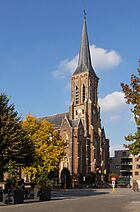
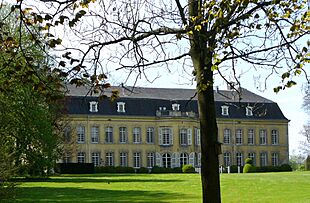
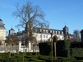
Gallery
See also
 In Spanish: Lanaken para niños
 | Jewel Prestage |
 | Ella Baker |
 | Fannie Lou Hamer |


