Lane, Kansas facts for kids
Quick facts for kids
Lane, Kansas
|
|
|---|---|

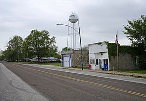
Kansas Avenue (2022)
|
|

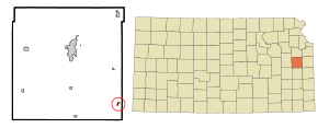
Location within Franklin County and Kansas
|
|

|
|
| Country | United States |
| State | Kansas |
| County | Franklin |
| Founded | 1855 |
| Incorporated | 1908 |
| Named for | James Lane |
| Area | |
| • Total | 0.24 sq mi (0.61 km2) |
| • Land | 0.23 sq mi (0.59 km2) |
| • Water | 0.01 sq mi (0.02 km2) |
| Elevation | 886 ft (270 m) |
| Population
(2020)
|
|
| • Total | 241 |
| • Density | 1,004/sq mi (395/km2) |
| Time zone | UTC-6 (CST) |
| • Summer (DST) | UTC-5 (CDT) |
| ZIP code |
66042
|
| Area code | 785 |
| FIPS code | 20-38400 |
| GNIS ID | 2395627 |
| Website | City info |
Lane is a small city located in Franklin County, Kansas, in the United States. In 2020, about 241 people lived there.
Contents
History of Lane, Kansas
The first temporary settlement near Lane began in 1838. Rev. Robert Simerwell started a Baptist Mission Station. It was on the south side of Pottawatomie Creek. This happened after the Potawatomie Trail of Death.
Later, in the mid-1840s, the government moved the Potawatomie people. The Baptist Mission also moved to the Kansas River valley. Brothers William, Peter, and "Dutch" Henry Sherman stayed behind. They became the first permanent settlers. People called the area "Dutch Henry's Crossing." This was because a wagon road crossed the creek near the Sherman family's cabin.
How Lane Got Its Name
The western part of Lane was first planned in 1855. It was called Shermanville then. In 1863, its name changed to Lane. It was named after James H. Lane. He was a leader of the Jayhawkers. This group worked to end slavery. James Lane was also one of the first Senators from Kansas.
Growth of Lane
In 1879, the Missouri Pacific Railroad came to the area. A new town called Emerson or Avondale started east of Kansas Avenue. It was a rival to Shermanville. But within two years, the two towns joined together. They became the single community of Lane. Lane officially became a city in 1908.
Lane is also near a historic site from 1856. The abolitionist John Brown and his followers were involved in a conflict there. This event is known as the Pottawatomie massacre.
Geography and Climate
Lane is a small city. The United States Census Bureau says it covers about 0.24 square miles (0.61 square kilometers). All of this area is land.
What is Lane's Climate Like?
Lane has a climate with hot, humid summers. The winters are usually mild to cool. This type of weather is called a humid subtropical climate. On climate maps, it is shown as "Cfa."
Population of Lane
| Historical population | |||
|---|---|---|---|
| Census | Pop. | %± | |
| 1880 | 166 | — | |
| 1910 | 272 | — | |
| 1920 | 351 | 29.0% | |
| 1930 | 291 | −17.1% | |
| 1940 | 234 | −19.6% | |
| 1950 | 200 | −14.5% | |
| 1960 | 282 | 41.0% | |
| 1970 | 254 | −9.9% | |
| 1980 | 249 | −2.0% | |
| 1990 | 247 | −0.8% | |
| 2000 | 256 | 3.6% | |
| 2010 | 225 | −12.1% | |
| 2020 | 241 | 7.1% | |
| U.S. Decennial Census | |||
Lane's Population in 2020
The 2020 United States census counted 241 people in Lane. There were 100 households and 64 families. Most people (88.8%) were white. A small number were black (1.66%) or Native American (0.83%). About 2.49% of the population was Hispanic or Latino.
About 37% of households had children under 18. Many households (43%) were married couples. The average household had 2.1 people. The average family had 2.9 people.
The median age in Lane was 44.1 years. About 20.7% of the people were under 18. And 20.3% were 65 or older.
Lane's Population in 2010
In the census of 2010, 225 people lived in Lane. There were 102 households. Most people (98.2%) were White. About 1.8% of the population was Hispanic or Latino.
About 23.5% of households had children under 18. Many households (47.1%) were married couples. The average household size was 2.21 people.
The median age was 45.1 years. About 21.8% of residents were under 18. And 15.1% were 65 or older. The population was almost evenly split between males (52%) and females (48%).
Education in Lane
Lane is part of the Central Heights USD 288 school district. The main office for this district is in Richmond. The school mascot for Central Heights is the Vikings.
Lane used to have its own schools. But they closed in 1965. This happened because schools were combined into larger districts. The mascot for the old Lane High School was the Lane Lions.
See also
 In Spanish: Lane (Kansas) para niños
 | Mary Eliza Mahoney |
 | Susie King Taylor |
 | Ida Gray |
 | Eliza Ann Grier |

