Largs, New South Wales facts for kids
Quick facts for kids LargsNew South Wales |
|||||||||||||||
|---|---|---|---|---|---|---|---|---|---|---|---|---|---|---|---|

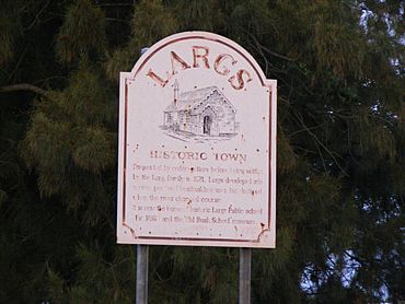
The sign at the entry to the town of Largs
|
|||||||||||||||
| Population | 1,940 (2016 census) | ||||||||||||||
| Postcode(s) | 2320 | ||||||||||||||
| Elevation | 3 to 40 m (10 to 131 ft) | ||||||||||||||
| Time zone | AEST (UTC+10) | ||||||||||||||
| • Summer (DST) | AEDT (UTC+11) | ||||||||||||||
| Location |
|
||||||||||||||
| LGA(s) | Maitland City Council | ||||||||||||||
| Region | Hunter | ||||||||||||||
| County | Northumberland | ||||||||||||||
| Parish | Maitland | ||||||||||||||
| State electorate(s) | Maitland | ||||||||||||||
| Federal Division(s) | Lyne | ||||||||||||||
|
|||||||||||||||
|
|||||||||||||||
Largs is a growing town next to Bolwarra Heights. It is a suburb in the City of Maitland, located in the Hunter Region of New South Wales, Australia. You can find Largs on the eastern side of the Hunter River, about 6 km north of the main part of Maitland.
The Maitland area is seeing new homes being built, especially on higher ground near the river. Maitland is a well-established city with schools and all the usual community services. The City of Maitland covers an area of 390 square kilometres.
Contents
What's in a Name?
Largs was named after a place called Largs in Ayrshire, Scotland. This Scottish town is famous for a big battle fought in 1263. This battle, called the Battle of Largs, helped Scotland gain its freedom from invaders from Norway.
A Look Back: History of Largs
The original people of the Maitland area are the Wonnarua people. They are the traditional owners and caretakers of this land.
Early Settlers and Industries
In the early days, Largs was settled by people who collected cedar wood. This was before the Lang family came to live here in 1821. Largs was an important place for trade and industry. It became a busy river port and a town where boats were built. This was before the Hunter River changed its path.
Largs Public School: A Long History
Largs Public School was started in 1838. It is a very special school because it has been open for the longest time without stopping, all from the same spot. It is also one of the oldest schools still running in all of Australia.
Exploring the Geography of Largs
Largs covers an area of about 7.72 square kilometres (2.98 sq mi). Most of the area is on the flat land near the Hunter River and Paterson River. These flat areas are called floodplains. The lowest parts of Largs are about 3 metres (9.8 ft) above sea level. The land then rises to small hills in the west, reaching a height of about 40 metres (130 ft).
Land Use and Nature
Most of the original plants and trees (from before 1760) have been cleared away. The floodplains are now used mainly for farming. Farmers use irrigation to grow crops like lucerne and vegetables. They also raise cattle and grow turf. The small hills in the west are where the town of Largs is located. Here you will find mostly homes and a few shops.
Different Landscapes
Largs has two main types of landscapes. The first type is the Hunter landscape group. These are large, flat plains made from river soil from the Hunter and Paterson Rivers. They are very flat, with a slope of less than 1%. Most of the tall forests that used to be here have been cleared.
The second type of landscape is the Bolwarra Heights group. These are rolling, low hills made from older rocks. They have slopes between 5% and 20%. The tall open forests that once grew here have also been cleared.
Climate in Largs
Largs has a humid subtropical climate. This means it has hot, humid summers and mild winters. It gets rain throughout the year.
Getting Around: Transport in Largs
Hunter Valley Buses runs one bus route that goes through Largs.
- Route 185: This bus goes from Maitland to Gresford. It passes through Bolwarra, Woodville, and Paterson along the way.
 | George Robert Carruthers |
 | Patricia Bath |
 | Jan Ernst Matzeliger |
 | Alexander Miles |


