Las Lomas, California facts for kids
Quick facts for kids
Las Lomas, California
|
|
|---|---|

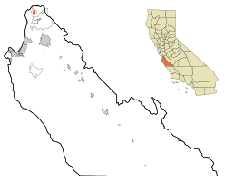
Location in Monterey County and the state of California
|
|
| Country | |
| State | |
| County | Monterey |
| Area | |
| • Total | 1.037 sq mi (2.686 km2) |
| • Land | 1.037 sq mi (2.686 km2) |
| • Water | 0 sq mi (0 km2) 0% |
| Elevation | 43 ft (13 m) |
| Population
(2020)
|
|
| • Total | 3,046 |
| • Density | 2,937.3/sq mi (1,134.0/km2) |
| Time zone | UTC-8 (Pacific) |
| • Summer (DST) | UTC-7 (PDT) |
| ZIP code |
95076 (Watsonville)
|
| Area code | 831 |
| FIPS code | 06-40592 |
| GNIS feature IDs | 1655082, 2408578 |
Las Lomas means 'The Hills' in Spanish. It is a small community in Monterey County, California, United States. It's called a census-designated place (CDP) because it's a community that the government counts for the census, but it's not officially a city or town.
Las Lomas is about 7 miles (11 km) north of Prunedale. It sits at an elevation of 43 feet (13 meters) above sea level. In 2020, about 3,046 people lived there.
Contents
History of Las Lomas
This community was once known by a different name: "Hall".
For many years, before 1981, the people of Las Lomas faced serious problems with their water. It wasn't safe to drink or use. To fix this, new sewer systems were built in 1981 and 1982. This project was possible because of money given by the federal government. A local leader, Marc Del Piero, helped get these funds.
Geography and Nature
Las Lomas is located in the northern part of Monterey County. You can find it along County Route G12, which runs between Prunedale and Pajaro.
A special natural area called the Elkhorn Slough is just south of Las Lomas. This slough is a 7-mile (11 km) long tidal estuary. An estuary is where fresh water from rivers mixes with salt water from the ocean. The Elkhorn Slough flows out into Monterey Bay.
The United States Census Bureau says that Las Lomas covers a total area of about 1.0 square mile (2.6 square kilometers). All of this area is land.
People of Las Lomas
| Historical population | |||
|---|---|---|---|
| Census | Pop. | %± | |
| 2000 | 3,078 | — | |
| 2010 | 3,024 | −1.8% | |
| 2020 | 3,046 | 0.7% | |
| U.S. Decennial Census | |||
Population in 2010
In 2010, the population of Las Lomas was 3,024 people. This means there were about 2,916 people living in every square mile.
The community is very diverse. Many different groups of people live here. About 89.2% of the people identified as Hispanic or Latino.
Most people in Las Lomas live in family homes. The average household had about 5 people living in it. Many homes had children under 18.
The ages of people in Las Lomas varied. About 33.1% of the population was under 18 years old. The median age was 27.7 years. This means half the people were younger than 27.7, and half were older.
Population in 2000
In the year 2000, there were 3,078 people living in Las Lomas. The population density was about 2,708 people per square mile.
About 83.92% of the people in Las Lomas were Hispanic or Latino.
Many households in 2000 had children under 18. The average household size was about 5.26 people.
The median age in 2000 was 26 years. This shows that Las Lomas has a relatively young population.
See also
 In Spanish: Las Lomas (California) para niños
 | Madam C. J. Walker |
 | Janet Emerson Bashen |
 | Annie Turnbo Malone |
 | Maggie L. Walker |


