
Limoza Island facts for kids

|
|

Limoza Island
Location in Antarctica

Limoza Island
Location in Antarctic Peninsula
|
|
| Geography | |
|---|---|
| Location | Antarctica |
| Coordinates | 62°59′40.6″S 56°16′27″W / 62.994611°S 56.27417°W |
| Archipelago | Joinville Island group |
| Length | 470 m (1,540 ft) |
| Width | 230 m (750 ft) |
| Administration | |
| Administered under the Antarctic Treaty System | |
| Demographics | |
| Population | uninhabited |
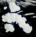
Limoza Island is a small, rocky island located near D'Urville Island in the Joinville Island group of Antarctica. It stretches about 470 meters (1,540 feet) from west to east and is 230 meters (750 feet) wide. This island is uninhabited, meaning no people live there permanently.
The island gets its name from the Limoza, an ocean fishing trawler. This ship belonged to a Bulgarian company called Ocean Fisheries – Burgas. The Limoza and other ships from this company fished in the waters around South Georgia, Kerguelen, the South Orkney Islands, South Shetland Islands, and the Antarctic Peninsula. They operated from the 1970s until the early 1990s. Bulgarian fishermen, along with those from the Soviet Union, Poland, and East Germany, were among the first to start modern Antarctic fishing.
Where is Limoza Island Located?
Limoza Island is found at 62°59′40.6″S 56°16′27″W / 62.994611°S 56.27417°W. It is about 1.5 kilometers (0.9 miles) north of D'Urville Island's coast. The island is also located:
- 10.98 kilometers (6.8 miles) east-southeast of Cape Juncal.
- 6.32 kilometers (3.9 miles) southeast of Harris Rock.
- 13.8 kilometers (8.6 miles) west-northwest of the largest of the Français Rocks.
British mappers created maps of this area in 1973.
Images for kids
-
An image showing D'Urville, Joinville, and Dundee Islands in Antarctica.
