Lino Lakes, Minnesota facts for kids
Quick facts for kids
Lino Lakes, Minnesota
|
|
|---|---|

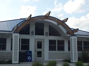
Lino Lakes Visitor Center
|
|
| Motto(s):
"A Community With A Vision"
|
|

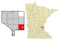
Location of the city of Lino Lakes
within Anoka County, Minnesota |
|
| Country | United States |
| State | Minnesota |
| County | Anoka |
| Organized | August 11, 1857 |
| Incorporated | May 11, 1955 |
| Area | |
| • Total | 33.21 sq mi (86.01 km2) |
| • Land | 28.22 sq mi (73.08 km2) |
| • Water | 4.99 sq mi (12.92 km2) |
| Elevation | 892 ft (272 m) |
| Population
(2020)
|
|
| • Total | 21,399 |
| • Estimate
(2022)
|
21,973 |
| • Density | 758.37/sq mi (292.81/km2) |
| Time zone | UTC-6 (Central (CST)) |
| • Summer (DST) | UTC-5 (CDT) |
| ZIP code |
55014/55038
|
| Area code(s) | Area code 651 |
| FIPS code | 27-37322 |
| GNIS feature ID | 2395725 |
Lino Lakes is a city in Anoka County, Minnesota, United States. In 2020, about 21,399 people lived there. It's located north of the Twin Cities area. Major highways like Interstates 35W and 35E pass through Lino Lakes, making it easy to get around.
Contents
History of Lino Lakes
When the first European settlers arrived, Native Americans already lived near the many lakes in this area. These lakes include Baldwin, Rice, Reshanau, and others. The Dakota people found plenty of wild rice and small animals here. There are also several Native American burial grounds in the area.
Around 1850, white hunters and trappers started coming to the area. Some families, like the Ramsdens and Wenzels, settled on the west side of the lakes. Other families, like the Cardinals and LaMottes, settled on the east side. Many of their family members still live in Lino Lakes today.
How Lino Lakes Got Its Name
People suggested many names for the new village, and most of them included the word "lakes." The exact meaning of the word "Lino" isn't fully known. A "Lino" post office was open for about 10 years in the late 1800s. Eventually, the town board decided to name the new village Lino Lakes.
On May 11, 1955, the Village of Lino Lakes officially became a town. It covered a large area of land and had about 1,800 citizens. In 1972, the state of Minnesota changed all villages into cities, so Lino Lakes became a city.
Early Government and Growth
The first local government in the area was the township of Centerville, formed on August 11, 1857. It covered 36 square miles. The population was less than 300 people. They lived in three main communities:
- The "German settlement" west of the lakes.
- The "Swede settlement" south of the lakes.
- The "French settlement" east of the lakes.
In the 1950s, nearby villages started taking parts of Centerville Township. To protect its borders and help pay for public improvements, the people of the township voted to become an official village.
Recent Events
On July 26, 2010, the Lino Lakes City Council decided that English would be the city's official language. This meant that all official city documents would be in English. The city would not pay to translate documents into other languages. Supporters said this would save money. However, some people felt it made the area seem less welcoming to those who speak other languages.
In 2024, a large housing project called Madinah Lakes faced some disagreements and was not built.
Geography of Lino Lakes
Lino Lakes covers about 33.21 square miles (86.01 square kilometers). Most of this area is land, but about 4.99 square miles (12.92 square kilometers) is water. In 2010, nearly half of the city's land was developed for homes and businesses.
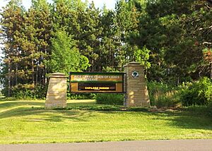
The Rice Creek flows through Lino Lakes. The city is also home to the Rice Creek Chain of Lakes Regional Park Reserve. This park is a great place for outdoor activities.
Population and People
| Historical population | |||
|---|---|---|---|
| Census | Pop. | %± | |
| 1860 | 351 | — | |
| 1870 | 687 | 95.7% | |
| 1880 | 876 | 27.5% | |
| 1890 | 1,134 | 29.5% | |
| 1900 | 1,175 | 3.6% | |
| 1910 | 1,028 | −12.5% | |
| 1920 | 740 | −28.0% | |
| 1930 | 704 | −4.9% | |
| 1940 | 745 | 5.8% | |
| 1950 | 1,219 | 63.6% | |
| 1960 | 2,329 | 91.1% | |
| 1970 | 3,692 | 58.5% | |
| 1980 | 4,966 | 34.5% | |
| 1990 | 7,807 | 57.2% | |
| 2000 | 11,791 | 51.0% | |
| 2010 | 20,216 | 71.5% | |
| 2020 | 21,399 | 5.9% | |
| 2022 (est.) | 21,973 | 8.7% | |
| U.S. Decennial Census 2020 Census |
|||
Population in 2010
In 2010, Lino Lakes had 20,216 people living there. There were 6,174 households. The city had a population density of about 516 people per square mile.
Most of the people in Lino Lakes were White (about 94%). There were also smaller groups of African American, Native American, and Asian residents. About 2.7% of the population was Hispanic or Latino.
Many households (48.1%) had children under 18 living with them. Most families (73.2%) were married couples. The average household had about 3 people. The average age of people in Lino Lakes was about 37 years old.
Education in Lino Lakes
Students in Lino Lakes attend public schools run by two different school districts:
- The Centennial School District
- The Forest Lakes School Area
Some of the elementary schools in Lino Lakes include:
- Blue Heron Elementary
- Lino Lakes Elementary
- Pine School
- Rice Lake Elementary
Notable People from Lino Lakes
- Chris Anderson — A player in Minor League Baseball.
- Gabbie Hughes — A player in the Professional Women's Hockey League and for the United States women's national ice hockey team.
- Tyler Pitlick — A player in the National Hockey League for the Dallas Stars. He was chosen by the Edmonton Oilers in the 2010 NHL Entry Draft.
- Pat Shortridge — The former leader of the Republican Party of Minnesota.
See also
 In Spanish: Lino Lakes (Minnesota) para niños
 | Claudette Colvin |
 | Myrlie Evers-Williams |
 | Alberta Odell Jones |


