Rice Creek (Mississippi River tributary) facts for kids
Quick facts for kids Rice Creek |
|
|---|---|

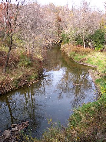
Rice Creek in Fridley
|
|
| Country | United States |
| Physical characteristics | |
| Main source | Clear Lake, Forest Lake, Minnesota 890 ft (270 m) |
| River mouth | Mississippi River, Fridley, Minnesota 806 ft (246 m) |
| Length | 28 mi (45 km) |
| Basin features | |
| Basin size | 201 sq mi (520 km2) |
Rice Creek is a cool stream that flows into the Mississippi River. It's located in the northern suburbs of the Minneapolis-St. Paul area in Minnesota, United States. This creek is about 28 miles (45 km) long. It collects water from a large area called a watershed, which is about 201 square miles (521 km2).
Contents
The Journey of Rice Creek
Rice Creek starts its journey at Clear Lake in Forest Lake. This is in Washington County. From there, it flows mostly southwest. It passes through Anoka and Ramsey Counties.
The creek flows through many cities, including:
It finally joins the Mississippi River in Fridley. This spot is at Manomin County Park. The creek drops about 84 feet (26 meters) from its start to its end. Most of this drop happens closer to where it meets the Mississippi River.
Parks and Trails Along the Creek
In Anoka County, Rice Creek flows through many lakes. This area is known as the Lino Lakes Chain of Lakes. Part of this chain is protected in the Rice Creek Chain of Lakes Regional Park Reserve. This is a big park managed by Anoka County.
In New Brighton, the creek goes through Long Lake. Long Lake Regional Park is right next to it. Ramsey County takes care of this park. In Fridley, you can find the Rice Creek West Regional Trail. This trail is great for biking and hiking. It runs alongside the lower part of the creek.
Other Streams Joining Rice Creek
Rice Creek has two main streams that flow into it. They are called tributaries.
- Hardwood Creek collects water from about 44 square miles (114 km2). It flows through Hugo, Forest Lake, and Lino Lakes.
- Clearwater Creek is about 8.33 miles (13.4 km) long. It drains an area of about 62 square miles (161 km2). This creek flows through White Bear Lake, White Bear Township, Hugo, Lino Lakes, and Centerville.
Both of these important tributaries join Rice Creek in Anoka County. They become part of the chain of lakes there.
The Story Behind Rice Creek's Name
Rice Creek has an interesting history behind its name. It was named after Henry Mower Rice. He was one of the first U.S. Senators for Minnesota when it became a state. Henry Mower Rice bought a lot of land near the creek in 1849.
The Dakota people had their own name for the creek. They called it "Psin ta wak pa dan" or Psiŋta wakpadaŋ. This means "Wild Rice Rivulet." The Ojibwe language also had names for it. One was "Ottonwey River" or Atoonowe-ziibi, meaning "River for making Canoes." Another Ojibwe name was "Manominikan Sibi" or Manoominikaan-ziibi. This means "river full of wild rice." Wild rice used to grow a lot in the lakes of this area.
An explorer named Joseph Nicollet wrote about the creek. He said it was about 30 feet wide. He noted its beautiful white lilies. He also mentioned that the Sioux people gathered their yearly wild rice there. The name "Manomin" (wild rice) was also used for the old Manomin County. This county later became part of Anoka County. Today, part of it is the city of Fridley, where Rice Creek meets the Mississippi River.
Ancient History Along the Creek
People have lived near Rice Creek for a very long time.
- Archaeologists have found proof that ancestors of the Sioux people hunted and fished near Bald Eagle Lake. This was around 2000 B.C. They even had a summer village in what is now Centerville.
- There are also burial mounds near Centerville Lake. These mounds were likely built by people of the Mississippian culture. They arrived in the area around the year 1400.
The Rice Creek Watershed Area
The Rice Creek watershed is the entire area of land where water drains into Rice Creek. It covers parts of four different counties in Minnesota:
- Anoka County - 76 square miles (197 km2)
- Hennepin County - less than 0.1 square miles (0.2 km2)
- Ramsey County - 48 square miles (124 km2)
- Washington County - 77 square miles (199 km2)
Cities and Towns in the Watershed
The watershed includes parts of many cities and towns:
- Arden Hills
- Birchwood
- Blaine
- Centerville
- Circle Pines
- Columbia Heights
- Columbus
- Dellwood
- Falcon Heights
- Forest Lake
- Fridley
- Grant
- Hugo
- Lauderdale
- Lexington
- Lino Lakes
- Mahtomedi
- May Township
- Mounds View
- New Brighton
- Roseville
- St. Anthony
- Scandia
- Shoreview
- Spring Lake Park
- White Bear Lake
- White Bear Township
- Willernie
Lakes and Wetlands in the Area
About 10% of the watershed is covered by lakes. That's about 19 square miles (49 km2)! The biggest lakes are:
- White Bear Lake (2140 acres or 8.66 km2)
- Bald Eagle Lake (1046 acres or 4.23 km2)
There are 28 lakes in the watershed that are larger than 100 acres (0.4 km2). Also, about 13% of the watershed is made up of wetlands. This is about 26 square miles (67 km2).
The Rice Creek Watershed District
The Rice Creek Watershed District was created in 1972. Its goal is to "conserve and restore the water resources of the District." This means they work to protect and improve the water for people now and in the future. It's a government group. A Board of Managers runs it. These managers are chosen by the county commissions of Anoka, Ramsey, and Washington Counties.
 | Selma Burke |
 | Pauline Powell Burns |
 | Frederick J. Brown |
 | Robert Blackburn |


