
National Register of Historic Places listings in Sussex County, New Jersey facts for kids

Welcome to Sussex County, New Jersey! Did you know that many places here are super old and important? They are so special that they are listed on the National Register of Historic Places. This is like a special list of buildings, areas, and sites across the United States that are worth protecting because of their history. Let's explore some of these cool spots in Sussex County!
Contents
Amazing Historic Places to Discover
Unique Buildings and Structures
The Backwards Tunnel
Imagine a tunnel that seems "backwards"! The Backwards Tunnel in Ogdensburg was built way back in 1871 for the Midland Railroad. It's called "backwards" because the part of the tunnel for the Wallkill River is actually wider than the part for the road. It's a neat piece of engineering history!

Crescent Theatre
Step back in time at the Crescent Theatre in Sussex. This theater opened in 1917 and quickly became a central gathering spot for the community. It was even one of the first places in the region to show movies with sound in 1929! Today, it's still used by the Tri-State Theater Company.

Bethany Chapel
In Hamburg, you can find the Bethany Chapel, a beautiful stone church built in 1869. It's a great example of the architecture from that time.

First Presbyterian Church of Wantage
The First Presbyterian Church of Wantage near Sussex has a long history. Its congregation started in 1787, making it one of the earliest in the area. The church building itself was built in 1829.

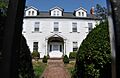
Lawrence Mansion
The Lawrence Mansion in Hamburg is a grand house built in 1841. It's designed in the Greek Revival style, which was popular back then, looking a bit like ancient Greek temples. Today, it's used for businesses.

Old Monroe School House
Imagine going to school in the Old Monroe School House in Monroe! This building, listed in 1977, gives us a peek into what education was like many years ago.

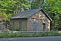
Plaster Mill
The Plaster Mill in Stanhope is another interesting old building. Mills like this were important for grinding materials, and this one shows us how people worked and lived in the past.

Casper and Abraham Shafer Grist Mill Complex
In Stillwater, you can visit the Casper and Abraham Shafer Grist Mill Complex. A grist mill is where grain was ground into flour. This complex tells the story of how food was processed long ago.
_from_SE_1.jpg)
Sterling Hill Mine
The Sterling Hill Mine in Ogdensburg is a super cool place! It's now the Sterling Hill Mining Museum. This mine was famous for its unique glowing minerals. It's a great spot to learn about geology and mining history.

Stockholm United Methodist Church
The Stockholm United Methodist Church in Stockholm was listed as a historic place in 1976. It's a significant part of the local community's history.

Sussex County Courthouse
The Sussex County Courthouse in Newton is an important building where legal matters for the county are handled. It was built in 1847 and is a key part of the town's historic center.
,_Newton,_NJ.jpg)
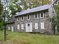
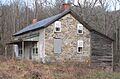
Elias Van Bunschooten House
The Elias Van Bunschooten House near Sussex is another old home that has been preserved. It gives us a glimpse into how people lived centuries ago in New Jersey.

Historic Districts and Areas
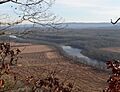
High Point State Park
High Point State Park is a large and important area that includes the highest point in New Jersey! It's roughly located between the New Jersey-New York state line and State Highway 23. This park is not just beautiful, but also historically significant.

Hill Memorial
The Hill Memorial in Newton is now home to the Sussex County Historical Society. This means it's a place where you can learn even more about the history of Sussex County!

Lafayette Village Historic District
The Lafayette Village Historic District includes parts of NJ 15, Morris Farm Road, and Meadows Road in Lafayette Township. This area has many old buildings that show what a historic village looked like.

Log Cabin and Farm
Near Branchville, there's a Log Cabin and Farm that was listed in 1977. The log cabin itself was even moved to a new spot within the county in 1989 to keep it safe.

Morris Canal
The Morris Canal is a very long historic waterway that once stretched across New Jersey, from Phillipsburg to Jersey City. Parts of it run through Sussex County. Canals were like highways for boats, helping transport goods a long time ago.

Newton Town Plot Historic District
The Newton Town Plot Historic District in Newton covers several streets like Church, High, Main, Moran, and Spring Streets, plus Park Place. This area was planned out in 1762 and still has many old buildings that show the town's history.

Old Mine Road Historic District
The Old Mine Road Historic District is a very old route that goes through Sussex County. It includes NJ 521, Delaware, Old Mine, and River Roads. This road was used for centuries, even by early European settlers and Native Americans.
.jpg)
Peters Valley Historic District
The Peters Valley Historic District in Sandyston Township includes Bevans, Walpack, and Kuhn Roads. It's a historic area that shows what life was like in a rural community.

Wallpack Center Historic District
The Wallpack Center Historic District in Walpack Township is centered around Wallpack Center Road. This historic village has preserved many of its old buildings, making it feel like a step back in time.

Waterloo Village
Waterloo Village near Andover is a restored 19th-century canal town. It's a living history museum where you can see what life was like when the Morris Canal was busy. It's a great place to explore and learn!

White Deer Plaza and Boardwalk District
The White Deer Plaza and Boardwalk District in Sparta is located around White Deer Plaza, Winona Parkway, and West Shore Trail at Lake Mohawk. This area is known for its unique architecture and its connection to the history of Lake Mohawk.

Images for kids
-
The Foster–Armstrong House in Montague Township.
-
The Cornelius Gunn House.
-
Harmony Hill United Methodist Church.
-
High Breeze Farm.
-
The Richard Layton House.
-
Meadowburn Farm.
-
The Henry W. Merriam House.
-
Minisink Archeological Site.
-
Old Monroe School House.
-
The Shoemaker-Houck Farm.
-
The Andrew Snable House.

.JPG)
_4.jpg)

.JPG)


.JPG)

