
List of highways in Hamilton County, New York facts for kids

Standard route marker for county routes in Hamilton County
|
|

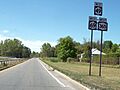
Hamilton County's road system, which mainly consists of state touring routes
|
|
Quick facts for kids Highway names |
|
|---|---|
| Interstates: | Interstate X (I-X) |
| County: | County Route X (CR X) |
| System links | |
| Numbered highways in New York Interstate • U.S. • N.Y. (former) • Reference • County |
|
Imagine a giant network of roads that helps people travel all over Hamilton County, New York! This network is called the highway system. It includes about 474.5 miles of roads. These roads are taken care of by different groups: the New York State Department of Transportation (NYSDOT), the county, and local towns and villages.
NYSDOT looks after five main state routes in Hamilton County. These routes cover about 178.7 miles of New York's state highways. Besides these, Hamilton County also has its own system of 25 county routes. These county roads, which are about 94.5 miles long, connect the state routes to many small towns and interesting places.
Hamilton County is the least populated county in New York State. Its five state routes spread out across the whole area. These routes are NY 8, NY 10, NY 28, NY 28N, and NY 30. The longest one is NY 30, which goes for about 83.72 miles from the Fulton County line in the south to the Franklin County line in the north.
These five state highways mostly go through quiet, rural parts of Adirondack Park. In fact, the only village you'll find along any of these roads is Speculator. This village is where NY 8 and NY 30 meet. NY 10 and NY 28 were first given their numbers in 1924. The other routes got their numbers in 1930.
Contents
NY 8

NY 8 is a long state highway, stretching over 200 miles! It starts in Deposit and ends near Lake George. The part of NY 8 that runs through Hamilton County is 43.30 miles long. It mostly goes through quiet, rural areas.
NY 8 enters Hamilton County from Herkimer County near Piseco. It then leaves the county for Warren County east of Wells. Along the way, NY 8 meets the end of NY 10 in Arietta.
This route is also one of two state roads that pass through the small village of Speculator. The other is NY 30. In Speculator, NY 8 and NY 30 share the same road for about 10 miles, heading east to Wells. NY 8 got its number in 1930 and hasn't changed in Hamilton County since then.
- Major intersections
Here are the main intersections along NY 8 in Hamilton County:
| Location | Mile | Roads intersected | Notes | |
|---|---|---|---|---|
| West county line | 0.00 | Continues into Herkimer County | ||
| Arietta | 15.54 | |||
| Speculator | 27.75 | Southern terminus of overlap with NY 30 | ||
| Wells | 37.44 | Northern terminus of overlap with NY 30 | ||
| East county line | 43.30 | Continues into Warren County | ||
| 1.000 mi = 1.609 km; 1.000 km = 0.621 mi | ||||
NY 10

NY 10 is the shortest state route in Hamilton County. It's about 14.51 miles long. Its only intersection in the county is where it ends at NY 8. NY 10 starts at the Fulton County line north of Caroga Lake. It then travels north to Arietta, where it meets NY 8.
This route goes through very rural areas of Hamilton County. You won't find any villages or major towns along its path until you reach Arietta. When NY 10 was first created in 1924, it followed a different path. It used to go through what is now NY 28N and NY 30. Around 1960, NY 10 was shortened. Part of its old path became part of NY 30.
- Major intersections
Here are the main intersections along NY 10 in Hamilton County:
| Location | Mile | Roads intersected | Notes | |
|---|---|---|---|---|
| South county line | 0.00 | Continues into Fulton County | ||
| Arietta | 14.51 | |||
| 1.000 mi = 1.609 km; 1.000 km = 0.621 mi | ||||
NY 28

NY 28 is a very scenic road, about 49.08 miles long in Hamilton County. It starts at the Herkimer County line and goes to the Warren County line near Blue Mountain Lake. As you drive away from the western county line, NY 28 follows the beautiful Fulton Chain Lakes.
At Blue Mountain Lake, NY 28 meets NY 30. This is also where NY 28N, a special branch of NY 28, begins. From here, NY 28 and NY 30 travel together for over 10 miles southeast into Indian Lake. In Indian Lake, NY 30 turns off and heads south. NY 28 was first assigned in 1924. It was extended into Hamilton County in 1930 and its number has stayed the same since then.
- Major intersections
Here are the main intersections along NY 28 in Hamilton County:
| Location | Mile | Roads intersected | Notes | |
|---|---|---|---|---|
| West county line | 0.00 | Continues into Herkimer County | ||
| Hamlet of Blue Mountain Lake | 25.73 | Western terminus of overlap with NY 30 | ||
| Indian Lake | 36.93 | Eastern terminus of overlap with NY 30 | ||
| East county line | 49.08 | Continues into Warren County | ||
| 1.000 mi = 1.609 km; 1.000 km = 0.621 mi | ||||
NY 28N

NY 28N is a special branch of NY 28. It's the only state route that actually starts within Hamilton County itself. About 19.66 miles of its total 51-mile length are in Hamilton County. This is roughly 40% of the entire route!
The route begins at a meeting point with NY 28 and NY 30 in Blue Mountain Lake. NY 28N then travels north with NY 30 through the mountains of Hamilton County to Long Lake. Here, NY 30 turns off and heads towards Franklin County. From Long Lake, NY 28N goes east, passing more mountains before entering Essex County and continuing to Newcomb.
NY 28N was created in 1930 as a branch of the longer NY 28. The part of the road that goes from Blue Mountain Lake to Long Lake used to be part of NY 10. Around 1960, NY 10 was shortened, and this section became part of NY 30, so NY 28N now shares the road with NY 30.
- Major intersections
Here are the main intersections along NY 28N in Hamilton County:
| Location | Mile | Roads intersected | Notes | |
|---|---|---|---|---|
| Hamlet of Blue Mountain Lake | 0.00 | Southern terminus of overlap with NY 30 | ||
| Long Lake | 10.64 | Northern terminus of overlap with NY 30 | ||
| East county line | 19.66 | Continues into Essex County | ||
| 1.000 mi = 1.609 km; 1.000 km = 0.621 mi | ||||
NY 30

NY 30 is the longest state highway in Hamilton County, stretching for about 83.73 miles within the county. It's one of only two highways that goes through a village in Hamilton County; the other is NY 8.
NY 30 shares parts of its road with three other state routes in Hamilton County:
- NY 8 near Speculator.
- NY 28 from Indian Lake to Blue Mountain Lake.
- NY 28N from Blue Mountain Lake to Long Lake.
NY 30 starts at the Fulton County line north of Mayfield. It then travels north to the Franklin County line, north of Long Lake and NY 28N.
When NY 30 was first created in 1930, it wasn't the longest route. It ended at NY 8 in Wells. The rest of what is now NY 30 was part of NY 8 and NY 10. Around 1960, NY 10 was shortened, and NY 30 was extended north. This made NY 30 the long route it is today.
- Major intersections
Here are the main intersections along NY 30 in Hamilton County:
| Location | Mile | Roads intersected | Notes | |
|---|---|---|---|---|
| South county line | 0.00 | Continues into Fulton County | ||
| Wells | 16.55 | Southern terminus of overlap with NY 8 | ||
| Speculator | 26.24 | Northern terminus of overlap with NY 8 | ||
| Indian Lake | 50.12 | Southern terminus of overlap with NY 28 | ||
| Hamlet of Blue Mountain Lake | 61.26 | Northern terminus of overlap with NY 28; southern terminus of overlap with NY 28N | ||
| Long Lake | 71.96 | Northern terminus of overlap with NY 28N | ||
| North county line | 83.72 | Continues into Franklin County | ||
| 1.000 mi = 1.609 km; 1.000 km = 0.621 mi | ||||
County routes
The Hamilton County Department of Public Works takes care of 25 special roads called county-designated highways. These roads make up almost 100 miles of the county's road system. The highest numbered route is CR 25 in Hope, and the lowest is CR 1 in Inlet.
Most of these county routes help connect state routes or other county routes. Some of them suddenly end and become local roads, while others cross the county line and become a different county route in the next county. Hamilton County's system of 25 routes is the smallest system of signed county routes in all of New York!
Here is a list of the county routes in Hamilton County:
| Route | Length (mi) |
Length (km) |
From | Via | To | Notes |
|---|---|---|---|---|---|---|
| 0.95 | 1.53 | Herkimer County line (becomes CR 118) | South Shore Road in Inlet | NY 28 | ||
| 0.42 | 0.68 | NY 28 | Raquette Lake Road in Long Lake | Church Street | Serves hamlet of Raquette Lake | |
| 11.54 | 18.57 | Dead end at North Point Estate | North Point Road in Long Lake and Arietta | NY 28N / NY 30 | Ends in hamlet of Hasbroucks | |
| 8.06 | 12.97 | Dead end at Chimney Mountain | Big Brook Road in Indian Lake | NY 30 | ||
| 2.47 | 3.98 | NY 30 | Algonquin Drive in Wells | NY 30 | Runs along west shore of Lake Algonquin | |
| 5.94 | 9.56 | Fulton County line (becomes CR 125) | Benson Road in Benson | NY 30 | ||
| 0.60 | 0.97 | Dead end | Cole and Town Barn Roads in Benson | NY 30 | ||
| 0.15 | 0.24 | CR 6 | West Stony Creek Road in Benson | Dead end | ||
| 5.83 | 9.38 | CR 15 | Hope Falls Road in Hope | Mason Road | ||
| 3.80 | 6.12 | NY 30 | Griffin Road in Wells | NY 8 | ||
| 0.92 | 1.48 | NY 30 | Lakeshore Drive in Indian Lake | NY 30 | Serves hamlet of Sabael | |
| 8.26 | 13.29 | Dead end at St. Lawrence County line | Sabattis Road in Long Lake | CR 10A | Serves hamlet of Sabattis | |
| 6.04 | 9.72 | NY 30 | Sabattis Circle Road in Long Lake | NY 30 | ||
| 6.04 | 9.72 | NY 8 | South Shore Road in Lake Pleasant | Downey Avenue | Serves village of Speculator | |
| 7.11 | 11.44 | West end of county maintenance | Cedar River Road in Indian Lake | NY 28 / NY 30 | ||
| 0.52 | 0.84 | NY 28 | Seventh Lake Road in Inlet | Seventh Lake | ||
| 2.07 | 3.33 | Limekiln Lake State Campground | Limekiln Lake Road in Inlet | NY 28 | ||
| 2.35 | 3.78 | Fulton County line | Old Northville Road in Hope | NY 30 | Former routing of NY 30 | |
| 2.36 | 3.80 | NY 30 | Gilmantown Road in Wells | North end of county maintenance | Serves hamlet of Gilmantown | |
| 4.00 | 6.44 | NY 8 | French Road in Morehouse | NY 8 | ||
| 2.20 | 3.54 | CR 4 | Chamberlain Road in Indian Lake | NY 28 | ||
| 1.05 | 1.69 | NY 28 | Durant Road in Indian Lake | NY 28 / NY 30 | Serves hamlet of Blue Mountain Lake | |
| 1.79 | 2.88 | Dead end at Forked Lake State Campground | Forked Lake Road in Arietta | CR 3 | ||
| 1.26 | 2.03 | Fulton County line (becomes CR 143) | Maple Grove Road in Hope | Dead end | Serves hamlet of Maple Grove | |
| NY 8 | Higgins Bay Road in Arietta | NY 8 | Served hamlet of Higgins Bay; former number; now town-maintained | |||
| 8.02 | 12.91 | NY 8 | Old Piseco Road in Arietta | NY 8 | Serves hamlet of Piseco | |
| 0.74 | 1.19 | NY 30 | Bennett Road in Hope | NY 30 |
Images for kids
-
Westbound along NY 49, NY 69 and NY 365 in Rome

See also
- County routes in New York
