
Lake Pleasant, New York facts for kids
Quick facts for kids
Lake Pleasant, New York
|
|
|---|---|

Route 8 near Lake Pleasant
|
|

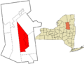
Location in Hamilton County and the state of New York
|
|
| Country | United States |
| State | New York |
| County | Hamilton |
| Government | |
| • Type | Town Council |
| Area | |
| • Total | 197.98 sq mi (512.77 km2) |
| • Land | 187.98 sq mi (486.88 km2) |
| • Water | 10.00 sq mi (25.90 km2) |
| Elevation | 1,831 ft (558 m) |
| Population
(2020)
|
|
| • Total | 897 |
| • Estimate
(2023)
|
897 |
| • Density | 4.5308/sq mi (1.7493/km2) |
| Time zone | UTC-5 (Eastern (EST)) |
| • Summer (DST) | UTC-4 (EDT) |
| ZIP code |
12108
|
| Area code(s) | 518 |
| FIPS code | 36-041-40794 |
| GNIS feature ID | 0979129 |
Lake Pleasant is a small town in Hamilton County, New York, United States. In 2020, about 897 people lived there.
The town includes the small community of Lake Pleasant, which is the main town for Hamilton County. Lake Pleasant is located inside the beautiful Adirondack Park. It's a popular spot for tourists, especially in summer. Many houses in the area are seasonal homes, used for vacations.
From late May to early September, the town becomes a busy place. People enjoy many activities like parades, fireworks, music shows, camping, hiking, water sports, and mountain biking.
Contents
History of Lake Pleasant
Early Native American Life
Long ago, Native Americans lived in the Lake Pleasant area. Tools like arrowheads and spearheads have been found near the lake. Historians believe that Mohawk and Algonquin tribes used this area for hunting and fishing. They usually came during the warmer months, as their main villages were in the Mohawk and Hudson Valley regions.
One famous Mohawk man, known as Captain Gill, lived near Lake Pleasant in the late 1700s and early 1800s. He was a guide for the first settlers, showing them where to hunt and fish. Captain Gill was also known for his stories, including legends of the Iroquois nation. One tale was about a forgotten tribe that lived year-round near what is now Sacandaga Lake. The legend says an evil deed caused a Flying Head to chase them out of the Adirondack Mountains.
The First Settlers Arrive
The first European settlers came to Lake Pleasant around 1795. At that time, this area was part of Mayfield in Montgomery County. People once described the land as "a wild waste" because it was so poor for farming.
New York City landowners offered cheap land to encourage people to move there. The area had thick forests, lots of animals for food and fur, and many lakes and streams full of fish. A few brave pioneers came, cleared the land, and built farms. They built gristmills (for grinding grain) and sawmills (for cutting wood).
Life was hard due to heavy snows and bad roads, which made them feel isolated in winter. Summers were cool, so they had to grow special crops for themselves and their animals. Sheep were common, and people made cloth at home. Wild animals like wolves and mountain lions were a problem. Some settlers also made money by making wooden shingles. Small dairies provided butter, cheese, and milk. Many settlers eventually left for easier lives closer to family or better jobs.
The area was too large to govern easily. In 1805, the town of Wells was created, which included the Lake Pleasant area.
Forming the Town of Lake Pleasant
The town of Lake Pleasant was officially formed in 1812 from part of Wells. It had about 300 residents. It was a very large area, stretching far north and west. Hamilton County was created in 1816, but it didn't have enough people to be a full county yet, so it was still counted with Montgomery County.
Lake Pleasant During the War of 1812
When the United States declared war on Great Britain in 1812, settlers in Wells and Lake Pleasant worried about attacks. They feared Native Americans who were allied with the British. Even though no attacks happened, many settlers fled their homes.
A few remaining settlers asked the New York Governor for help. They wanted to form a group of volunteers to protect the area and encourage people to return. Their request was approved. William B. Peck became the captain of the Wells and Lake Pleasant Home Guards. This group helped calm fears and brought people back.
The war also led to new roads being built through the town. These "military roads" helped move soldiers and supplies towards the St. Lawrence River and Canada.
Changes and New Names
Lake Pleasant was a "mother town" for Hamilton County. Over time, parts of its land were used to create other towns, like Morehouse (1835) and Arietta (1836).
Two communities grew a few miles apart near Lake Pleasant. In 1844, the community of Lake Pleasant was called "Sageville" after Hezekiah Sage, who built a hotel and tried to rename the area after himself. But in 1897, the town's name went back to Lake Pleasant.
Another small settlement at the foot of the lake was also called Lake Pleasant until 1864. Then, Joel Newton built a store and hotel and got a post office named "Newton's Corners." After his building burned down, a new hotel was built in 1882. In 1896, this community got a new name: Speculator. It was named after the mountain seen across the lake.
In 1925, the village of Speculator became an "incorporated" village, meaning it had its own local government with a mayor and trustees. By 1926, Speculator even had electricity!
The Rise of Tourism
Tourism really grew in Lake Pleasant between the mid-1800s and early 1900s. Families came to enjoy the fresh mountain air. More hotels, stores, and cottages were built. Around the 1850s, people from cities came to the Adirondack Mountains to hunt, fish, and explore. They hired local guides who knew the area well.
Many private summer camps and cottages were built around the lakes. There were also camps for children, like Camp-of-the-Woods and Deerfoot Lodge. After World War I, famous athletes like Gene Tunney and Max Schmeling even came to Lake Pleasant to train!
The Lumbering Era
At first, small sawmills in Lake Pleasant provided wood for local use. After the Civil War, large lumber companies started. They built mills near Glens Falls. Logs were floated down the Hudson River and later the Sacandaga River to these mills. The state of New York even made rivers public highways for moving logs.
Many local farmers found work in the winter with these lumber companies. They also supplied the companies with food like potatoes, meat, and dairy products. The lumber companies bought huge pieces of land for their timber. Some of this land was later given up and became state land. This was the start of the Adirondack Park, which was officially created in 1892.
Geography
The town of Lake Pleasant covers about 198 square miles (513 square kilometers). Most of this area is land, with about 10 square miles (26 square kilometers) being water.
Two main highways cross in the village of Speculator: New York State Route 8 (running east-west) and New York State Route 30 (running north-south).
The Sacandaga River, which flows into the Hudson River, starts in the town and flows out through its eastern side.
Population Information
| Historical population | |||
|---|---|---|---|
| Census | Pop. | %± | |
| 1820 | 312 | — | |
| 1830 | 266 | −14.7% | |
| 1840 | 296 | 11.3% | |
| 1850 | 305 | 3.0% | |
| 1860 | 356 | 16.7% | |
| 1870 | 318 | −10.7% | |
| 1880 | 343 | 7.9% | |
| 1890 | 416 | 21.3% | |
| 1900 | 469 | 12.7% | |
| 1910 | 458 | −2.3% | |
| 1920 | 393 | −14.2% | |
| 1930 | 540 | 37.4% | |
| 1940 | 584 | 8.1% | |
| 1950 | 696 | 19.2% | |
| 1960 | 718 | 3.2% | |
| 1970 | 812 | 13.1% | |
| 1980 | 859 | 5.8% | |
| 1990 | 887 | 3.3% | |
| 2000 | 876 | −1.2% | |
| 2010 | 781 | −10.8% | |
| 2020 | 897 | 14.9% | |
| 2023 (est.) | 897 | 14.9% | |
| U.S. Decennial Census | |||
In 2000, there were 876 people living in Lake Pleasant. Most of the people were White (about 97.5%). About 18.6% of the population was under 18 years old. The average age was 45 years.
Places in Lake Pleasant
Communities and Hamlets
- Lake Pleasant – This small community is the main town for Hamilton County. It was once called "Sageville."
- Moffitt Beach State Campground – A state camping area at the east end of Sacandaga Lake.
- Oak Mountain – A place north of Speculator.
- Perkins Clearing – An old lumber camp area west of NY-30.
- Sacandaga Camp – A community located on NY-8 between Lake Pleasant hamlet and Speculator.
- Sled Harbor – A place west of Perkins Clearing where travelers used to switch from cars to horse-drawn transport.
- Speculator – This is the only incorporated village in Hamilton County. It was once called "Newtons Corners."
Natural Features
- Blue Ridge Mountain – A mountain in the northern part of the town.
- Buckhorn Lake – A small lake at the town's southwest border.
- Cedar River Flow – A man-made lake in the northern part of Lake Pleasant.
- Fawn Lake – A lake west of Sacandaga Lake.
- Gilman Lake – A small lake next to NY-30 near the eastern town line.
- Hamilton Lake – A small lake south of Lake Pleasant Lake.
- Indian Lake – The southern part of this large lake is in northern Lake Pleasant.
- Lake Pleasant – This lake gives its name to both the town and the main community. It's south of NY-8 and Speculator.
- Lewey Lake – A lake in the northern part of the town.
- Lewey Mountain – A mountain in the northern part of the town, west of Lewey Lake.
- Mason Lake – A lake north of Perkins Clearing.
- Owl Pond – A lake on the eastern town line.
- Mud Lake – A small lake north of Sacandaga Lake.
- Oxbow Lake – A lake at the western town line, next to NY-8.
- Sacandaga Lake – One of the large lakes in the town, north of Lake Pleasant and NY-8.
- Sacandaga Outlet – A short river flowing between Sacandaga Lake and Lake Pleasant, under New York Highway 8.
- Sacandaga River – A river that starts in the town and flows out its eastern side.
- Speculator Mountain – A mountain south of the Village of Speculator. It's about 2,977 feet (907 meters) tall and gave its name to the village.
- Vly Lake – A small lake at the western town line, west of Fawn Lake.
- Wakely Dam – A place in the northern part of the town at the north end of Cedar River Flow. It's an east entrance to the Moose River Plains Wilderness Area.
- Whitaker Lake – A lake east of NY Highway 30.
Notable Person
- Eleanor Macomber (1801–1840) – A missionary and teacher.
Images for kids
-

Route 8 near Lake Pleasant
-
Location in Hamilton County and the state of New York
See also
 In Spanish: Lake Pleasant (Nueva York) para niños
