List of neighborhoods in Houston facts for kids
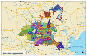
Houston, Texas, is a huge city with many different areas, or "neighborhoods." Some are carefully planned communities, while others are older, historic parts of the city. There isn't one simple way to define each neighborhood. However, the city of Houston has a special way of organizing them into 88 "super neighborhoods."
A super neighborhood is like a big team! It's a specific area where people who live there, local groups, schools, and businesses all work together. They figure out what their community needs and make plans to help it grow and improve. These super neighborhoods cover all parts of Houston. They help people in different areas work together on important local issues.
Contents
What Are Management Districts?
In Texas, there are special groups called municipal management districts (MMDs). Think of them as independent government agencies. They are created by the Texas Legislature to help neighborhoods get extra money. This money is used for things like improving roads, parks, and other public services in city areas.
How Do Management Districts Help?
Since these districts started in 1999, many have been set up in Houston's business areas and neighborhoods. They play a big role in making different parts of the city look and feel unique. They often help "brand" an area, making it more recognizable.
How Are They Funded?
Management districts get their money from special taxes. These taxes are paid by businesses and commercial properties within the district's boundaries. This extra funding helps them provide services that might not be covered by regular city taxes. As of 2016, there were 51 management districts in the greater Houston area. Some well-known ones include:
| Official district name | Encompassed neighborhoods | Boundaries |
|---|---|---|
| 5 Corners District | Almeda, Fondren Gardens, Winchester | Interstate 610 to the north, Beltway 8 to the south, and Texas State Highway 288 to the east |
| Downtown District | Downtown | Enclosed by Interstate 45, Interstate 10, and Interstate 69 (U.S. Highway 59) |
| Greater East End Management District | Eastwood, Harrisburg, Idylwood, Magnolia Park, and Pecan Park | East of the East Downtown Management District, north of Interstate 45, south of Clinton Drive, and east of Interstate 610 |
| International Management District | Alief and Little Saigon | Westpark Tollway to the north, Beltway 8 to the east, Bissonnet Street and Bellfort Street to the south, Texas State Highway 6 to the west |
| Midtown Houston | Midtown | South of Interstate 45, west and north of Interstate 69 |
| North Houston District | Greenspoint | Centered around the junction of Interstate 45 and Beltway 8 |
| Southwest Management District | Sharpstown, Mahatma Gandhi District, portions of Chinatown | Westpark Tollway to the north, Hillcroft Road to the east, Bissonnet Street to the south, Beltway 8 to the west |
| Uptown Houston District | Uptown Houston | Woodway Drive to the north, Interstate 610 to the east, Westpark Tollway to the south, Sage Road (approximately) to the west |
Other Houston Neighborhoods
Besides the official "super neighborhoods" and management districts, Houston has many other areas. These include smaller communities and individual housing developments. Each one has its own unique feel and history. Here are just a few examples of the many neighborhoods you can find in Houston:
- Acres Homes
- Alief
- Clear Lake City
- Downtown
- Eastwood
- Fifth Ward
- Houston Heights
- Kingwood
- Memorial
- Montrose
- River Oaks
- Sharpstown
- Spring Branch
- Sunnyside
- Third Ward
- Uptown
- Westbury
See also
- Geographic areas of Houston
- History of Houston
- Wards of Houston
 | William Lucy |
 | Charles Hayes |
 | Cleveland Robinson |


