Geographic areas of Houston facts for kids
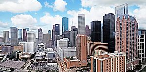
Houston is a huge city, and its different areas are usually described as being either inside or outside a big highway called Interstate 610. People often call this highway "the Loop." The Loop goes around the main business area of Houston. It also surrounds smaller cities like West University Place, Southside Place, and part of Bellaire. These are called "island cities" because Houston grew around them without taking them over.
Other "island cities" include the Memorial Villages: Bunker Hill Village, Hedwig Village, Hilshire Village, Hunters Creek Village, Piney Point Village, and Spring Valley Village.
Areas outside the Loop include the rest of Bellaire, the Memorial Villages, the airports, and many of Houston's suburbs. Another big highway, Beltway 8 (or "the Beltway"), circles the city about 5 miles (8 km) further out. A third highway, State Highway 99 (the Grand Parkway), is being built even further out. It's about 10 miles (16 km) beyond the Beltway and goes around the outer suburbs.
Phone numbers in Houston used to follow these highway lines. Now, new phone numbers can have different area codes like 713, 281, 832, or 346, no matter where you are in the city. Zip codes in Houston mostly range from 77002 to 77099.
Houston is special because it's the biggest city in the U.S. without zoning laws. This means there aren't strict rules saying where homes or businesses must be built. Because of this, Houston has grown in a unique way. Instead of just one main downtown area, it has five other big business districts spread out. If you put all these business districts together, they would form the third largest downtown area in the United States!
Contents
How Houston's Areas Grew
Before the big highways were built, Houston had many unique neighborhoods with interesting names.
In the 1960s, when the 610 Loop was developed, Houston's focus started to move away from Downtown Houston. This made the city grow outwards, like a doughnut, with Downtown becoming the "hole." As more connections to the 610 Loop opened, Downtown became just one of many important spots in the city. By 1998, Beltway 8 was almost finished, and more development happened in the central city. It was like Houston had stretched so far that it started growing back in on itself.
Unlike many older cities in Europe or on the East Coast, Houston started by spreading out. Then, it developed denser areas in the middle. Many of Houston's busy areas have parking garages, which help people get around by car even where parking spaces are limited.
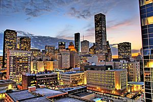
Downtown Houston
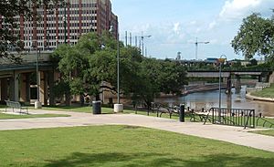
Downtown is right in the middle of Houston's highway system. It's bordered by I-45 to the south and west, I-69/US-59 to the east, and Buffalo Bayou to the north.
The Skyline District is the heart of downtown. Many big company headquarters and banks are located here.
The Houston Theater District, in north downtown, is home to Houston's eight performing arts groups. You can find places like the Alley Theatre, Hobby Center for the Performing Arts, and Jones Hall, where the Houston Symphony Orchestra plays. It's the second-largest performing arts district in the U.S., after New York City.
Downtown also has one of Houston's two Chinatowns. The first one is near the George R. Brown Convention Center. The newer, larger Chinatown is mostly on Bellaire Boulevard, west of the Sharpstown neighborhood.
The Main Street Corridor in downtown became a popular nightlife spot in 2004, especially since the city added light rail service. The light rail line starts at the University of Houston–Downtown.
Preston Station is a downtown neighborhood named after the MetroRail station there. It's known for its bars and restaurants and has famous buildings like the Rice Hotel.
South Side
South of downtown, you'll find areas like Hiram Clarke, Sunnyside, and South Park. These are mostly African-American communities with many Latino residents too. These areas were once rural and are sometimes called the "Southside" along with the Third Ward.
Hiram Clarke is a smaller neighborhood in south Houston. It's named after a former president of Houston Lighting & Power.
Southwest Houston
The term "southwest Houston" often refers to areas that grew after World War II. These used to be considered suburbs, like Alief, Fondren Southwest, Meyerland, Sharpstown, and Westbury. Alief is a large area with many different cultures. Fondren Southwest and Meyerland are important centers for Houston's Jewish community. Sharpstown was Houston's first master-planned community and has large Hispanic and Asian American populations. The Mahatma Gandhi District, also known as Hilcroft, is a Pakistani and Indian area in the southwest.
Northside
The Northside of Houston includes several historic neighborhoods like Houston Heights, Near Northside, the Fifth Ward, the Historic Sixth Ward, and Acres Homes. People who live here often just call it "Northside." Many people from the Houston suburbs sometimes confuse this area with northern suburbs like Spring or The Woodlands. The Northside, like other areas inside the 610 Loop, is seeing new development. The Houston Light Rail is extending its route north from the University of Houston–Downtown. The Northside is mainly home to Hispanic and African American communities, except for Houston Heights, which has many Caucasian residents.
Energy Corridor
The Energy Corridor is a business area in west Houston, along Memorial Drive and Eldridge Parkway. It's generally located north of I-10 (the Katy Freeway) and south of Westheimer. This area is known for its many oil industry companies, homes, restaurants, and parks.
Midtown
Midtown is just south of downtown. It's a recently redeveloped area with many new apartments and condos. It's also home to Little Saigon, which is the center for Vietnamese American businesses in the city. Midtown is an official State of Texas Cultural Arts and Entertainment District.
Uptown
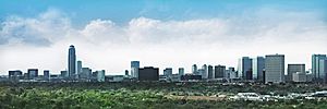
Uptown is Houston's second-largest business district. It's home to the famous Williams Tower, which is one of the tallest buildings outside of a main business district in the world. Uptown also has Houston's tallest condo towers. Many Fortune 500 companies, fancy stores, and fashion designers have locations here.
Most residents don't call this area "Uptown." They usually refer to it as the Galleria Area because of the Houston Galleria mall located there.
Texas Medical Center
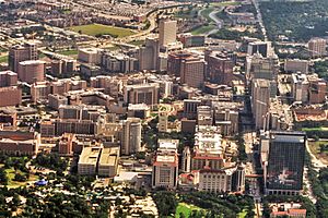
The Texas Medical Center is about 3 miles (5 km) south of Midtown. It's the largest medical complex in the world! Next to it are Reliant Park to the south and the Rice University/Rice Village area to the west.
Museum District
The Museum District has more than 20 museums and institutions, including Hermann Park, the Houston Zoo, and the Miller Outdoor Theatre. It's one of the most visited museum districts in the country. The district covers an area about 1.5 miles (2.4 km) around Mecom Fountain in Hermann Park.
Houston's Historic Wards
When Houston was founded in 1837, the city was divided into political areas called "wards." These ward names are still used today for some neighborhoods.
The First Ward is mostly bordered by Houston Avenue, Interstates 10 and 45, and Washington Avenue. Many older homes here have been updated or moved due to rising land values.
The Second Ward, east of downtown, grew in the early 1900s. It's mainly a Hispanic community and is seeing new development because it's close to downtown. It's one of Houston's oldest neighborhoods.
The Third Ward, southeast of downtown, was once home to one of the richest African American communities in the South after World War I. Texas Southern University and the University of Houston are located here.
The Fourth Ward is known as Freedmen's Town. This is because freed slaves settled there after the U.S. Civil War. It was Houston's first and most important African American community. It's also seeing new development because it's so close to downtown. The Freedmen's Town Historical District was created in 1988.
The Fifth Ward is another mostly African American community that was first settled by freed slaves. It's also undergoing new development. A part of the Fifth Ward, Frenchtown, was once the main area for the Creole community in Houston.
The Sixth Ward was created in 1877 as a residential area. It has many beautiful old buildings with Greek revival and Victorian styles. However, many are being torn down for modern homes due to new development.
Greenway Plaza
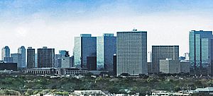
The Greenway Plaza business district is west of Midtown and southwest of Downtown Houston. It's home to Lakewood Church, which is the largest megachurch in the country.
Neartown
Neartown is in west-central Houston and is a major cultural area. It's known for being unique and having a diverse population. The eastern part of Neartown, often called Montrose, is the center of Houston's gay and lesbian community. It's famous for its vintage shops, 1950s-style diners, and street art. It's also where you'll find the Menil Collection and the University of Saint Thomas.
Other Important Communities
The historic Houston Heights, near downtown, is the highest point in the city. It used to be a separate town connected to Houston by streetcar. It joined Houston in 1919. It still has a ban on alcohol sales and is popular for antique shopping. Many of its old Victorian and Craftsman homes are very popular. The Houston Heights is also home to the ArtCar Museum, which is a fun place to visit.
River Oaks is the richest area in Houston, often compared to Beverly Hills. It's known for its large mansions and is home to many famous people. Near River Oaks, the areas of Highland Village and Upper Kirby have many fancy shops and restaurants.
To the west is the Memorial Area. Its zip code (77024) is one of the wealthiest in Texas. It includes several rich cities that are separate from Houston but surrounded by it, like the Memorial Villages.
Clear Lake City is a planned community in southeast Houston. It's home to the Lyndon B. Johnson Space Center (NASA's space center!), the University of Houston–Clear Lake, and a large Asian American community. It became part of Houston in 1979.
To the northeast is Kingwood, a huge planned community that became part of Houston in 1996. It's the largest planned community in Harris County.
Cities and Suburbs Near Houston
Besides the "island cities" like Bellaire and the Memorial Villages, many other communities near Houston are important to the wider metropolitan area.
Harris County
Pasadena is Houston's biggest suburb. It's located near the ship channel, where many of the city's oil refineries are. This makes Pasadena a key part of Houston's huge chemical industry. Nearby cities like Baytown, La Porte (home to the San Jacinto Monument), and Channelview also have many refineries and chemical plants.
Katy is about 30 minutes west of downtown. Many people live in the "Greater Katy Area," which has a population of over 250,000. This area includes developments like Cinco Ranch. The Katy area also extends into Fort Bend and Waller counties.
Cypress is an area about 30 minutes northwest of downtown. It used to be farms and forests but has grown a lot since the 1980s, mostly with single-family homes. Cypress is home to Cy-Fair ISD, the second-largest school district in metro Houston.
Humble is a town northeast of Downtown, next to Bush Intercontinental Airport. The Humble area, including Atascocita, has a large population and is one of the fastest-growing areas near Houston.
Fort Bend County
Sugar Land is a city southwest of Houston in Fort Bend County. It's named after the old Imperial Sugar refinery. It's home to many international companies and is one of the fastest-growing and wealthiest cities in Texas. This is because of its many planned communities like First Colony and Riverstone. In 2006, Money magazine called Sugar Land one of the best places to live in the U.S.
Stafford is between Sugar Land and Houston. Many companies have offices here because the city doesn't have a property tax. The Stafford Municipal School District is unique because it's run by the city government.
Missouri City is mostly in Fort Bend County. It has a large African American population. Planned communities within the city, like Quail Valley, have many white, African-American, and Asian-American residents.
Brazoria County
Pearland is a city south of Houston in Brazoria County. It's the fastest-growing city in Brazoria County, with its population growing from about 19,000 in 1990 to 82,000 by 2000. It's the closest suburb to Downtown Houston and the Texas Medical Center, which attracts professionals from many industries.
Montgomery County
The Woodlands is a large planned community about 30 miles (48 km) north of Downtown Houston in Montgomery County. It's one of the biggest and most popular planned communities in the country.
Galveston County
A popular day trip from Houston is to Galveston to visit Moody Gardens or the sandy beach. Before a big storm in 1900, Galveston was actually bigger and richer than Houston! It was called "The Wall Street of the Southwest." Galveston is also home to the Schlitterbahn Waterpark. Galveston's location on a narrow island led to the creation of the Port of Houston, which was built inland to be more protected.
Another popular tourist spot is Kemah, where visitors can enjoy the Kemah Boardwalk with its many seafood restaurants and attractions.
Five other cities are along Interstate 45 in mainland Galveston County. League City is the largest city in the county. Other cities include Dickinson, La Marque, Friendswood, and Texas City.
 | John T. Biggers |
 | Thomas Blackshear |
 | Mark Bradford |
 | Beverly Buchanan |


