West University Place, Texas facts for kids
Quick facts for kids
City of West University Place
|
|
|---|---|
|
City
|
|
 |
|
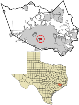
Location in Harris County and the state of Texas
|
|
| Country | United States |
| State | Texas |
| County | Harris |
| Area | |
| • Total | 2.00 sq mi (5.19 km2) |
| • Land | 2.00 sq mi (5.19 km2) |
| • Water | 0.00 sq mi (0.00 km2) |
| Elevation | 49 ft (15 m) |
| Population
(2020)
|
|
| • Total | 14,955 |
| • Density | 7,776.95/sq mi (3,002.58/km2) |
| Time zone | UTC-6 (Central (CST)) |
| • Summer (DST) | UTC-5 (CDT) |
| ZIP code |
77005
|
| Area code(s) | 281/346/713/832 |
| FIPS code | 48-77956 |
| GNIS feature ID | 1349820 |
| Website | http://westutx.gov/ |
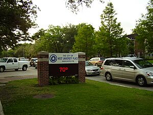
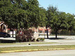
West University Place, often called West University or West U, is a city in Texas. It's part of the larger Houston area in Harris County. In 2020, about 14,955 people lived here. The city is known as "The Neighborhood City." It's mostly a place where families live and then travel to work in other areas.
West University Place is surrounded by other cities like Bellaire, Houston, and Southside Place. In 2011, West University Place had one of the highest numbers of families with higher incomes in Texas.
Contents
History of West University Place
The city was started in 1917 by Ben Hooper, who used to be a governor of Tennessee. Its name, "West University Place," comes from being close to Rice Institute, which is now Rice University. The very first pieces of land were sold in 1917. Some parts of West University were once part of a "Poor Farm" for Harris County.
In the 1920s, a student named Lillian "Lilly" Nicholson helped name the streets. She used names from her English literature books. That's why many streets in West University Place are named after famous authors. One street, Weslayan Road, is actually a misspelling of "Wesleyan."
West University Place officially became a city on January 2, 1924. This happened because the city of Houston wasn't extending power lines far enough. Unlike some other towns, West University Place decided not to join Houston. This meant Houston couldn't take over its land. In 1939, the city chose to stay independent and created its own official city rules the next year. In the 1960s and 1970s, about 15,000 people lived there.
Before 1992, West University Place made it easier for new houses to be built. This changed the city from older, smaller homes to a wealthier area with newer, larger houses. Property values went up, and the city earned more tax money. By 2018, West University Place was even named the "best city to live in" by 24/7 Wall Street and USA Today.
Geography and Location
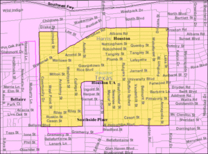
West University Place covers about 2 square miles (5.19 square kilometers) of land. Most of the city is surrounded by Houston. Its borders are generally Bellaire Boulevard, Kirby Drive, Bissonnet Road, and Community Drive. The city is about 6 miles (9.7 km) from Downtown Houston.
If you look at a map, the city's shape looks a bit like a small house. It even has a "chimney" on the west side and a "door" because it surrounds the city of Southside Place.
A ditch called the Poor Farm Ditch helps drain water into the Brays Bayou. It was widened and deepened in 1954 to help with flooding.
City's Appearance
In 2018, someone described West University Place as a "neat and tidy area" with older brick homes and newer, grander houses. Most building lots in the city are about 5,000 square feet (465 square meters).
Many of the original homes were small bungalows. Over time, about half of the older houses were replaced with new ones, often in a style called Georgian.
West University Place has 26 different neighborhoods, or "subdivisions." Some of these include Belle Court, Pemberton, and Colonial Terrace. Pemberton is known for having some of the city's more expensive homes.
Population and People
| Historical population | |||
|---|---|---|---|
| Census | Pop. | %± | |
| 1930 | 1,322 | — | |
| 1940 | 9,221 | 597.5% | |
| 1950 | 17,074 | 85.2% | |
| 1960 | 14,628 | −14.3% | |
| 1970 | 13,317 | −9.0% | |
| 1980 | 12,010 | −9.8% | |
| 1990 | 12,920 | 7.6% | |
| 2000 | 14,211 | 10.0% | |
| 2010 | 14,787 | 4.1% | |
| 2020 | 14,955 | 1.1% | |
| U.S. Decennial Census | |||
| Race | Number | Percentage |
|---|---|---|
| White (NH) | 10,758 | 71.94% |
| Black or African American (NH) | 120 | 0.8% |
| Native American or Alaska Native (NH) | 23 | 0.15% |
| Asian (NH) | 1,889 | 12.63% |
| Pacific Islander (NH) | 3 | 0.02% |
| Some Other Race (NH) | 50 | 0.33% |
| Mixed/Multi-Racial (NH) | 699 | 4.67% |
| Hispanic or Latino | 1,413 | 9.45% |
| Total | 14,955 |
In 2010, there were 14,787 people living in West University Place. Most residents were White (90.6%), with Asian people making up 8.4%. About 6.9% of the population was Hispanic or Latino. By 2020, the population was 14,955.
In 2010, about 44% of households had children under 18. Most households (74.1%) were married couples. The average household had 2.81 people.
The median age in the city was 41.4 years. About 30.6% of the population was under 18.
In 2018, many residents were lawyers or worked at nearby places like Rice University and the Texas Medical Center. West University Place is seen as a successful community. In 2009, it was described as a "tidy, orderly community" where parents raise successful children.
As of 2011, 85% of adults in West University Place had bachelor's degrees. This was the highest percentage in the Southern United States.
Religion in West University Place
West University Baptist Church started in 1928. St. Andrews Presbyterian Church is also in the city. St. George Orthodox Church moved to West University Place in 1954. The local Catholic church, St. Vincent de Paul, is just outside the city limits in Houston.
Economy
AT&T has a telephone center at 4068 Bellaire Boulevard.
Parks and Recreation
West University Place has good recreational facilities. From 1988 to 2003, a group called Friends of West University Place Parks Fund Inc. raised $1.5 million. This money helped improve parks and create new green spaces.
The West University Place Recreation Center has a swimming pool, a weight room, and racquetball courts. It also offers classes like yoga. The city wants the center to be mainly for its residents. Non-residents can only use the pool or other facilities if they are with a resident.
Colonial Park, at 4130 Byron Street, has a playground, picnic area, tennis courts, and a walking path. The park was made bigger, and new facilities were added around 2003. The Colonial Park Pool is open from May to September.
Other parks include:
- Friends Park (3771 Rice Boulevard) – opened in 2007.
- Huffington Park (3901 Milton Street) – has a playground and picnic tables.
- Whitt Johnson Park (6540 Wakeforest Street) – has a playground and a basketball court.
- Judson Park (4242 South Judson Street) – has a playground and a tennis court.
- Wier Park (3012 Nottingham Street) – has a playground, picnic tables, and tennis courts.
Education
West University Place is part of the Houston Independent School District (HISD). The schools here are well-funded.
Public Schools
Students living in West University Place usually go to:
- West University Elementary School (in West University Place)
- Pershing Middle School (in Houston)
- Lamar High School (in Houston)
Students zoned to Pershing Middle School can also choose to attend Pin Oak Middle School in Bellaire. Pin Oak was recognized as a top school in 2008.
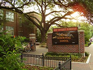
West University Elementary opened in 1925. In the 1970s and 1980s, parents helped make it a central part of the community. By the 1990s, it became a model for how schools could keep families in public education. In 2015, West U Elementary was HISD's largest elementary school.
The The Rice School is a special school for kindergarten through 8th grade in Houston. It opened in 1994 to help reduce crowding at West University Elementary.
Gabriela Mistral Early Childhood Center is the closest public preschool.
Private Schools
St. Mark's Episcopal School (K–8) is located in West University Place. The Beehive Preschool Center is also here.
Other private schools nearby include:
- School of St. Vincent De Paul Catholic Church (Houston)
- St. John's School (Houston)
- Episcopal High School (Bellaire)
- St. Francis Episcopal Day School (Texas) (Piney Point)
- The Post Oak School (Bellaire and Houston)
There are also Catholic schools for girls like Incarnate Word Academy and St. Agnes Academy. For boys, there are Strake Jesuit and St. Thomas High School.
Colleges and Universities
The Texas Legislature has said that Houston Community College System (HCC) serves West University Place. The city is also close to the University of Houston and Rice University.
Public Libraries
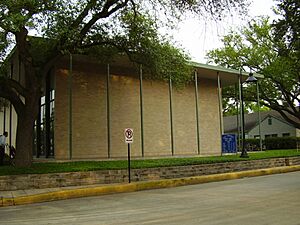
The Harris County Public Library has a branch in West University Place. The library first opened in 1942. The current library building, which is about 6,100 square feet (567 square meters), opened in 1963.
Media and News
- The Houston Chronicle is the main regional newspaper.
- The West University Examiner is a local newspaper.
- The West University Buzz is a monthly magazine about people and services in the community.
- The Village News and Southwest News is another local newspaper.
- InstantNewsWestU.com is a local online newspaper.
- West University Essentials and West U Connections are monthly magazines.
Transportation
West University Place is part of the Metropolitan Transit Authority of Harris County, Texas (METRO). This means the city has access to bus lines that help people get around.
In Culture
The novel A Gracious Neighbor by Chris Cander is set in West University Place.
Notable People
- Craig Biggio, a retired baseball player for the Astros.
- Brian Cushing, a former football player for the Houston Texans.
- Rafael Espada, who was the Vice President of Guatemala.
- Jeff Van Gundy, a former NBA basketball coach.
- Dylan Sprayberry, an actor known for Teen Wolf.
See also
 In Spanish: West University Place (Texas) para niños
 | Delilah Pierce |
 | Gordon Parks |
 | Augusta Savage |
 | Charles Ethan Porter |


