Katy, Texas facts for kids
Quick facts for kids
Katy, Texas
|
||
|---|---|---|
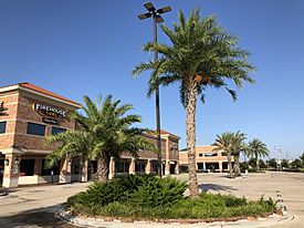
Kingsland Boulevard
|
||
|
||
| Motto(s):
"Small Town Charm with Big City Convenience"
|
||
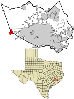
Location of Katy, Texas
|
||
| Country | United States | |
| State | Texas | |
| Counties | Harris, Fort Bend, Waller | |
| Founded | 1896 | |
| Incorporated | 1945 | |
| Area | ||
| • Total | 15.312 sq mi (39.658 km2) | |
| • Land | 15.294 sq mi (39.610 km2) | |
| • Water | 0.018 sq mi (0.047 km2) | |
| Elevation | 138 ft (42 m) | |
| Population
(2020)
|
||
| • Total | 21,894 | |
| • Estimate
(2023)
|
26,360 | |
| • Density | 1,755.75/sq mi (677.89/km2) | |
| Demonym(s) | Katyite | |
| Time zone | UTC–6 (Central (CST)) | |
| • Summer (DST) | UTC–5 (CDT) | |
| ZIP Codes |
77449, 77450, 77491, 77492, 77493, 77494
|
|
| Area code(s) | 713, 281, 832, and 346 | |
| FIPS code | 48-38476 | |
| GNIS feature ID | 1338960 | |
| Sales tax | 8.25% | |
Katy is a city in the U.S. state of Texas. It is part of the Greater Houston area, which is a large metropolitan area. Katy is special because it sits where three counties meet: Harris, Fort Bend, and Waller. In 2020, about 21,894 people lived there.
Katy was first settled in the mid-1890s. It began as a railway town along the Missouri–Kansas–Texas (MKT) Railroad. This railroad ran next to what is now Interstate 10, leading into downtown Houston. The city got its name when the MKT Railroad's stop became known as "the K-T," which later turned into "the Katy." The area around Buffalo Bayou was great for rice farming.
Starting in the 1960s, Houston grew quickly westward along Interstate 10, bringing Katy into its bigger urban area. Today, Katy is the center of a larger region called Greater Katy, which has many homes and businesses. Even though it's part of a big city, Katy is known for Katy Mills Mall, the strong football team at Katy High School, and its historic town square.
Contents
Katy's History
The land where Katy is now was once home to the Karankawa people. European settlers first met this tribe in 1528. For the next 250 years, French and Spanish explorers traveled through the area. They were looking for land and trade. By 1779, the Karankawa people were fighting with Spanish settlers. The war ended in 1790, and soon after, people began to settle there.
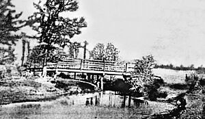
In the early 1800s, Katy was called "Cane Island." This name came from a creek that flows through the area. The creek was full of tall cane plants, which were not native. People think the Karankawa Indians or Spanish explorers planted them to help with fur trapping.
In 1845, James J. Crawford received land in this area. It was hard to get people to settle here because of the hot summers and thick clay soil. By 1875, only a few families lived in Cane Island. These included freed slaves like Thomas and Mary Robinson, and Milto McGinnis, along with Mr. Crawford, Peter Black, and John Sills.
In 1895, James Oliver Thomas planned out a town. In January 1896, the town was officially named Katy. The name "Katy" came from the MKT Railroad Company. People often called this railroad "the K-T," which then became "the Katy." Since the railroad had a main station here, the area became known as Katy.
People hoped the new town would grow, and it did. Many families arrived by train and wagon in the early 1900s. At first, cotton, peanuts, and corn were the main crops. But soon, rice became the most important crop. Katy became famous for rice farming. The first concrete rice driers in Texas were built here in 1944. They are still important landmarks today. The farming community helped local businesses like hotels, stores, and saloons grow.
On September 8, 1900, a huge storm hit. It was the Great Galveston Hurricane of 1900, the deadliest hurricane in U.S. history. Almost all of Katy's first homes were destroyed. Only three original houses survived. But Cane Island was rebuilt quickly and continued to grow.
In 1943, Humble Oil opened the Katy Gas Field. This field became a major supplier of gas for the Allied forces during World War II. It grew into one of the most productive gas fields in Texas. Today, Humble Oil is part of Exxon, which still manages the large underground pipeline network in the area.
In 1945, the City of Katy officially became a city. C. L. Baird was its first mayor. The city's borders were set to include most residents and be a size that city services could manage.
The building of Interstate 10 in 1966 brought fast growth to the area. Houston expanded westward, and Katy grew with it. Many parts of the K-T railway were removed to make way for the I-10 expansion. This marked the end of passenger trains through the region. I-10 was made even wider in 2008, with plans for more widening in the future.
Katy's Geography
The City of Katy is located where three counties meet: Harris, Fort Bend, and Waller. It is along Interstate 10, about 29 miles (47 km) west of downtown Houston. The city covers about 15.312 square miles (39.66 km2) of land and a small amount of water.
Katy is often talked about in two ways: "Old Towne Katy" and "Greater Katy." Old Towne Katy is the part of the city that became official in 1945. Its borders are near Kingsland Boulevard, across Interstate 10 to Morton Road. Katy Fort Bend Road and Cane Island Creek are its east and west borders. The Greater Katy area includes the city of Katy and much more land around it. This larger area matches the boundaries of the 181 square mile (469 km2) Katy Independent School District.
Greater Katy includes many communities. Some of these are Cinco Ranch, Green Trails, Grayson Lakes, Seven Meadows, and Firethorne. It also has older neighborhoods from the 1970s and 1980s, like Memorial Parkway and Kelliwood.
New homes are being built in Old Towne Katy in places like Pin Oak Village and Cane Island. The city government is also working on improving the downtown area. This includes a new city hall and a future downtown green space. Other projects include Typhoon Texas Water Park and the Katy Independent School District's Legacy Football Stadium.
Katy's Climate
The weather in Katy has hot, humid summers and generally mild to cool winters. It has a humid subtropical climate. This means it gets a lot of rain and has warm temperatures for most of the year. The area is part of the Western Gulf Coastal Grasslands, which is a type of coastal prairie.
Katy's Population
| Historical population | |||
|---|---|---|---|
| Census | Pop. | %± | |
| 1950 | 849 | — | |
| 1960 | 1,569 | 84.8% | |
| 1970 | 2,923 | 86.3% | |
| 1980 | 5,660 | 93.6% | |
| 1990 | 8,005 | 41.4% | |
| 2000 | 11,775 | 47.1% | |
| 2010 | 14,102 | 19.8% | |
| 2020 | 21,894 | 55.3% | |
| 2023 (est.) | 26,360 | 86.9% | |
| U.S. Decennial Census Texas Almanac: 1850-2000 2020 Census |
|||
2020 Census Information
| Race | Number | Percentage |
|---|---|---|
| White (NH) | 11,652 | 53.22% |
| Black or African American (NH) | 1,455 | 6.65% |
| Native American or Alaska Native (NH) | 51 | 0.23% |
| Asian (NH) | 1,687 | 7.71% |
| Pacific Islander (NH) | 12 | 0.05% |
| Some Other Race (NH) | 99 | 0.45% |
| Mixed/Multi-Racial (NH) | 797 | 3.64% |
| Hispanic or Latino | 6,141 | 28.05% |
| Total | 21,894 | 100.00% |
In 2020, Katy had 21,894 people living in 7,199 households. About 5,804 of these were families. The city had about 1,505 people per square mile. Most residents were White (59.3%), followed by Hispanic or Latino (28.0%). There were also African American (6.8%), Asian (7.8%), and other groups.
In 2022, the average household had 3.24 people. Most homes (79.4%) were owned by the people living in them. The median household income was $114,917. Only 3.5% of the population lived below the poverty line. About 66.1% of people in Katy had jobs. Also, 47.0% had a bachelor's degree or higher.
Katy's Religions
Katy was once known as the "City of Churches." This was because religion was a big part of daily life. Many churches were in the city, and people were very religious. Around the 1900s, the city even had a "City of Churches" sign.
The first church in Katy was First Baptist Church, started in 1898. It moved to a new building in 2007 because it grew so much. Today, Katy has places of worship for many different faiths. These include Catholicism, Islam, Latter-Day Saints, Judaism, Hinduism, and Protestantism.
Katy's Economy
Many companies have their main offices near Katy. Igloo Corporation, which makes coolers, is located west of Katy. Academy Sports and Outdoors has its main offices and a large distribution center nearby.
BP America, a big energy company, has its main office in the Houston Energy Corridor. It is the largest employer in the area. BP's Katy operations support much of its work in the United States and the Gulf of Mexico.
In 2017, Amazon built a very large distribution center near Highway 90. In 2021, new projects were being finished to help the local economy grow.
After 2009, many new stores and shopping centers were built in Katy. This was because more people were moving to the area. A large H-E-B grocery store opened in 2010. In 2013, Costco announced it would open a store in Katy, which was completed in 2014.
In 2018, Katy Asian Town opened. This area has many different restaurants, shops, and homes. It features an Asian grocery store called HMart and a Japanese bookstore called Kinokuniya. Katy Asian Town also hosts cultural events like Chinese New Year celebrations. It is also home to Andretti Indoor Karting and Games, which has kart racing, video games, and virtual reality.
The Katy Area Economic Development Council helps the area's economy grow. It was started in 2003. Its goal is to make Katy a great place for families and businesses. Since it began, the Council has helped create over 16,200 jobs and brought in more than $2.5 billion in investments.
Katy's Education
Schools for Kids and Teens
Students who live in Katy go to schools in the Katy Independent School District. Many schools have "Katy, Texas" addresses, but only some are actually inside the city limits.
Elementary Schools
- Zelma Hutsell Elementary School
- Katy Elementary School
- WoodCreek Elementary School
- Bryant Elementary School
- Robertson Elementary School
Middle Schools
- Katy Junior High School
- WoodCreek Junior High School
High Schools
- Katy High School is the oldest high school. It is located close to the city center. It was founded in 1898 and moved to its current spot in 1947. Katy ISD also has three alternative schools within the city: Martha Raines High School, Miller Career and Technology Center, and the Opportunity Awareness Center.
Other Schools
- Aristoi Classical Academy is a K-12 charter school in Katy.
- Mirus Academy is a private school in the city center for grades 8-12.
Colleges in Katy
The Houston Community College System serves Katy. HCC Northwest College has a campus in an area near Katy. For those in Waller County, Blinn College also serves the area.
The Bible Seminary offers college-level Bible study and training for ministry.
The University of Houston built a new campus in Katy. Its construction was finished in 2019.
Public Libraries
Katy has a public library called the Katy Branch of Harris County Public Library (HCPL). It is located at 5414 Franz Road. The city joined the county library system in 1921. The first Katy library opened in 1940. The current library building, which is 15,000 square feet (1,400 m2), opened in 2003.
Parks and Fun in Katy
- Harris County runs the Mary Jo Peckham Community Center at 5597 Gardenia Lane.
- The City of Katy Dog Park is located at 5414 Franz Road.
- The annual Katy Rice Harvest Festival is a two-day event with live entertainment, craft booths, food, and a carnival.
Getting Around Katy
Public Transportation
The Metropolitan Transit Authority of Harris County (METRO) operates the Kingsland Park and Ride. This is east of Katy at 21669 Kingsland Boulevard. In 2008, METRO opened another park and ride near Grand Parkway and I-10. These routes offer express bus service to and from downtown Houston during busy morning and evening hours.
METRO also opened a large six-story parking garage for buses at I-10 West and the Grand Parkway. This helps people who commute.
Bus Lines Between Cities
Greyhound Bus Lines has a station in Katy at Millers Exxon. Megabus.com stops at Katy Mills. This bus travels between Austin, San Antonio, and Houston. It's a place where people from Katy can park their cars and catch the bus.
Airports Near Katy
There are a few privately owned airports near Katy for public use:
- Houston Executive Airport in Waller County
- West Houston Airport in Harris County
Airports for private use include:
- Hoffpauir Airport in Harris County
- Cardiff Brothers Airport in Fort Bend County
For commercial flights, people in Katy use George Bush Intercontinental Airport and William P. Hobby Airport. Both of these are in Houston.
Famous People from Katy
Many notable people have connections to Katy, including:
- Masyn Winn, an MLB player for the St. Louis Cardinals
- Rodney Anderson, a former NFL running back
- Clint Black, a country singer and musician
- Kimberly Caldwell, a singer and TV host from American Idol
- Christian Cappis, a professional soccer player
- Roger Creager, a Texas country singer
- Dan Crenshaw, a Texas Representative
- Andy Dalton, an NFL quarterback
- De'Aaron Fox, a professional basketball player for the Sacramento Kings
- Janeane Garofalo, an actress and comedian
- Cullen Gillaspia, an NFL fullback
- Sammy Guevara, a professional wrestler
- Julie Henderson, a model
- Jalen Milroe, a quarterback for Alabama Crimson Tide football
- Bo Levi Mitchell, a professional quarterback in the Canadian Football League
- Tyler Myers, a professional hockey player for the Vancouver Canucks
- Josh Nebo (born 1997), a basketball player for Maccabi Tel Aviv
- Megan Nicole, a singer
- Sage Northcutt, a UFC fighter
- Renee O'Connor, an actress known for Xena: Warrior Princess
- Jesse Sorensen, a professional wrestler
- Ty Tabor, a guitarist and vocalist for the band King's X
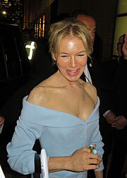
- Renée Zellweger, a famous actress and producer
- Horst Christian Simco, also known as RiFF Raff, a professional rapper
See also
 In Spanish: Katy (Texas) para niños
 | Frances Mary Albrier |
 | Whitney Young |
 | Muhammad Ali |


