
Stafford, Texas facts for kids
Quick facts for kids
Stafford, Texas
|
|
|---|---|

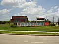
Monument on US 90 Alternate
|
|
| Motto(s):
"City with no property taxes"
|
|

Location of Stafford, Texas
|
|
| Country | |
| State | |
| Counties | Fort Bend, Harris |
| Government | |
| • Type | Mayor-Council |
| Area | |
| • Total | 7.04 sq mi (18.24 km2) |
| • Land | 7.01 sq mi (18.16 km2) |
| • Water | 0.03 sq mi (0.09 km2) |
| Elevation | 85 ft (26 m) |
| Population
(2020)
|
|
| • Total | 17,666 |
| • Density | 2,476.39/sq mi (956.11/km2) |
| Time zone | UTC-6 (Central (CST)) |
| • Summer (DST) | UTC-5 (CDT) |
| ZIP codes |
77477, 77497
|
| Area code(s) | 281 |
| FIPS code | 48-69908 |
| GNIS feature ID | 1347777 |
Stafford is a city in the state of Texas, USA. It is part of the large Houston area. Most of Stafford is in Fort Bend County, with a small part in Harris County. In 2020, about 17,666 people lived in Stafford.
Contents
History of Stafford
In 1830, a man named William Stafford started a large farm here. He grew sugarcane and used a horse-powered machine to clean cotton. During the Texas Revolution in 1836, soldiers burned his farm. But Stafford rebuilt it and lived there until he passed away in 1840.
A small community called "Stafford's Point" grew around his farm. It became a town in 1853 when a railway started stopping there. Stafford's Point had a post office from 1854 to 1869. The town, now called Stafford, had a post office again from 1869 to 1918, and it reopened in 1929.
In 1884, Stafford had about 50 people, two general stores, and a grocery store. By 1896, the population grew to 300. But by 1914, it dropped to 100. In 1931, 320 people lived in Stafford, and this number grew to 400 by 1946. Stafford officially became a city in 1956.
Geography and Climate

Stafford is located in the eastern part of Fort Bend County. A small section of the city reaches into Harris County. It is surrounded by other cities like Houston to the north, Sugar Land to the west, and Missouri City to the south.
A major highway, Interstate 69, runs through northwest Stafford. This road connects Stafford to downtown Houston, about 16 miles away. Another important road, U.S. 90 Alternate, goes through Stafford as Main Street.
The United States Census Bureau says Stafford covers about 7.04 square miles. Most of this area is land, with a very small part being water.
Stafford's Weather
Stafford has a climate with hot, humid summers. Winters are usually mild or cool. This type of weather is known as a humid subtropical climate.
City Limits and School Zones
Stafford has special areas outside its main city limits. These areas are not officially part of Stafford but are close by. The city has chosen not to add these areas to its limits. This is because Stafford wants its city boundaries to match the boundaries of its own school district, the Stafford Municipal School District.
People of Stafford
| Historical population | |||
|---|---|---|---|
| Census | Pop. | %± | |
| 1960 | 1,485 | — | |
| 1970 | 2,906 | 95.7% | |
| 1980 | 4,755 | 63.6% | |
| 1990 | 8,397 | 76.6% | |
| 2000 | 15,681 | 86.7% | |
| 2010 | 17,693 | 12.8% | |
| 2020 | 17,666 | −0.2% | |
| U.S. Decennial Census | |||
| Race | Number | Percentage |
|---|---|---|
| White (NH) | 2,858 | 16.18% |
| Black or African American (NH) | 5,239 | 29.66% |
| Asian (NH) | 3,849 | 21.79% |
| Hispanic or Latino | 5,115 | 28.95% |
| Total | 17,666 |
In 2020, there were 17,666 people living in Stafford. There were 6,042 households, which are groups of people living together.
In 2010, the city had 17,693 people. About 33.2% of households had children under 18. Many families were married couples living together. The average household had 2.62 people. The average family had 3.25 people.
The median age in Stafford was 31.9 years old. This means half the people were younger than 31.9, and half were older.
Economy and Jobs
Stafford is special because it has not collected a city property tax since 1995. This is unusual for a city. Even though many people live in Stafford and work in Houston, many businesses are also in Stafford. This helps the city financially through sales taxes. Big companies like FedEx and UPS have important operations here.

Stafford used to be a farming community. Today, it has many different types of businesses. These include manufacturing, retail stores, and service industries. Stafford is known around the world for its valve manufacturing companies; it has 11 of them. The city also has 15 business parks and many hotels.
Texas Instruments (TI) had a factory in Stafford. They made parts for cell phones and TVs there. In 2009, TI was the city's largest employer, with about 1,500 workers. However, in 2012, TI announced they would close the Stafford plant. This was because the demand for larger parts changed. The company moved its work to newer factories. This closure affected Stafford's economy.
Fun and Recreation

Stafford has about 35.6 acres of green space for parks. Stafford City Park is the biggest, covering 16 acres. It has fields for baseball, softball, and soccer. There are also basketball courts, playgrounds, and picnic areas.
Gordon Fountain Lake Park is the second largest, with 9 acres. It has a half-mile jogging trail, a lake, and playground equipment. Vaccaro Manor Park has a lighted jogging trail and playgrounds. Rubin Park and First Street Park also offer playgrounds and sports fields.
The Margaret Havens Historical Memorial Garden is a beautiful spot next to City Hall. It has a rose garden and a fountain. Many couples choose to get married there. Stafford also has a Civic Center and a City Pool for residents to enjoy.
Media and News
The Fort Bend Star is a weekly newspaper that has its main office in Stafford. The Houston Chronicle is another newspaper that covers news for the area.
Education in Stafford

Colleges and Universities
The Houston Community College System serves Stafford. Its Southwest College has a campus in Stafford. In 2012, over 8,000 students attended classes there. Stafford is also home to North American University, a smaller private university.
Schools for Kids

Stafford has the only city-run school district in all of Texas. It is called the Stafford Municipal School District. In 1977, Stafford created its own school district. This means the city controls its schools. All students in Stafford attend schools within this district.
Before 1977, most of Stafford was part of the Fort Bend Independent School District. There was a school called Staffordshire Elementary for Black students. In 1965, schools became desegregated, and Staffordshire School closed.
Private Schools
Everest Academy, a private school for younger students, is located in Stafford. Sugar Creek Montessori School also has a campus in the city.
Public Libraries
The Mamie George Branch of Fort Bend County Libraries is in nearby Sugar Land. This library opened in 1974 and was named after a kind person from Fort Bend County. It was updated in 1991.
Gallery
-
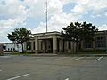
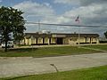
Stafford Municipal Court
-
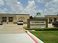
Stafford Police Department, part of the J.C. "Buster" Public Safety Complex
-
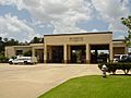
Fire Station No. 1, part of the J.C. "Buster" Court Public Safety Complex
-
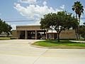
Northside Fire Station
-
Stafford Centre for the Performing Arts
-
Stafford Post Office


See also
 In Spanish: Stafford (Texas) para niños
