Little Delaware River facts for kids
Quick facts for kids Little Delaware River |
|
|---|---|

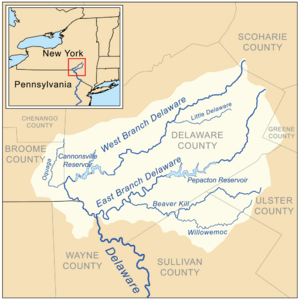
Little Delaware shown as a tributary of the West Branch Delaware
|
|
|
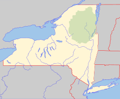
Location of the mouth within New York
|
|
| Country | United States |
| State | New York |
| Region | Catskills |
| County | Delaware |
| Towns | Bovina, Delhi |
| Physical characteristics | |
| Main source | Unnamed mountain NE of Bovina 42°17′23″N 74°39′58″W / 42.2898067°N 74.665988°W |
| River mouth | West Branch Delaware River Delhi 1,325 ft (404 m) 42°15′35″N 74°55′43″W / 42.2598072°N 74.9284952°W |
| Length | 16 mi (26 km) |
| Basin features | |
| River system | Delaware River |
| Basin size | 52.2 sq mi (135 km2) |
| Tributaries |
|
The Little Delaware River is a cool river in Delaware County, New York. It starts high up on Plattekill Mountain, near a small place called Bovina. The river then flows west until it joins with the West Branch Delaware River near the village of Delhi.
Contents
Fishing in the Little Delaware River
This river is a great spot for fishing! You can find two main types of trout here: brown trout and brook trout.
Stocking Fish
To help the fish population, about 700 young brown trout are added to the river each year. These fish are placed in two main areas. One area is about 0.8 miles (1.3 km) long, right where the river meets the West Branch Delaware River. The other area is about 1.2 miles (1.9 km) long, downstream from Bovina Center.
Types of Trout
While brown trout are the most common wild trout in the river, you can also find many brook trout. These brook trout are especially common further upstream from Bovina Center.
What is a Watershed?
A watershed is an area of land where all the water drains into a single river, lake, or ocean. Think of it like a giant funnel. All the rain and snow that falls in that area eventually flows into the same body of water.
Little Delaware's Watershed
The Little Delaware River's watershed is an important part of the larger West Branch Delaware River system. It makes up about 7.84% of the West Branch Delaware River's total watershed area. This means that a good portion of the water flowing into the West Branch comes from the Little Delaware River and its surrounding land.
How We Measure the River
Scientists use special tools to measure how much water is in a river and how fast it's flowing. This helps them understand the river's health and how it changes over time.
The Delhi Stream Gauge
The United States Geological Survey (USGS) has a special measuring station on the Little Delaware River. This station is located near the village of Delhi. It's about 10 feet (3.0 m) downstream from a bridge on Thomson Cross Road. It's also about 1.5 miles (2.4 km) upstream from where the Little Delaware River joins the West Branch Delaware River.
What the Gauge Measures
This station has been measuring the river since October 1937. It records how much water is flowing (called "discharge") and the water's height (called "gauge height"). For example, on January 19, 1996, during a flood, the river's discharge was very high, about 6,100 cubic feet per second (170 m3/s). The water level was also very high, at 8.51 feet (2.59 m). On the other hand, in August and September 1964, the river's discharge was very low, only about .8 cubic feet per second (0.023 m3/s).
 | Laphonza Butler |
 | Daisy Bates |
 | Elizabeth Piper Ensley |


