
Little River (Withlacoochee River tributary) facts for kids
Quick facts for kids Little River |
|
|---|---|
| Country | United States |
| Physical characteristics | |
| Main source | Georgia |
The Little River is a 105-mile (169 km) long river in Georgia. It's a smaller river that flows into a bigger one, called the Withlacoochee River. From there, its water travels to the Suwannee River and eventually reaches the Gulf of Mexico. Long ago, people also called this river the Ockolocoochee River.
The Little River starts in the northwest part of Turner County, Georgia, about 7 miles (11 km) northwest of Ashburn. It flows southeast into Tift County, passing west of Tifton. Then, it turns more to the south. As it continues, it forms the border between several counties: Colquitt and Cook, then Cook and Brooks, and finally Brooks and Lowndes. The river joins the Withlacoochee River about 4 miles (6 km) west of Valdosta, near an old, empty town called Troupville, Georgia.
Fun on the Little River

Reed Bingham State Park is a great place to visit along the Little River. This park has a large lake, covering 375 acres (1.52 square kilometers). The lake was made in 1965 when a dam was built across the river. It's a popular spot for outdoor activities.
River Crossings
Many roads and bridges cross over the Little River as it flows through Georgia. These crossings help people travel easily from one side of the river to the other. Some of the main roads that cross the Little River include SR 37 and SR 133.


Images for kids
-
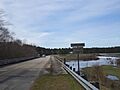
The Roundtree Bridge over the Little River.
-
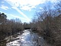
A bridge in Reed Bingham State Park.
-
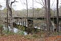
An old railroad bridge in Reed Bingham State Park.


