Little Snake River facts for kids
Quick facts for kids Little Snake River |
|
|---|---|

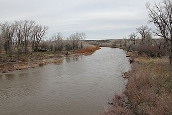
The river as it passes under Wyoming Highway 70 near Dixon.
|
|
 |
|
| Physical characteristics | |
| Main source | Confluence of Middle Fork and North Fork 7,001 ft (2,134 m) 40°59′36″N 107°02′51″W / 40.99333°N 107.04750°W |
| River mouth | Confluence with Yampa River 5,620 ft (1,710 m) 40°27′09″N 108°26′32″W / 40.45250°N 108.44222°W |
| Basin features | |
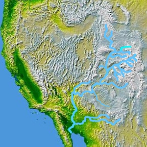
| Progression | Yampa—Green—Colorado |
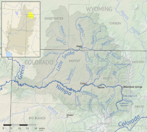
The Little Snake River is a river in the western United States. It flows through parts of southwestern Wyoming and northwestern Colorado. This river is about 155 miles (249 km) long. It is a smaller river that flows into the Yampa River.
Where the River Starts
The Little Snake River begins high up in the mountains. It starts near the continental divide in northern Routt County, Colorado. The continental divide is like a big ridge that separates rivers flowing to the Pacific Ocean from those flowing to the Atlantic Ocean. The river's source is in the Routt National Forest, close to the Park Range mountains.
The River's Journey
From its start, the Little Snake River flows mostly west. It follows the border between Wyoming and Colorado. The river often crosses back and forth between these two states. Along its path, it flows past the towns of Dixon and Baggs in Wyoming.
After a while, the river turns to the southwest. It then flows through Moffat County, Colorado. Finally, the Little Snake River joins the Yampa River. This meeting point is about 45 miles (72 km) west of Craig. It is also just east of Dinosaur National Monument, a famous park.
The Little Snake River is not usually used for boats. Most of the time, it is too shallow for navigation. However, in years when there is a lot of rain or snowmelt, the water level can rise. During these times, it might be possible to navigate some parts of the river.
 | Janet Taylor Pickett |
 | Synthia Saint James |
 | Howardena Pindell |
 | Faith Ringgold |


