
Little Turcotte River facts for kids
Quick facts for kids Little Turcotte |
|
|---|---|

Harricana River basin in yellow
|
|
| Country | Canada |
| Province | Ontario |
| District | Cochrane |
| Physical characteristics | |
| Main source | Cochrane District, Ontario 304 m (997 ft) 49°06′52″N 79°28′37″W / 49.11444°N 79.47694°W |
| River mouth | Turcotte River Cochrane District, Ontario 270 m (890 ft) 49°41′50″N 79°42′33″W / 49.69722°N 79.70917°W |
| Length | 13.7 km (8.5 mi) |
| Basin features | |
| Tributaries |
|
The Little Turcotte River is a small river in Canada. It flows through the Cochrane District in Northeastern Ontario. This river is a branch, or tributary, of the Turcotte River.
The main activity in this area is forestry. This means people work with forests, like cutting down trees for wood. Tourism, which is when people visit for fun, is also important.
The river usually freezes over in early November. It stays frozen until mid-May. But it's generally safe to walk or travel on the ice from mid-November to the end of April.
Contents
Where is the Little Turcotte River?
The Little Turcotte River starts from a small, unnamed lake in the eastern part of the Cochrane District in Ontario. This lake is about 304 meters (997 feet) above sea level.
The river flows for about 13.7 kilometers (8.5 miles). It generally flows towards the south and then southeast. Along its way, it passes through a marshy area.
The Little Turcotte River eventually joins the Turcotte River. This meeting point is on the northern side of the Turcotte River.
Nearby Rivers
The Little Turcotte River is surrounded by other rivers. Here are some of them:
- To the north: Detour River
- To the east: Turgeon River and Garneau River
- To the south: Turcotte River, Burntbush River, Kabika River, and Chabbie River
- To the west: Turcotte River, Chabbie River, and Burntbush River
What does "Turcotte" mean?
The name "Turcotte" comes from a family name that is originally French.
Images for kids
-
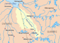
This map shows the Harricana River basin in yellow. The Little Turcotte River is part of this larger river system.
