Liverpool River facts for kids
Quick facts for kids Liverpool |
|
|---|---|
|
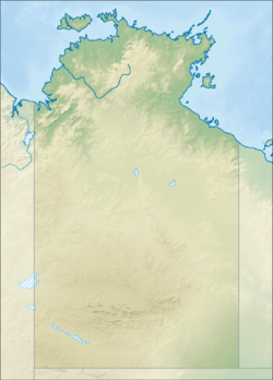
Location of the Liverpool River mouth in the Northern Territory
|
|
| Country | Australia |
| Territory | Northern Territory |
| Physical characteristics | |
| Main source | Spencer Range, Arnhem Land, Australia 161 m (528 ft) |
| River mouth | Australia 0 m (0 ft) 12°07′00″S 134°10′30″E / 12.11667°S 134.17500°E |
| Length | 138 km (86 mi) |
| Basin features | |
| Basin size | 8,280 km2 (3,200 sq mi) |
The Liverpool River is an important river in the Northern Territory of Australia. It's one of the biggest tidal river systems in northern Arnhem Land. A tidal river means its water level changes with the ocean's tides.
This river system includes two other major rivers: the Tomkinson River and the Mann River. Together, they form a large and important waterway in this part of Australia.
Contents
Where is the Liverpool River Located?
The Liverpool River starts in the eastern part of the Spencer Range. From there, it flows towards the north-east. Eventually, its waters reach the Arafura Sea. This happens south of Bat Island. It's also to the south-west of the Aboriginal community of Maningrida.
Understanding the River's Mouth and Estuary
The place where the river meets the sea is called its estuary. The Liverpool River's estuary is very special. It's mostly untouched by human activity. This area is tidal, meaning the ocean's tides strongly affect it.
The open water in the estuary covers about 33.8 square kilometres (13 sq mi). Around this water, there's a large area of 60.8 square kilometres (23 sq mi) covered with mangrove trees. Mangroves are unique trees that grow in salty coastal waters. They create important habitats for many animals.
What is the Liverpool River's Catchment Area?
A river's catchment area is all the land where water flows into that river. The Liverpool River has a large catchment area of about 8,280 square kilometres (3,197 sq mi). Imagine an area bigger than many cities!
This catchment area is located between other river systems. To the west, it's next to the Goomadeer River catchment. To the east, you'll find the Blyth River catchment. To the south, it borders the Roper River catchment. Every year, about 3,810 gigalitres (4.983×10⁹ cu yd) of water flows out of this river system into the sea.
Who Named the Liverpool River?
The Liverpool River was named by an explorer named Phillip Parker King. He explored this area in 1818. King decided to name the river after the British Prime Minister at that time.
The Prime Minister was Robert Banks Jenkinson, who was also known as Lord Liverpool. This is how the river got its name, honoring a significant political figure from that era.
Early Plans for the Region
Another explorer, Captain Francis Cadell, explored the area between 1867 and 1868. He thought the Liverpool River region was a great spot. He believed it would be perfect for farming and raising livestock. He even suggested it could be the site for a new capital city in the Top End.
However, less than a year later, a different plan was put into action. George Goyder and his team started building the city of Palmerston. Today, Palmerston is known as Darwin. It's located about 500 kilometers to the west of the Liverpool River.
 | James B. Knighten |
 | Azellia White |
 | Willa Brown |


