Llullaillaco facts for kids
Quick facts for kids Llullaillaco |
|
|---|---|
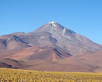
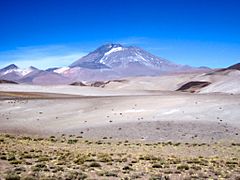
Llullaillaco from the east
|
|
| Highest point | |
| Elevation | 6,723 or 6,739 m (22,057 or 22,110 ft) |
| Prominence | 2,344 m (7,690 ft) |
| Listing | Ultra |
| Geography | |
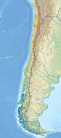
| Location | Chile and Argentina |
| Parent range | Andes, Puna de Atacama |
| Geology | |
| Age of rock | Pleistocene |
| Mountain type | Stratovolcano |
| Last eruption | May 1877 |
| Climbing | |
| First ascent | 1950, but previous climbs by Inka |
Llullaillaco is a huge volcano, 6,739 meters (about 22,110 feet) tall. It's located in the Andes Mountains, right on the border between Argentina and Chile. It's actually the 7th tallest mountain in the entire Andes range!
This giant volcano sits in a place called the Puna de Atacama. This area has many tall volcanoes on a high, flat landform called a plateau. It's also part of the Atacama Desert, which is one of the driest places on Earth.
Contents
Exploring Llullaillaco's Past
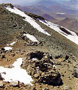
The first recorded climb to the top of Llullaillaco happened on December 1, 1952. Two climbers from Chile, Bión González and Juan Harseim, made this journey. When they reached the top, they found signs that people had been there long before them. These were people from the pre-Columbian period, meaning before Christopher Columbus arrived in the Americas.
Later, from 1983 to 1985, an American archaeologist named Johan Reinhard led several trips. He explored the top and sides of the mountain, looking for ancient sites.
The very top of Llullaillaco is the highest archaeological site in the world. This means it's the highest place where scientists have found old human remains and objects. In 1999, Johan Reinhard and Constanza Ceruti, with their team, made an amazing discovery there. They found the mummified bodies of three Inca children. Along with the children, they also found other ancient artifacts.
About the Volcano
Llullaillaco is a type of volcano called a stratovolcano. These volcanoes are usually tall and cone-shaped, built up by many layers of hardened lava and ash. This volcano is located on the border between Chile and Argentina. On the Chilean side, it's part of the Llullaillaco National Park.
Llullaillaco has erupted a few times in recorded history, in 1854, 1866, and 1877. Since the last eruption in 1877, it has been quiet. It is known as the world's second highest active volcano, with only Ojos del Salado being taller.
Llullaillaco is also known as an Ultra peak. This is a special term for mountains that stand out a lot from the land around them. To be an Ultra, a mountain's peak must rise at least 1,500 meters (about 4,921 feet) higher than any connecting ridge.
Gallery
-
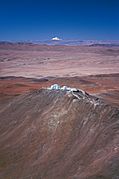
Paranal Observatory and Llullaillaco, 200 km away
Related pages
Images for kids
-
Llullaillaco from Salar de Aguas Calientes IV
See also
 In Spanish: Volcán Llullaillaco para niños
 | Calvin Brent |
 | Walter T. Bailey |
 | Martha Cassell Thompson |
 | Alberta Jeannette Cassell |


