Lobawn facts for kids
Quick facts for kids Lobawn |
|
|---|---|
| Lúbán | |

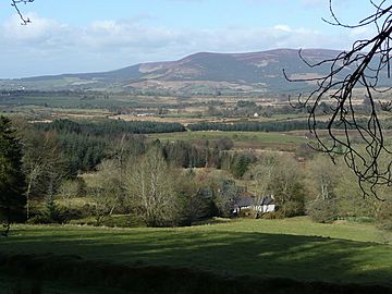
Sugarloaf (l) and Lobawn (r) from the Glen of Imaal in the south
|
|
| Highest point | |
| Elevation | 636 m (2,087 ft) |
| Prominence | 111 |
| Listing | Hewitt, Arderin, Simm, Vandeleur-Lynam |
| Naming | |
| English translation | "Little Bend" |
| Language of name | Irish |
| Geography | |
| Location | Wicklow, Ireland |
| Parent range | Wicklow Mountains |
| OSI/OSNI grid | S977978 |
| Topo map | OSi Discovery 56 |
| Geology | |
| Mountain type | Dark slate-schist, quartzite & coticule |
Lobawn (Irish: Lúbán, meaning little bend) is a mountain in Wicklow, Ireland. It stands tall at 636 metres (2,087 ft) (about 2,087 feet) and is known for its flat, wet top. It is one of the many beautiful peaks in the Wicklow Mountains.
Contents
Exploring Lobawn Mountain
Lobawn is one of the higher peaks in Ireland. It is ranked 182nd on the Arderin scale and 219th on the Vandeleur-Lynam scale. These scales help people compare mountains by their height.
Where is Lobawn?
This mountain is located in the western part of the Wicklow Mountains. It is found in Wicklow, Ireland. Lobawn also has a smaller peak nearby called Sugarloaf (West Wicklow), which is 552 metres (1,811 ft) high.
What's Special About Lobawn's Top?
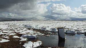
The very top of Lobawn is a flat, wet area. It is often described as "boggy," meaning it is soft and marshy. At the summit, you will find a concrete post. This post is a special marker from the "War Department," which means it was placed there by the military.
Nearby Areas: Glen of Imaal
Both Lobawn and its smaller neighbour, Sugarloaf, are very close to the Glen of Imaal. This area is famous for being a military firing range. The summits of these mountains are near the actual boundaries of the Glen of Imaal Military Artillery Firing Range.
 | Emma Amos |
 | Edward Mitchell Bannister |
 | Larry D. Alexander |
 | Ernie Barnes |


