London to Lewes Way facts for kids
The London to Lewes Way was a long Roman road built by the Romans. It stretched about 71 kilometers (44 miles) from Peckham in London all the way to Lewes in Sussex. This ancient road passed through towns like Beckenham and West Wickham. It also crossed the North Downs hills. Part of the road is now under the High Street in Edenbridge.
The road continued across the high ground of Ashdown Forest. Here, you can sometimes see its path from above. It then went down through Piltdown to Lewes. This road connected with other Roman paths, like the Sussex Greensand Way near Barcombe Mills. It was part of a bigger network of roads around Lewes.
Contents
When Was the Road Built?
Archaeologists found pieces of pottery from the 1st and early 2nd centuries near the road. These were found near Barcombe Mills. This, along with how strongly the road was built, tells us it was likely made around the late 1st or early 2nd century AD.
How the Romans Built the Road
The Romans planned the road using five main straight sections. Sometimes they made small detours to avoid steep hills or muddy areas.
Materials Used
The builders used different materials depending on the area.
- They used flint and gravel over the North Downs and near the South Downs.
- For the middle parts, they often used 'slag'. Slag is a waste product from the Wealden iron industry. It's like a rocky leftover from making iron.
- Sometimes, slag was mixed with sandstone from Ashdown Forest. Other times, it was used as a solid layer.
At Holtye, near East Grinstead, a section of the road was dug up in 1939. It showed iron slag that still had marks from ancient carts. A small part of this road is still open for people to see today.
Road Width and Thickness
The road's width changed a lot from place to place. It could be as narrow as 4.4 meters (14 feet). But in some spots, like Butcher's Cross, it was as wide as 10.5 meters (34 feet). The Romans didn't use a kerb (a raised edge), so the exact planned width is hard to know.
When the road crossed hillsides, it was built on a flat shelf called a terraceway. Here, it was about 3.8 meters (12 feet) wide. On Ashdown Forest, you can sometimes see ditches on the sides of the road. These ditches were about 19 meters (62 feet) apart.
The thickness of the road material also varied. In some places, a thick layer of iron slag was laid directly on the ground. At Holtye, the slag was 30 centimeters (12 inches) thick in the middle. It became thinner at the edges. This slag rusted together, forming a very strong, concrete-like surface.
In other areas, the road had an earth mound, called an agger. This mound was covered with a thinner layer of stone. For example, on Ashdown Forest, only about 7.5 centimeters (3 inches) of compacted sandstone was used. The London end of the road was built with gravel or small flints. These were placed over a layer of larger flints or pebbles. This layer was about 30 centimeters (12 inches) thick in the center.
The Road's Journey
Peckham to Blythe Hill Fields
The northern end of this Roman road started near Watling Street in Peckham. Today, this spot is in the back gardens of houses. Here, the road was made of gravel on a base of pebbles. It ran past Nunhead railway station and along Ivydale Road. It then crossed the Crystal Palace Railway and Brockley Rise. The road continued towards Blythe Hill Fields.
Blythe Hill Fields to Titsey
At Blythe Hill, the road turned slightly south. It then crossed the River Pool. After another small turn, it continued on its next main straight path. Under a golf course, archaeologists found the road still in good condition. It was made of gravel on pebbles and flints.
The road then crossed the railway near Beckenham station. It went through Beckenham and past Langley House. It also passed east of West Wickham village. The road crossed Corkscrew Hill and went down to the road between Addington and Hayes. A small Roman-British settlement once existed here.
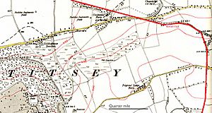
From Rowdown Woods, the border between Surrey and Kent followed the road. The road made a "V" shape at Skid Hill to cross a steep valley. This path, often marked by tracks and hedges, continued to the top of the North Downs. Here, it was over 260 meters (850 feet) above sea level. The road then turned sharply east. It followed the ridge of the downs, passing south of Tatsfield church. It began its descent down the steep slope, called an escarpment, on a terraceway. This part was about 3.8 meters (12 feet) wide. It crossed the Pilgrims Way. The border between Titsey and Tatsfield parishes followed the road for about 4 kilometers (2.5 miles).
Titsey to Marlpit Hill
About 600 meters (650 yards) south of the Pilgrims Way, at the bottom of the escarpment, the road passed a Roman temple. Here, it turned onto a major straight section that led to Marlpit Hill. This section was parallel to the one north of the downs, but about half a mile further east.
The M25 motorway now cuts across the road south of the temple site. This is near the eastern exit of Clacket Lane services. Some Roman items found when the service areas were built are on display there. In the woods east of Limpsfield Chart, the road curved to avoid steep slopes. It followed the path of the modern road through Crockham Hill. Then it rejoined its straight line north of Marlpit Hill.
Marlpit Hill to Ashdown Forest
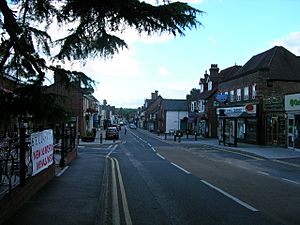
At Marlpit Hill, the road made a small turn of only three degrees. It then mostly stayed on this straight line towards the high ground of Ashdown Forest. The straight stretch of Edenbridge High Street is a very impressive surviving part of the road. It crosses the River Eden and continues to Dencross. Beyond this, the road is harder to see. You can only find traces of it in hedgerows and fields.
In Peters Wood at Holtye, you can see an agger (earth mound) with iron slag. On a footpath south of the A264 road, almost 100 meters (330 feet) of intact road was dug up in 1939. It showed a slag surface in excellent condition, even with wheel marks. Part of this area has been kept uncovered by the Sussex Archaeological Trust. The agger is clearly visible south of this point. It can also be seen at Butcherfield Lane, Hartfield. Here, 40 centimeters (16 inches) of slag was found on a wide agger. The road then climbed a small steep hill through a cut made by engineers.
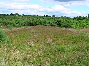
At Chuck Hatch, the road entered Ashdown Forest. It zig-zagged to cross a small stream, called a gill, at Loneoak Hall. Then it continued its straight line onto the high forest. It then turned 46 degrees west. It used several straight sections to follow the ridge to Camp Hill. This forest section was paved with sandstone. It was clearer before being damaged by tank training during World War II. Clear side ditches near Camp Hill are 19 meters (62 feet) apart.
Camp Hill to Lewes
The southernmost 18 kilometers (11 miles) of the road went to Lewes. It was sighted between Camp Hill and Malling Hill on the east side of Lewes. The road passed east of Streater's Farm, which might have gotten its name from the road. It ran east of the modern road to Duddleswell. Then it crossed the modern road north of Fairwarp church.
An agger with slag can be seen at Old Workhouse Farm. This is where the road leaves the open forest. Before reaching the roundabout on the A22 road, there is a 4.5 meter (15 feet) wide terrace cut into a sandstone rock. After passing west of Maresfield, the road can be found through Park Wood and Fairhazel Wood at Piltdown. Here, it appears as an agger with slag.
A clear agger in the park at Buckham Hill House was found by Ivan Margary. It had perfectly intact slag, gravel, and brown flints. This section was 4.5 meters (15 feet) wide and 38 centimeters (15 inches) thick in the center. The road passed west of Isfield's church. It went through a triangular water meadow. Then it crossed the River Ouse next to a Norman castle mound. This suggests there was still a river crossing to protect during the Norman conquest.
Near Gallops Farm, the road ran along the eastern side of Alder Coppice. Traces of slag can be found in the fields all the way to Barcombe Mills. This is where it met the Sussex Greensand Way. The road crossed the Ouse again at the mill site. It was found intact in a field to the south. This part was 6 meters (20 feet) wide and strongly built from flint and a little slag. Some pottery pieces found here suggest it was built around 100 AD or even earlier.
Beyond this, about 700 meters (765 yards) of the road have been washed away by the river. Then, the road's path can be seen by traces of slag in the fields west of Wellingham House. The modern A26 road follows the Roman road's line from Pay Gate Cottages. It goes past Upper Stoneham Farm. Then it turns southwest to go around Malling Down. The Roman road, however, continued along the east side of the allotments and over the hill to Cliffe.
 | Emma Amos |
 | Edward Mitchell Bannister |
 | Larry D. Alexander |
 | Ernie Barnes |


