
Longtown, Missouri facts for kids
Quick facts for kids
Longtown, Missouri
|
|
|---|---|

Longtown, Missouri from Highway 61
|
|

Location of Longtown, Missouri
|
|
| Country | United States |
| State | Missouri |
| County | Perry |
| Township | Union |
| Area | |
| • Total | 0.13 sq mi (0.32 km2) |
| • Land | 0.13 sq mi (0.32 km2) |
| • Water | 0.00 sq mi (0.00 km2) |
| Elevation | 656 ft (200 m) |
| Population
(2020)
|
|
| • Total | 90 |
| • Density | 720.00/sq mi (278.38/km2) |
| Time zone | UTC-6 (Central (CST)) |
| • Summer (DST) | UTC-5 (CDT) |
| ZIP code |
63775
|
| Area code(s) | 573 |
| FIPS code | 29-43940 |
| GNIS feature ID | 2396724 |
Longtown is a small village located in Perry County, Missouri, in the United States. It is part of Union Township. In 2020, the village had a population of 90 people.
Contents
History of Longtown
Early Settlers and Community Beginnings
The first European settlers arrived in the Longtown area around 1817. These were English and Scotch-Irish Presbyterian families from North Carolina. They settled a bit south of the current village.
Soon after, in 1821, more English and Scotch-Irish families, who were Methodists, moved into the area where Longtown is today. Some of the first families included the Abernathys, Farrars, and Rutledgers. Many people moved from North Carolina after the War of 1812.
In 1826, these settlers built their first simple log meeting house. This was later replaced by the York Chapel Methodist church in 1836.
Growth and Naming of the Village
At first, the area was known as the "Abernathy Settlement." It wasn't a proper town yet, as people lived on farms spread out in the countryside. Emil Urban and Oliver Abernathy were the first people to open stores there.
By 1860, a small community had started to form along a main road called the King's Road. This road is now known as King's Highway.
In April 1874, the community officially became a village and was named "Longtown." There are two ideas about where the name came from. One idea is that it was named after a German couple, Johann and Maria Lang, who moved to the area. "Lang" means "long" in German. Another idea is that it was named after an early settler named John Long. The first mayor of Longtown was Velentine Bergmann. A post office was opened in 1883, but it closed in 1966.
Churches in Longtown
For many years, the German Protestant people in Longtown went to the Frieden (Peace) Lutheran Church in nearby Friedenberg. However, the dirt roads made it hard to travel, especially in bad weather. Because of this, people wanted a church closer to home.
In 1882, a new church called Cross Congregation Lutheran Church was started in the school house in Longtown. This church was for members who followed the Ohio Synod teachings. However, it was a small church and didn't last long, closing in 1898. Only the small Cross Cemetery remains today.
Another Lutheran church, Zion Lutheran Church, was built in 1897. The first church building was made of wood. By 1912, it was replaced with the brick church you can see today.
Life in the Early 20th Century
In the early 1900s, Longtown had about 158 people. It had two churches, a public school, three general stores, a bank, a tavern, and a flour mill. It was mainly a farming community.
Over the years, some businesses faced challenges. For example, the Hacker & Funke General Store and Barbershop had a bad fire in 1936. Later, in 1981, another fire completely destroyed the Wallace Hacker General Store.
Geography of Longtown
Longtown is a small village. The United States Census Bureau says that the village covers about 0.13 square miles (0.32 square kilometers) of land. There is no water area within the village limits.
Nearby Communities
This map shows Longtown and other towns and villages that are close by.

Population Changes in Longtown
| Historical population | |||
|---|---|---|---|
| Census | Pop. | %± | |
| 1900 | 108 | — | |
| 1910 | 158 | 46.3% | |
| 1920 | 162 | 2.5% | |
| 1930 | 150 | −7.4% | |
| 1940 | 138 | −8.0% | |
| 1950 | 139 | 0.7% | |
| 1960 | 113 | −18.7% | |
| 1970 | 113 | 0.0% | |
| 1980 | 121 | 7.1% | |
| 1990 | 107 | −11.6% | |
| 2000 | 76 | −29.0% | |
| 2010 | 102 | 34.2% | |
| 2020 | 90 | −11.8% | |
| U.S. Decennial Census 2020 | |||
The table above shows how the population of Longtown has changed over many years, based on the U.S. Census. You can see that the population has gone up and down. For example, in 1910, there were 158 people, but by 2020, it was 90 people.
Longtown's Population in 2010
In 2010, the village of Longtown had 102 people living in 39 households. A household is a group of people living together in one home. Most of these households (30 of them) were families.
The village had a population density of about 785 people per square mile. This means that for every square mile of land, there were about 785 people.
Almost all the people in Longtown (99.02%) were White. A small number (0.98%) were from other racial backgrounds. About 2% of the population identified as Hispanic or Latino.
Many households (33.3%) had children under 18 living with them. Most households (74.4%) were married couples living together. The average household had 2.62 people, and the average family had 3.07 people.
The average age of people in Longtown in 2010 was 36.7 years old. About 26.5% of the residents were under 18. About 12.7% were 65 years old or older. The number of males and females in the village was almost equal, with 50% male and 50% female.
Gallery
-
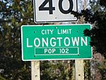
Population Road sign
-
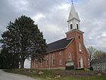
Zion Lutheran Church
-
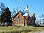
Zion Lutheran Church
-
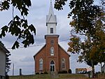
York Methodist Chapel


See also
 In Spanish: Longtown (Misuri) para niños
