Loretto, Kentucky facts for kids
Quick facts for kids
Loretto, Kentucky
|
|
|---|---|

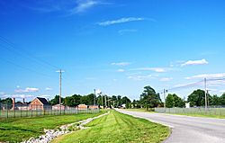
Kentucky Route 52 in Loretto
|
|

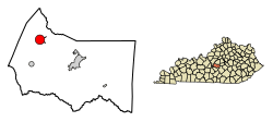
Location in Marion County, Kentucky
|
|
| Country | United States |
| State | Kentucky |
| County | Marion |
| Incorporated | 1866 |
| Named for | a local Catholic sisterhood |
| Area | |
| • Total | 3.22 sq mi (8.34 km2) |
| • Land | 3.19 sq mi (8.26 km2) |
| • Water | 0.03 sq mi (0.08 km2) |
| Elevation | 738 ft (225 m) |
| Population
(2020)
|
|
| • Total | 723 |
| • Density | 226.72/sq mi (87.54/km2) |
| Time zone | UTC-5 (Eastern (EST)) |
| • Summer (DST) | UTC-4 (EDT) |
| ZIP code |
40037
|
| Area code(s) | 270 & 364 |
| FIPS code | 21-47710 |
| GNIS feature ID | 0497170 |
Loretto is a small city in Marion County, Kentucky, in the United States. In 2020, about 723 people lived there. It is most famous for being the home of the Maker's Mark distillery.
Contents
History of Loretto
Loretto got its name from the Sisters of Loretto. This was a group of Catholic sisters who started their community in 1812 near St. Mary. The sisters were named after a town in Italy called Loreto. This Italian town is famous for a church that is believed to hold the original home of the Virgin Mary.
The Sisters of Loretto started a school in the area. They wanted to educate the children living on the frontier. By 1833, the community had grown large enough to have its own post office. Loretto officially became a city in 1866.
The Maker's Mark Distillery
The Maker's Mark distillery in Loretto has a long history. It started with a distillery built by Charles Burks in the early 1800s. His family greatly expanded it in the late 1880s.
In 1953, Bill Samuels bought the distillery. He then renamed the brand "Maker's Mark." The distillery is located about 3 miles (4.8 km) east of Loretto. It is a very important historical site. It is listed on the National Register of Historic Places. It has also been named a National Historic Landmark. You can see its large barrel warehouses in the western part of Loretto.
Geography of Loretto
Loretto is located in the northwestern part of Marion County. Its exact location is 37°38′8″N 85°23′12″W. The city covers a total area of about 3.2 square miles (8.3 square kilometers). Only a small part of this area, about 0.03 square miles (0.08 square kilometers), is water.
The city is mainly built around where two roads meet: Kentucky Route 52 and Kentucky Route 49. Loretto is about 10 miles (16 km) northwest of Lebanon. It is also about 13 miles (21 km) southwest of Springfield. And it is about 15 miles (24 km) south of Bardstown.
Population Information
| Historical population | |||
|---|---|---|---|
| Census | Pop. | %± | |
| 1870 | 42 | — | |
| 1880 | 129 | 207.1% | |
| 1970 | 985 | — | |
| 1980 | 954 | −3.1% | |
| 1990 | 820 | −14.0% | |
| 2000 | 623 | −24.0% | |
| 2010 | 713 | 14.4% | |
| 2020 | 723 | 1.4% | |
| U.S. Decennial Census | |||
The census is a count of all the people living in a place. The 2000 census showed that 623 people lived in Loretto. There were 252 households, which are groups of people living in one home. Most of the people living in Loretto were White.
About 28% of the households had children under 18 years old. More than half, 53%, were married couples living together. About 29% of all households were made up of single individuals. The average household had about 2.47 people.
About 24.7% of the population was under 18 years old. Around 14.1% of the people were 65 years old or older. The average age of people in Loretto was 36 years. For every 100 females, there were about 103.6 males.
See also
 In Spanish: Loretto (Kentucky) para niños
 | Lonnie Johnson |
 | Granville Woods |
 | Lewis Howard Latimer |
 | James West |

