Lowell, Ohio facts for kids
Quick facts for kids
Lowell, Ohio
|
|
|---|---|
|
Village
|
|

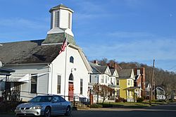
Fourth Street
|
|

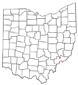
Location of Lowell, Ohio
|
|

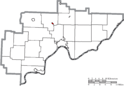
Location of Lowell in Washington County
|
|
| Country | United States |
| State | Ohio |
| County | Washington |
| Government | |
| • Type | Mayor-council |
| Area | |
| • Total | 0.24 sq mi (0.61 km2) |
| • Land | 0.23 sq mi (0.59 km2) |
| • Water | 0.01 sq mi (0.02 km2) |
| Elevation | 623 ft (190 m) |
| Population
(2020)
|
|
| • Total | 567 |
| • Density | 2,478.07/sq mi (957.41/km2) |
| Time zone | UTC-5 (Eastern (EST)) |
| • Summer (DST) | UTC-4 (EDT) |
| ZIP code |
45744
|
| Area code(s) | 740 |
| FIPS code | 39-45164 |
| GNIS feature ID | 2399194 |
Lowell is a small village in Washington County, Ohio, United States. It is located right next to the Muskingum River. In 2020, about 549 people lived there. The village is about 7.6 miles (12.2 km) north of Marietta, Ohio.
Contents
Discovering Lowell's Past
Early Settlers and New Lands
The first European settlers arrived in the Lowell area in the late 1700s. This happened after the Northwest Ordinance of 1787 opened up new lands for people to settle. Soon after, a group called the Ohio Company of Associates bought a huge amount of land. They bought 1.5 million acres (6,100 km²) along the Muskingum River.
The very first settlement in Ohio was Marietta, founded in 1788. It was built near where the Muskingum River flows into another river. This was about 14 miles (22.5 km) downstream from where Lowell is today. By 1789, people had started settling further north. They reached the spot where Cats Creek joins the Muskingum River.
Building Locks and Dams
By the 1830s, many people lived in the Muskingum Valley. Local leaders wanted to make the Muskingum River better for power. In 1836, the state government approved a plan. They decided to spend $400,000 to build a series of locks and dams along the river. These would go as far north as Dresden.
Between 1837 and 1841, eleven dams and twelve locks were built. The cost grew to over $1.6 million. The third lock was built in a one-mile (1.6 km) long canal. This canal helped boats get around some fast-moving parts of the Muskingum River.
How Lowell Was Founded
Two different companies bought land near this new canal. They both wanted to build a town. The first settlement was started on November 8, 1837. It was named Lowell. The idea was that it would grow into a big factory city, like Lowell, Massachusetts. This first Lowell was located on the west side of Cats Creek.
The second settlement was called Buell's Lowell. It was started on March 22, 1838. Buell's Lowell quickly became more important. The first settlement became known as Upper Lowell. In 1850, Buell's Lowell officially became a village. In 1889, it changed its name to just Lowell.
Changes Over Time
In the late 1800s, many mills, tanneries, and factories were built along the canal. In 1888, a railroad was built across the river from Lowell. This gave the village train access to other towns.
By the early 1900s, Lowell's importance began to lessen. River trade was replaced by railroads and then by cars. Factories in the village closed down. Much of the land along the canal is now parkland. Today, many people who live in Lowell travel to nearby Parkersburg and Marietta for work and shopping.
In 2015, Steve Weber was elected Mayor of Lowell.
Lowell's Location and Landscape
Lowell is located right next to the Muskingum River.
The village covers a total area of 0.24 square miles (0.62 km²). Most of this area, 0.23 square miles (0.60 km²), is land. A small part, 0.01 square miles (0.026 km²), is water.
State Routes 60 and 530 meet in Lowell. These roads connect the village to other places.
Who Lives in Lowell?
| Historical population | |||
|---|---|---|---|
| Census | Pop. | %± | |
| 1870 | 350 | — | |
| 1880 | 322 | −8.0% | |
| 1890 | 441 | 37.0% | |
| 1900 | 381 | −13.6% | |
| 1910 | 569 | 49.3% | |
| 1920 | 516 | −9.3% | |
| 1930 | 545 | 5.6% | |
| 1940 | 528 | −3.1% | |
| 1950 | 638 | 20.8% | |
| 1960 | 783 | 22.7% | |
| 1970 | 852 | 8.8% | |
| 1980 | 729 | −14.4% | |
| 1990 | 617 | −15.4% | |
| 2000 | 628 | 1.8% | |
| 2010 | 549 | −12.6% | |
| 2020 | 565 | 2.9% | |
| U.S. Decennial Census | |||
Looking at the 2010 Census
In 2010, there were 549 people living in Lowell. These people lived in 248 households, and 157 of these were families. The village had about 2,387 people per square mile (921.6 per km²). There were 289 homes, with about 1,256 homes per square mile (485 per km²).
Most people in the village (98.7%) were White. A small number were African American (0.4%) or from other backgrounds. About 0.4% of the population was Hispanic or Latino.
About 29.8% of households had children under 18 living with them. About 46% were married couples. Some households (14.1%) had a female head of household with no husband. About 3.2% had a male head of household with no wife. About 36.7% were not families.
About 32.3% of all households had only one person living there. About 16.2% had someone aged 65 or older living alone. The average household had 2.21 people. The average family had 2.75 people.
The average age in the village was 45.2 years. About 22.6% of residents were under 18. About 22.8% were 65 or older. The village was 45.9% male and 54.1% female.
Learning in Lowell
Lowell is home to Lowell Elementary, which teaches students from kindergarten to sixth grade. This school is part of the Fort Frye School District. Lowell High School used to be in the village, but it is no longer used.
Exploring Historic Places
Lowell is where you can find Lock #3 on the Muskingum River. This lock helps create an island called Buell Island. The island is named after Don Carlos Buell, a famous person from Lowell. Some people live on Buell Island, but it is mostly used for fun activities at Buell Park.
Buell Island also has the historic Strait Run one-room schoolhouse. Even though the school has been moved from its first spot, its building and furniture are still the same.
Famous People from Lowell
- Don Carlos Buell: A Major General who fought in several important wars, including the American Civil War.
- Lee Fohl: A baseball player and manager.
- Dan Hughes: A coach for women's professional basketball teams, like the San Antonio Stars and Seattle Storm.
- Mary Reed (1854-1943): A missionary.
 In Spanish: Lowell (Ohio) para niños
 | Anna J. Cooper |
 | Mary McLeod Bethune |
 | Lillie Mae Bradford |

