Lower Granite Lake facts for kids
Quick facts for kids Lower Granite Lake |
|
|---|---|

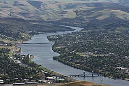
A view of Lower Granite Lake/Snake River from Lewiston Hill. The city of Lewiston, Idaho is on the left with Clarkston, Washington on the right. The Interstate Highway Bridge is in the foreground and the Southway Bridge in the center of the photograph.
|

Lower Granite Lake is a large artificial lake, also known as a reservoir. It was created by the Lower Granite Dam, which is a big concrete dam located in southeastern Washington. This dam helps to generate electricity and allows boats to travel along the river.
The dam was finished in 1975. It sits on the lower part of the Snake River, connecting Whitman and Garfield counties. It is about 22 miles south of Colfax and 35 miles north of Pomeroy.
Lower Granite Dam is part of a bigger system of dams in the Columbia River Basin. The United States Army Corps of Engineers built and operates these dams. The electricity they make is sent out by the Bonneville Power Administration, which provides power to homes and businesses.
Lower Granite Lake stretches about 39 miles east, all the way to the cities of Lewiston, Idaho and Clarkston, Washington. Because of this lake, Lewiston and Clarkston became important ports. This means ships and barges can load and unload goods there. The very first barge carrying wheat left Lewiston on August 9, 1975. It traveled 374 miles to Portland.
Bridges Crossing Lower Granite Lake
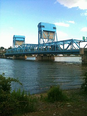
Several bridges cross Lower Granite Lake, connecting the cities on its banks. These bridges are important for travel and trade in the area.
- Southway Bridge - This bridge connects Lewiston, Idaho and Clarkston, Washington.
- Interstate Highway Bridge - This bridge also crosses between Lewiston and Clarkston. It carries U.S. Route 12, which is a major highway.
Images for kids
-
Another photo of the lake from Lewiston Hill. It shows the Clearwater River to the left (in Idaho) and the Snake River in the center. Washington state is to the right.
 | Ernest Everett Just |
 | Mary Jackson |
 | Emmett Chappelle |
 | Marie Maynard Daly |


