Luthersville, Georgia facts for kids
Quick facts for kids
Luthersville, Georgia
|
|
|---|---|
|
City
|
|

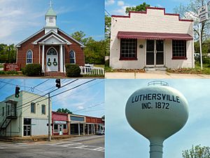
Luthersville in 2013
|
|

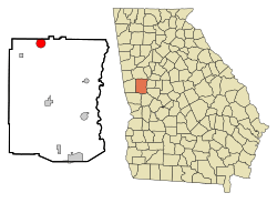
Location in Meriwether County and the state of Georgia
|
|
| Country | United States |
| State | Georgia |
| County | Meriwether |
| Area | |
| • Total | 3.19 sq mi (8.25 km2) |
| • Land | 3.16 sq mi (8.19 km2) |
| • Water | 0.02 sq mi (0.06 km2) |
| Elevation | 942 ft (287 m) |
| Population
(2020)
|
|
| • Total | 776 |
| • Density | 245.26/sq mi (94.70/km2) |
| Time zone | UTC-5 (Eastern (EST)) |
| • Summer (DST) | UTC-4 (EDT) |
| ZIP code |
30251
|
| Area code(s) | 770 |
| FIPS code | 13-48008 |
| GNIS feature ID | 0317494 |
Luthersville is a small city located in Meriwether County, Georgia, in the United States. In 2020, about 776 people lived there. This number was a bit lower than in 2010, when 874 people called Luthersville home.
Contents
A Look Back: Luthersville's History
Luthersville became an official town in 1872. This happened when the Georgia General Assembly, which is like Georgia's state government, made it a city. The town was named after Martin Luther. He was a very important German reformer from the 1500s.
Where is Luthersville?
Luthersville is in the northern part of Meriwether County, Georgia. Its northern edge touches the border of Coweta County. You can find its exact spot using these coordinates: 33°12′33″N 84°44′43″W / 33.20917°N 84.74528°W.
Roads and Travel
U.S. Route 27 Alternate is the main road in Luthersville. It's often called Main Street. If you drive south on this highway for about 13 miles, you'll reach Greenville. Greenville is the main town, or county seat, of Meriwether County. Driving north for about 12 miles will take you to Newnan.
Another important road is Georgia State Route 54. It crosses U.S. Route 27 Alternate right in the middle of Luthersville. This road goes northeast for about 11 miles to Turin. It also goes southwest the same distance to Hogansville.
Land and Water
Luthersville covers a total area of about 3.2 square miles. Most of this area is land. Only a tiny part, about 0.02 square miles, is water.
The city sits on a raised area of land called a ridge. This ridge acts like a natural dividing line for water. Water on the west side of the ridge flows into the Chattahoochee River. Water on the east side flows into the Flint River.
For example, the northwest part of Luthersville drains into Yellowjacket Creek. This creek eventually joins the Chattahoochee River. The southern and northeast parts of the city drain into Coleman Creek and Bear Creek, which are both part of the Flint River system.
Who Lives in Luthersville?
This section tells us about the people who live in Luthersville. It includes information like how many people live there and their different backgrounds.
Population Changes Over Time
The table below shows how Luthersville's population has changed over many years.
| Historical population | |||
|---|---|---|---|
| Census | Pop. | %± | |
| 1880 | 179 | — | |
| 1900 | 209 | — | |
| 1910 | 349 | 67.0% | |
| 1920 | 359 | 2.9% | |
| 1930 | 321 | −10.6% | |
| 1940 | 354 | 10.3% | |
| 1950 | 312 | −11.9% | |
| 1960 | 282 | −9.6% | |
| 1970 | 400 | 41.8% | |
| 1980 | 597 | 49.3% | |
| 1990 | 741 | 24.1% | |
| 2000 | 783 | 5.7% | |
| 2010 | 874 | 11.6% | |
| 2020 | 776 | −11.2% | |
| U.S. Decennial Census | |||
People in 2020
In 2020, the 2020 United States census counted 776 people living in Luthersville. There were 248 households, which means 248 different homes where people lived. Out of these, 173 were families.
The table below shows the different racial backgrounds of the people in Luthersville in 2020.
| Race | Num. | Perc. |
|---|---|---|
| White (non-Hispanic) | 341 | 43.94% |
| Black or African American (non-Hispanic) | 387 | 49.87% |
| Native American | 2 | 0.26% |
| Asian | 8 | 1.03% |
| Other/Mixed | 17 | 2.19% |
| Hispanic or Latino | 21 | 2.71% |
See also
 In Spanish: Luthersville para niños
 | Misty Copeland |
 | Raven Wilkinson |
 | Debra Austin |
 | Aesha Ash |

