Mameigwess Lake (south Kenora District) facts for kids
Quick facts for kids Mameigwess Lake |
|
|---|---|
| lac Mameigwess | |
| Location | Kenora District, Ontario |
| Coordinates | 49°33′03″N 91°49′32″W / 49.55083°N 91.82556°W |
| Type | Lake |
| Part of | Hudson Bay drainage basin |
| Primary outflows | Mameigwess River |
| Basin countries | Canada |
| Max. length | 14 kilometres (8.7 mi) |
| Max. width | 8 kilometres (5.0 mi) |
| Surface elevation | 405 metres (1,329 ft) |
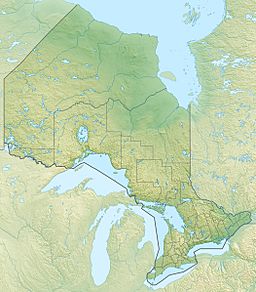
Mameigwess Lake (also known as French: lac Mameigwess in French) is a beautiful lake located in the northwestern part of Ontario, Canada. It is found in the southern area of the Unorganized Part of Kenora District. This lake is an important part of the huge Hudson Bay drainage basin, which means its waters eventually flow into Hudson Bay.
The lake is quite large, stretching about 14 kilometres (8.7 mi) (about 8.7 miles) long and 8 kilometres (5.0 mi) (about 5 miles) wide. It sits at an elevation of 405 metres (1,329 ft) (about 1,329 feet) above sea level.
Contents
Exploring Mameigwess Lake
Mameigwess Lake is a great spot for nature lovers. It's located about 15 kilometres (9.3 mi) (about 9 miles) northwest of a community called Ignace. You can easily reach the lake by road, as it's only about 6 kilometres (3.7 mi) (about 3.7 miles) north of Ontario Highway 17.
Lake Geography
The lake's southwest corner touches an area known as geographic Isley Township. Meanwhile, the southeast corner of the lake is in geographic Bradshaw Township. These are older ways of dividing up land in Canada.
Activities at the Lake
If you love the outdoors, you'll be interested to know that there is a hunting and fishing camp right on Mameigwess Lake. This makes it a popular place for people who enjoy these activities.
Water Flow and Connections
Mameigwess Lake is part of a large network of rivers and lakes that connect across Canada.
Inflows and Outflows
Many small streams and rivers flow into Mameigwess Lake, though most of them don't have official names. The main river that flows out of the lake is the Mameigwess River. This river starts at the southeast end of the lake, also in geographic Bradshaw Township.
Journey to Hudson Bay
The water from Mameigwess Lake goes on a long journey!
- First, the Mameigwess River flows into the Agimak River.
- Next, the Agimak River joins the English River.
- Then, the English River flows into the Winnipeg River.
- Finally, the Winnipeg River connects to the Nelson River, which carries all this water all the way to Hudson Bay.
This shows how Mameigwess Lake is an important part of a much bigger water system that stretches across a large part of Canada.


