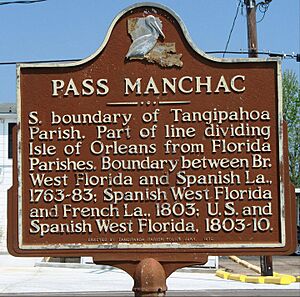
Manchac, Louisiana facts for kids
Quick facts for kids
Manchac, Louisiana
|
|
|---|---|

This view toward the north from midstream in Pass Manchac shows its confluence with North Pass (center).
|
|
| Country | United States |
| State | Louisiana |
| Parish | Tangipahoa |
| Elevation | 3 ft (0.9 m) |
| Time zone | UTC-6 (CST) |
| • Summer (DST) | UTC-5 (CDT) |
| ZIP code |
70421
|
| Area code(s) | 985 |
Manchac (also known as Akers) is a small community in Tangipahoa Parish, Louisiana, United States. It's called an "unincorporated community" because it doesn't have its own local government like a city or town. Instead, it's governed by the parish.
Contents
What's in a Name?
The name Manchac comes from a Native American language. Dr. John R. Swanton, a language expert, believed it came from the Choctaw word Imashaka. This word means "the rear entrance." An old Choctaw dictionary explains that im means "place" and ashaka means "the back side or rear."
Willie Akers and the Community
Willie Akers, who had the same name as his father (who founded the city of Ponchatoula), moved to Manchac in 1871. He built his home near a high piece of land called Jones Island.
In 1857, Willie Akers became the first postmaster of Manchac. A postmaster is in charge of a post office. He also worked as the local telegraph operator. Because of Willie Akers, the community became known as "Akers" for a while.
A Glimpse into History
Manchac has a long history, especially because of its location.
- Early Forts: In 1763, a place called Fort Bute (also known as Manchac Post) was built. It was named after the British Prime Minister at the time. This fort was important for military and trading activities.
- Changing Hands: During the American Revolutionary War, the fort was captured by Spanish forces in 1775. Later, in 1779, Spanish forces led by Bernardo Galvez captured it again from the British.
- Railroad Connection: In 1852, a railroad was planned through Manchac. This made Manchac an important stop, usually about ten miles from other stations. Today, this railway is part of the Canadian National Railway system.
- Civil War Era: Manchac was also part of events during the American Civil War.
Exploring Manchac's Location
Manchac is located right on Lake Maurepas. It's connected to Lake Pontchartrain by the Pass Manchac waterway. The Manchac Swamp Bridge on Interstate 55 has exits and entrances for Manchac, making it easy to visit.
Manchac is also home to the old ruins of the Pass Manchac Light, which was a lighthouse for Lake Pontchartrain.
- The last lighthouse built there was finished in 1857.
- It became automated in 1941, meaning it worked by itself.
- The U.S. Coast Guard stopped using it in 1987.
- Sadly, Hurricane Isaac destroyed the lighthouse structure in 2012.
- However, the top part of the lighthouse, called the lantern room, was saved before the hurricane. You can now see it at the Lake Pontchartrain Basin Maritime Museum in Madisonville.
Manchac is a great place for outdoor activities! It's well-known for:
- fishing
- duck hunting
- delicious seafood restaurants, like Middendorf's
- exciting swamp tours
 | Emma Amos |
 | Edward Mitchell Bannister |
 | Larry D. Alexander |
 | Ernie Barnes |


