Manhasset Hills, New York facts for kids
Quick facts for kids
Manhasset Hills, New York
|
|
|---|---|
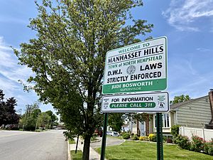
A welcome sign to Manhasset Hills, located at the intersection of Old Courthouse Road and Shelter Rock Road.
|
|
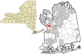
Location in Nassau County and the state of New York
|
|
| Country | |
| State | |
| County | Nassau |
| Town | North Hempstead |
| Area | |
| • Total | 0.59 sq mi (1.53 km2) |
| • Land | 0.59 sq mi (1.53 km2) |
| • Water | 0.00 sq mi (0.00 km2) |
| Elevation | 125 ft (38 m) |
| Population
(2020)
|
|
| • Total | 3,649 |
| • Density | 6,174.28/sq mi (2,382.85/km2) |
| Time zone | UTC-5 (Eastern (EST)) |
| • Summer (DST) | UTC-4 (EDT) |
| ZIP code |
11040
|
| Area codes | 516, 363 |
| FIPS code | 36-44908 |
| GNIS feature ID | 1867410 |
Manhasset Hills is a small community on Long Island, New York. It is known as a hamlet and a census-designated place (CDP). A hamlet is a small settlement, and a CDP is an area defined by the government for counting people. Manhasset Hills is part of the Town of North Hempstead in Nassau County. In 2020, about 3,649 people lived here. It is near other communities like Herricks and North Hills.
Contents
The Story of Manhasset Hills
By the late 1950s, much of the land in Manhasset Hills was developed. This means many homes were built there. One of the last big housing projects was called Cherrywood Homes. It was built on 24 acres of land. This project included 88 split-level houses. These homes were designed by A.H. Salkowitz.
In the 1980s and 1990s, some residents of Manhasset Hills worked to prevent a group home for people with mental disabilities from being built in their neighborhood. They were worried about property values. The residents were successful, and the home was later built in nearby New Hyde Park.
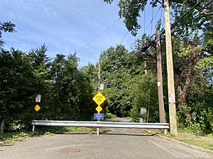
The historic Long Island Motor Parkway used to run along the northern edge of the community.
Where is Manhasset Hills?
Manhasset Hills is located at coordinates 40.759230 degrees North and -73.679861 degrees West. This is its exact spot on a map.
Size of the Area
According to the United States Census Bureau, Manhasset Hills covers about 0.6 square miles (1.53 square kilometers). All of this area is land, with no large bodies of water.
How People Live and Work
Manhasset Hills is mainly a "bedroom community." This means many people who live here travel to New York City for their jobs. They live in Manhasset Hills and commute to the city.
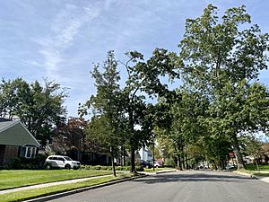
The community is mostly made up of homes. Most of the land is set aside for single-family houses. There is only a small area in the southwest corner of Manhasset Hills that has businesses or industrial buildings.
Population Facts
| Historical population | |||
|---|---|---|---|
| Census | Pop. | %± | |
| 2000 | 3,661 | — | |
| 2010 | 3,592 | −1.9% | |
| 2020 | 3,649 | 1.6% | |
| U.S. Decennial Census | |||
In 2020, the population of Manhasset Hills was 3,649 people. This number has stayed fairly steady over the years. The community has a mix of different backgrounds.
Fun Places and Activities
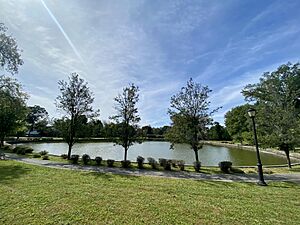
The Town of North Hempstead owns and takes care of two parks in Manhasset Hills. These parks are great places for outdoor activities.
- Clinton G. Martin Park
- Ridder's Pond Park
Learning and Libraries
School Districts
Most children in Manhasset Hills go to public schools in the Herricks Union Free School District. However, a small part of the community in the west is in the Great Neck Union Free School District. So, where a child lives in Manhasset Hills determines which school district they attend.
Library Districts
Manhasset Hills is also served by two library districts. These are the Great Neck Library District and the Shelter Rock Library District. The areas covered by these libraries are similar to the school district boundaries.
Getting Around and Services
Transportation
Roads
A small part of the Northern State Parkway runs through the northeast corner of Manhasset Hills. The old Long Island Motor Parkway also used to pass through here. Major roads like Denton Avenue, Marcus Avenue, and Shelter Rock Road also go through the community.
Trains
There are no train lines directly in Manhasset Hills. The closest Long Island Rail Road stations are New Hyde Park and East Williston.
Buses
Bus lines n25 and n26 run along New Hyde Park Road, which is on the western edge of Manhasset Hills. These buses are run by Nassau Inter-County Express (NICE).
Utilities
Natural Gas and Power
National Grid USA supplies natural gas to homes and businesses in Manhasset Hills. PSEG Long Island provides electricity to everyone in the community. The path where the old Long Island Motor Parkway used to be is now used for power lines.
Water and Sewage
Manhasset Hills gets its water from two different water districts: the Garden City Park Water District and the Manhasset–Lakeville Water District. All homes in Manhasset Hills are connected to sanitary sewers. These sewers are part of the Nassau County Sewage District, which cleans the community's wastewater.
See also
 In Spanish: Manhasset Hills para niños
 | Chris Smalls |
 | Fred Hampton |
 | Ralph Abernathy |


