Marana, Arizona facts for kids
Quick facts for kids
Marana, Arizona
|
|||
|---|---|---|---|

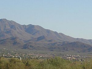
Marana in the foreground of the Tortolita Mountains.
|
|||
|
|||

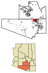
Location of Marana in Pima County and Pinal County, Arizona
|
|||
| Country | United States | ||
| State | Arizona | ||
| County | Pima, Pinal | ||
| Incorporated | 1977 | ||
| Government | |||
| • Type | Council-manager | ||
| • Body | Marana Town Council | ||
| Area | |||
| • Total | 121.78 sq mi (315.41 km2) | ||
| • Land | 121.10 sq mi (313.65 km2) | ||
| • Water | 0.68 sq mi (1.77 km2) | ||
| Elevation | 1,991 ft (607 m) | ||
| Population
(2020)
|
|||
| • Total | 51,908 | ||
| • Density | 428.64/sq mi (165.50/km2) | ||
| Time zone | UTC-7 (MST (no DST)) | ||
| ZIP code |
85653, 85658, 85743
|
||
| Area code(s) | 520 | ||
| FIPS code | 04-44270 | ||
| GNIS feature ID | 7681 | ||
| Website | http://www.marana.com/ | ||
Marana is a town in Arizona, a state in the United States. Most of Marana is in Pima County, with a small part in Pinal County. It is located northwest of Tucson. In 2020, about 51,908 people lived there.
Contents
History of Marana
Scientists who study old civilizations, called archaeologists, have found signs that people have lived in the Marana area for about 4,200 years. Many important old sites have been discovered near Marana.
- Las Capas is a very old farming site. It was used from 4,200 to 2,500 years ago. This site has the oldest known cemetery in the American Southwest. It also has the oldest known canals in North America. The oldest tobacco pipes in the world were found here too.
- Marana Mound dates back to between 1150 and 1300 A.D. It is what's left of a large platform mound. This mound was the center of a community of people called the Hohokam. These people lived between the Santa Cruz River and the Tortolita Mountains.
- Linda Vista Hill was used between 1200 and 1350 A.D. It is a site where people from the Trincheras culture lived on mountain slopes. They built more than 150 terraces and 75 pit houses on the hillside.
- Los Morteros is a Hohokam village ruin with a ballcourt. It is located near the Santa Cruz River. This site might also be where the Juan Bautista de Anza expedition camped in 1775.
In 1775, Juan Bautista de Anza led an expedition north through this area. His group included about 200 people and over 1,000 animals. Their campsite later became the CalPortland Cement Plant near Marana. A 15-mile (24 km) part of their route through Marana is now part of the Juan Bautista de Anza National Historic Trail.
The Pointer Mountain Station was a stop for the Butterfield Overland Mail stagecoach line, used from 1858. It was found near the Los Morteros site.
Spanish settlers started living in this area in the 1600s and 1700s. They often married Native Americans. Mining and ranching were the main ways people made a living. The area became part of Mexico in 1821.
Becoming Part of the U.S.
Later, in 1853, the United States bought this land as part of the Gadsden Purchase. This was after the Mexican-American War.
Early 1900s in Marana
In 1919, William Anway and his two children, Louis and Ila, moved to an area northwest of Tucson called Postvale. In 1920, William Anway married Orpha Ralston. She was part of a women's club that worked to change the local post office's name from Postvale to Marana. Eventually, the whole town became known as Marana.
Marana became a big farming area after World War I. Farmers grew crops like cotton, wheat, barley, alfalfa, and pecans.
During World War II, the Army built the Marana Airfield (1942–45). This became the largest pilot-training center in the world, training about 10,000 pilots.
In March 1977, Marana officially became a town. It covered about 10 square miles (26 km2). In August of that year, the 1,500 residents chose their first town council. By 1979, the town started to grow by adding nearby areas. Now, it is a little over 120 square miles (310 km2).
Geography of Marana
Marana is located at 32°23′12″N 111°7′32″W / 32.38667°N 111.12556°W.
The town covers about 121.4 square miles (313.6 km2). Most of this area is land, and a small part is water.
Marana stretches along Interstate 10. It goes from the border between Pinal and Pima counties to the Tucson city line. The town has a history of farming and ranching. Marana is in the Sonoran Desert. It is surrounded by the Tortolita Mountains, the Santa Catalina Mountains, and the Tucson Mountains. The Dove Mountain area is also part of Marana.
The Tucson Mountains and the western part of Saguaro National Park are to the south. Phoenix is about 90 minutes away by car, going northwest on Interstate 10.
Climate in Marana
Marana has a hot semi-arid climate. This means it has hot summers and mild winters. On average, the area gets only about 12.19 inches (310 mm) of rain each year.
In the dry, sunny winter months, daytime temperatures are usually between 60°F and 70°F (16°C and 21°C). Nights get cooler, often below 50°F (10°C), and sometimes below 40°F (4°C). Temperatures can even drop below freezing.
In the summer, high temperatures are usually between 95°F and 105°F (35°C and 41°C). Nights cool down to around 70°F (21°C). Sometimes, during a heat wave, temperatures can go above 110°F (43°C) for several days. Rain happens more often in the summer because of the North American Monsoon. These rains can bring strong winds and thunderstorms.
| Climate data for Marana, AZ | |||||||||||||
|---|---|---|---|---|---|---|---|---|---|---|---|---|---|
| Month | Jan | Feb | Mar | Apr | May | Jun | Jul | Aug | Sep | Oct | Nov | Dec | Year |
| Record high °F (°C) | 87 (31) |
90 (32) |
97 (36) |
104 (40) |
108 (42) |
116 (47) |
115 (46) |
113 (45) |
109 (43) |
106 (41) |
95 (35) |
88 (31) |
116 (47) |
| Mean daily maximum °F (°C) | 66 (19) |
69 (21) |
75 (24) |
83 (28) |
92 (33) |
101 (38) |
101 (38) |
99 (37) |
96 (36) |
86 (30) |
75 (24) |
66 (19) |
84 (29) |
| Mean daily minimum °F (°C) | 39 (4) |
42 (6) |
46 (8) |
52 (11) |
61 (16) |
69 (21) |
74 (23) |
72 (22) |
68 (20) |
57 (14) |
46 (8) |
39 (4) |
55 (13) |
| Record low °F (°C) | 15 (−9) |
19 (−7) |
26 (−3) |
27 (−3) |
42 (6) |
51 (11) |
51 (11) |
46 (8) |
46 (8) |
35 (2) |
26 (−3) |
21 (−6) |
15 (−9) |
| Average precipitation inches (mm) | 1.01 (26) |
1.03 (26) |
0.93 (24) |
0.34 (8.6) |
0.24 (6.1) |
0.17 (4.3) |
2.10 (53) |
2.47 (63) |
1.33 (34) |
0.86 (22) |
0.58 (15) |
1.13 (29) |
12.19 (310) |
| Source: The Weather Channel | |||||||||||||
People in Marana
| Historical population | |||
|---|---|---|---|
| Census | Pop. | %± | |
| 1970 | 1,154 | — | |
| 1980 | 1,674 | 45.1% | |
| 1990 | 2,187 | 30.6% | |
| 2000 | 13,556 | 519.8% | |
| 2010 | 34,961 | 157.9% | |
| 2020 | 51,908 | 48.5% | |
| 2022 (est.) | 55,962 | 60.1% | |
| U.S. Decennial Census | |||
In 2010, there were 34,961 people living in Marana. There were 11,759 households, and 8,871 families.
About 32.5% of households had children under 18 living with them. Most households (63.2%) were married couples. The average household had 2.81 people.
The population was spread out by age:
- 26.7% were under 18
- 7.4% were from 18 to 24
- 34.3% were from 25 to 44
- 22.1% were from 45 to 64
- 9.5% were 65 or older
The average age was 37 years. The town was almost evenly split between females (50.1%) and males (49.9%).
The average income for a household in Marana was $68,361. For families, it was $75,281.
Economy of Marana
The Asarco Silver Bell mine is located near Marana.
Main Employers
Here are the biggest employers in Marana, based on a 2022 report:
| # | Employer | # of Employees |
|---|---|---|
| 1 | Marana Unified School District | 922 |
| 2 | Town of Marana | 403 |
| 3 | Marana Main Health Center | 356 |
| 4 | Walmart | 343 |
| 5 | Ritz-Carlton Dove Mountain | 320 |
| 6 | Fry's Food & Drug | 315 |
| 7 | Sargent Aerospace & Defense | 311 |
| 8 | Northwest Fire District | 278 |
| 9 | Costco | 250 |
| 10 | FLSmidth Krebs | 239 |
Transportation in Marana
Interstate 10 runs through Marana, making it easy to travel to other places. Sun Tran offers a shuttle service to Tucson and an express route to downtown Tucson.
The Marana Regional Airport is a general aviation airport owned by the town. It is used for private planes, not commercial flights. For commercial flights, people use Tucson International Airport or Phoenix Sky Harbor International Airport.
Fun Facts About Marana
- Marana got its name from the Spanish word maraña, which means "thicket." Railroad workers in the 1800s had to clear a lot of thick bushes to build the railway through the area.
- From 2007 to 2014, Marana hosted a big golf tournament called the WGC-Accenture Match Play Championship (later the WGC-Cadillac Match Play Championship). The world's top 64 professional golfers played in this event. Famous golfers like Tiger Woods and Ian Poulter won here.
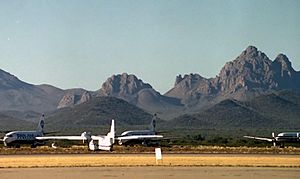
- Pinal Airpark is just north of Marana. Many commercial airlines send their airplanes here for storage. It was also known in the 1970s and 1980s as a secret air base. Access to the Airpark is watched very carefully.
Veterans Cemetery
Marana is home to one of Arizona's four state Veterans Memorial Cemeteries. It was built in 2016. Over 2,450 burials have taken place there.
Education in Marana
Most of Marana is served by the Marana Unified School District, which has 16 schools.
A small part of the town in the southeast is covered by the Flowing Wells Unified School District. The part of Marana within Pinal County is served by the Red Rock Elementary School District and the Santa Cruz Valley Union High School District.
See also
 In Spanish: Marana (Arizona) para niños


