Marble Mountain-Trout Creek Hill facts for kids
Quick facts for kids Marble Mountain-Trout Creek Hill |
|
|---|---|

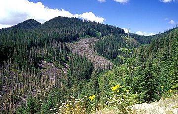
West Crater with associated lava flows
|
|
| Highest point | |
| Elevation | 492 to 4,521 ft (150 to 1,378 m) |
| Geography | |
| Location | Skamania County, Washington, United States |
| Parent range | Cascade Range |
| Topo map | USGS Bare Mountain |
| Geology | |
| Age of rock | less than 700,000 years |
| Mountain type | Volcanic field |
| Volcanic arc/belt | Cascade Volcanic Arc |
| Last eruption | ~7,700 years BP |
The Marble Mountain-Trout Creek Hill volcanic field (often called MMTC) is a special area in Washington, USA. It's not just one big volcano, but a group of smaller volcanoes and lava flows spread across a wide area. This field is part of the amazing Cascade Volcanic Arc, which includes many famous volcanoes like Mount St. Helens.
What is a Volcanic Field?
A volcanic field is like a neighborhood of volcanoes. Instead of one giant mountain, you find many smaller volcanoes, lava domes, and volcanic cones. These features are all connected to the same underground system of magma. The Marble Mountain-Trout Creek Hill field has been active for less than 700,000 years. Its last known eruption happened about 7,700 years ago.
Main Volcanoes and Features
The Marble Mountain-Trout Creek Hill volcanic field has several interesting features. Each one tells a part of the field's fiery history. Here are some of the most important ones:
| Name | Elevation | Coordinates | Last eruption |
| Bare Mountain | |||
| Marble Mountain | 4,127 ft (1,258 m) | ||
| Trout Creek Hill | 2,930 ft (893 m) | 45°49′N 122°00′W / 45.817°N 122.000°W | ~340,000 years ago |
| West Crater | 4,360 ft (1,329 m) | 45°53′N 122°05′W / 45.88°N 122.08°W | 5750 BC? |
Trout Creek Hill
Trout Creek Hill is a small shield volcano within the field. It's called a shield volcano because its shape is wide and gently sloped, like a warrior's shield lying on the ground. This shape forms from very runny lava that flows easily. About 340,000 years ago, Trout Creek Hill erupted. Its lava flowed a long way, about 20 kilometers (12 miles) to the southeast. This powerful lava flow actually blocked the mighty Columbia River for a short time! Imagine a river being stopped by molten rock.
West Crater
West Crater is another interesting part of the volcanic field. It is a small lava dome. A lava dome forms when thick, sticky lava piles up around a volcano's vent instead of flowing far away. This creates a steep, dome-shaped mound. West Crater also has associated lava flows, meaning lava came out and spread a bit from its base. Scientists think its last eruption might have been around 5750 BC.

