
Marlborough, New York facts for kids
Quick facts for kids
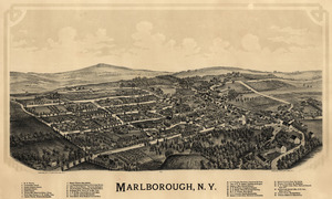
Marlborough, New York
|
|
|---|---|

Location in Ulster County and the state of New York.
|
|
| Country | United States |
| State | New York |
| County | Ulster |
| Area | |
| • Total | 26.50 sq mi (68.63 km2) |
| • Land | 24.47 sq mi (63.38 km2) |
| • Water | 2.03 sq mi (5.26 km2) |
| Elevation | 515 ft (157 m) |
| Population
(2020)
|
|
| • Total | 8,712 |
| • Density | 328.75/sq mi (126.942/km2) |
| Time zone | UTC-5 (Eastern (EST)) |
| • Summer (DST) | UTC-4 (EDT) |
| ZIP code |
12542
|
| Area code(s) | 845 |
| FIPS code | 36-45722 |
| GNIS feature ID | 0979200 |
Marlborough is a town located in Ulster County, New York, in the United States. It's in the southeastern part of Ulster County. In 2020, about 8,712 people lived here. Important roads like U.S. Route 9W, US Route 44, and NY 55 pass through the town. Marlborough was named after the Duke of Marlborough.
Contents
The History of Marlborough
Early Beginnings
The land where Marlborough is today was first given to Captain John Evans of the Royal Navy in 1694. The first settlers arrived in the area around 1697.
Forming the Town
The region was once part of the Newburgh Precinct. It became a separate area in 1772. The official Town of Marlborough was created in 1788. This was a time when many towns were being formed in the county. Later, in 1800, a part of Marlborough was used to create the town of Plattekill.
Geography of Marlborough
Size and Location
Marlborough covers a total area of about 26.5 square miles (68.6 square kilometers). Most of this area, about 24.8 square miles (63.38 square kilometers), is land. The rest, about 1.7 square miles (5.26 square kilometers), is water.
Borders and Features
The eastern border of the town is the Hudson River. This river also marks the border with Dutchess County. To the south, Marlborough borders Orange County. The western edge of the town runs close to the Marlboro Mountain ridge. This ridge separates Marlborough from the town of Plattekill.
Elevation
The lowest point in Marlborough is along the shore of the Hudson River, which is at sea level. The highest point is the top of Marlboro Mountain, which reaches 1,127 feet (344 meters) high.
People of Marlborough
Population Growth Over Time
Marlborough has seen its population grow steadily over many years. Here's how the number of people living in the town has changed:
| Historical population | |||
|---|---|---|---|
| Census | Pop. | %± | |
| 1790 | 2,241 | — | |
| 1820 | 2,248 | — | |
| 1830 | 2,272 | 1.1% | |
| 1840 | 2,523 | 11.0% | |
| 1850 | 2,406 | −4.6% | |
| 1860 | 2,776 | 15.4% | |
| 1870 | 2,975 | 7.2% | |
| 1880 | 3,472 | 16.7% | |
| 1890 | 3,598 | 3.6% | |
| 1900 | 3,978 | 10.6% | |
| 1910 | 3,841 | −3.4% | |
| 1920 | 3,274 | −14.8% | |
| 1930 | 3,627 | 10.8% | |
| 1940 | 3,794 | 4.6% | |
| 1950 | 4,003 | 5.5% | |
| 1960 | 4,863 | 21.5% | |
| 1970 | 5,657 | 16.3% | |
| 1980 | 7,055 | 24.7% | |
| 1990 | 7,430 | 5.3% | |
| 2000 | 8,263 | 11.2% | |
| 2010 | 8,808 | 6.6% | |
| 2020 | 8,712 | −1.1% | |
| U.S. Decennial Census 2020 | |||
In 2000, there were 8,263 people living in Marlborough. There were 3,020 households, which are groups of people living together. About 2,144 of these households were families.
Age Groups
The population in 2000 included people of all ages. About 26.5% of the people were under 18 years old. About 7.4% were between 18 and 24 years old. The largest group, 30.8%, was between 25 and 44 years old. About 11.7% of the population was 65 years or older. The average age in the town was 37 years.
Communities and Locations in Marlborough
Marlborough is home to several smaller communities and areas:
- Baileys Gap – This is a small hamlet located at the northern border of the town, along Route 44.
- Central – You can find this area west of the hamlet of Milton.
- Marlboro – This hamlet is in the southeastern part of the town. It is located on Route 9W.
- Milton – This hamlet is in the northeastern part of the town. It is also on Route 9W and is right next to the Hudson River.
- Lattintown – This hamlet is in the western part of the town on Route 11. The Lattingtown Baptist Church in this area was added to the National Register of Historic Places in 2010.
See also
 In Spanish: Marlborough (Nueva York) para niños
