Marquand, Missouri facts for kids
Quick facts for kids
Marquand, Missouri
|
|
|---|---|

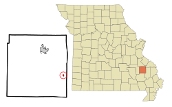
Location in Madison County and the state of Missouri
|
|
| Country | United States |
| State | Missouri |
| County | Madison |
| Area | |
| • Total | 0.24 sq mi (0.62 km2) |
| • Land | 0.24 sq mi (0.62 km2) |
| • Water | 0.00 sq mi (0.01 km2) |
| Elevation | 564 ft (172 m) |
| Population
(2020)
|
|
| • Total | 186 |
| • Density | 781.51/sq mi (301.45/km2) |
| Time zone | UTC-6 (Central (CST)) |
| • Summer (DST) | UTC-5 (CDT) |
| ZIP code |
63655
|
| Area code(s) | 573/235 |
| FIPS code | 29-46244 |
| GNIS feature ID | 2395016 |
Marquand is a small city located in eastern Madison County, Missouri, in the United States. In 2020, about 186 people lived there. Marquand became an official town in 1906.
Contents
History of Marquand
Marquand was planned out and officially marked on a map in 1869. It was named after Henry G. Marquand. He was an important person who worked for the railroad. A post office opened in Marquand in 1870 and has been serving the community ever since.
Geography and Location
Marquand is right next to the Castor River. You can find it along Missouri Route A. If you travel by road, it is about 14 miles (23 km) southeast of Fredericktown. Fredericktown is the main city in Madison County. Marquand is also about 17 miles (27 km) northwest of Marble Hill. A small stream called Whitener Creek flows through the town from the northeast.
Size of the City
According to the U.S. Census Bureau, Marquand covers a total area of about 0.24 square miles (0.62 square kilometers). Most of this area is land. Only a tiny part, about 0.002 square miles (0.01 square kilometers), is water.
People Living in Marquand
| Historical population | |||
|---|---|---|---|
| Census | Pop. | %± | |
| 1910 | 339 | — | |
| 1920 | 352 | 3.8% | |
| 1930 | 429 | 21.9% | |
| 1940 | 403 | −6.1% | |
| 1950 | 369 | −8.4% | |
| 1960 | 392 | 6.2% | |
| 1970 | 400 | 2.0% | |
| 1980 | 397 | −0.7% | |
| 1990 | 278 | −30.0% | |
| 2000 | 251 | −9.7% | |
| 2010 | 203 | −19.1% | |
| 2020 | 186 | −8.4% | |
| U.S. Decennial Census | |||
2010 Census Information
In 2010, the census showed that 203 people lived in Marquand. There were 92 households, and 56 of these were families. The city had about 846 people per square mile (327 people per square kilometer). There were 108 housing units, which means places where people live.
Almost everyone living in Marquand at that time was White. A very small number, less than 1%, were Hispanic or Latino.
Households and Families
Out of the 92 households, 37% had children under 18 living with them. About 42% were married couples living together. Some households had a female head without a husband (13%), or a male head without a wife (5.4%). About 39% of households were not families.
Many households (34.8%) had only one person living in them. About 15% of households had someone aged 65 or older living alone. On average, there were 2.21 people in each household and 2.80 people in each family.
Age of Residents
The average age of people in Marquand in 2010 was 40.5 years.
- About 23.6% of residents were under 18 years old.
- About 8.9% were between 18 and 24 years old.
- About 21.1% were between 25 and 44 years old.
- About 32.5% were between 45 and 64 years old.
- About 13.8% were 65 years or older.
The city had slightly more males (50.7%) than females (49.3%).
Education in Marquand
The Marquand-Zion R-VI School District serves the students in Marquand and the surrounding areas. This is a small, rural school district. It has one elementary school and one combined junior-senior high school.
According to the Missouri Department of Elementary and Secondary Education, in the 2008–2009 school year, there were 184 students and 35 certified staff members in the district. The school colors are purple and gold, and their mascot is the tiger. Students can play sports like boys' basketball and baseball, girls' volleyball, and cheerleading.
See also
 In Spanish: Marquand (Misuri) para niños
 | Lonnie Johnson |
 | Granville Woods |
 | Lewis Howard Latimer |
 | James West |

