Martín García Island facts for kids
|
Isla Martín García
|
|
|---|---|
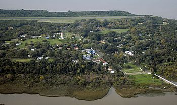
Aerial photograph of Martín García Island from the west, with airstrip visible in background
|
|
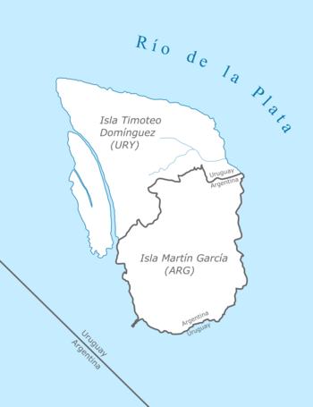
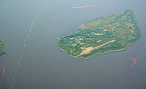
Diagram of Martín García and Timoteo Domínguez Islands, after they were physically united in one land mass
|
|
| Geography | |
| Location | Río de la Plata |
| Coordinates | 34°10′57″S 58°15′00″W / 34.18250°S 58.25000°W |
| Area | 1.84 km2 (0.71 sq mi) |
| Highest elevation | 27 m (89 ft) |
| Administration | |
| Province | Buenos Aires |
| Partido | La Plata |
| Demographics | |
| Population | 150 (2008) |
Martín García Island (Spanish: Isla Martín García) is a small island in the Río de la Plata river. Even though it is surrounded by Uruguayan waters, a special agreement in 1973 made it part of Argentina. The island is also a nature reserve, meaning its plants and animals are protected.
The island is about 1.84 km2 (0.71 sq mi) in size. Around 150 people live there permanently, which is about 50 families. It belongs to the Buenos Aires Province in Argentina. You can get to the island by plane, landing at the Martín García Island Airport.
Because of its important location, the island was once a key military spot. In the 1820s, Argentine soldiers built a fort called Constitución there. This fort helped stop the Brazilian navy during the Cisplatine War. It allowed Argentina to win an important battle on the Uruguay River.
Over the years, several important Argentine leaders were kept on the island by military governments. These included former presidents like Hipólito Yrigoyen (in 1930), Juan Perón (in 1945), and Arturo Frondizi (in 1962).
Contents
Island History: From Discovery to Today
Spanish explorers found Martín García Island in 1516 during an expedition led by Juan Díaz de Solís. The island was named after Martín Garcia, a storekeeper who died on the ship and was buried there. For a long time, Spain and Portugal argued over who owned the island. This was because of its important spot near the main river channels, which were like gateways to other big rivers like the Paraná and Uruguay rivers.
From 1765 to 1886, the island was used as a place to keep prisoners. The first leader of the Viceroyalty of the Río de la Plata, Pedro de Cevallos, made the island stronger with defenses and soldiers. In 1814, Admiral William Brown led a fleet to the island. His forces won against the Spanish royalists, and Martín García became part of the United Provinces of the Río de la Plata.
The island saw more battles during the Argentine War of Independence and the Cisplatine War in the 1820s. In 1838, during the time of Governor Juan Manuel de Rosas, British and French forces attacked Martín García. Later, forces from Montevideo took it over. In 1843, Rosas's troops got it back, but then Giuseppe Garibaldi took it for Montevideo in 1845. The island's military importance ended after Rosas was defeated in 1852.
In 1850, President Domingo Sarmiento suggested building a base on the island. He imagined a small country called Argirópolis City, managed by Argentina, Uruguay, and Paraguay together.
Starting in 1879, many native people captured during the Conquest of the Desert were sent to Martín García island. These prisoners included fighters, but also women, children, and older people. While on the island, many were forced to work. Some historians believe Martín García was used like a camp where many native people were held. It's thought that up to 3,000 native prisoners were on the island in the 1870s and 1880s.
In 1886, the island became part of the Argentine Navy. An airstrip was built in the late 1920s, which later became the Martín García Island Airport. During World War I, German sailors from the ship SMS Cap Trafalgar were kept on the island. Later, in 1943, German sailors from the Graf Spee warship were also held there.
The official status of the island was decided by the Treaty of Río de la Plata in 1973. This treaty said that Martín García Island is Argentine land, even though it's surrounded by Uruguayan waters. In return, Argentina gave Uruguay some land in the Río de la Plata, like Juncal Island.
The treaty also stated that Martín García Island must be used only as a nature reserve. This means it's for protecting animals and plants.
Over time, the channel between Martín García and Timoteo Domínguez Island (which is Uruguayan) filled up with dirt. Now, the two islands are physically connected. This means the border between Martín García and Timoteo Domínguez is the only land border between Argentina and Uruguay.
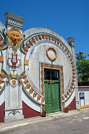
Uruguayan officials have often reminded Argentina that the island should only be used as a nature reserve. In 1985, the Navy gave control of the island's buildings to the Province of Buenos Aires. Today, the island is a popular place for tourists to visit. You can see the old Chinatown, remains of forts, and a forest with red deer. The island is also famous for its homemade pastries.
Amazing Plants and Animals
Martín García Island is covered in forests. You can find trees like the ceiba and creole laurel. There are also plants that like dry weather, similar to those in the Gran Chaco region. These include gorse, cacti, and lapachillo. The island's beaches have reeds, fig trees, and over 800 different kinds of plants.
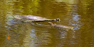
The island is home to many animals, especially birds. There are more than 250 bird species! These include eight types of hummingbirds, sparrowhawks, lapwings, herons, vultures, parrots, and great horned owls. You can also find different reptiles like lizards, geckos, and turtles. Other animals include frogs, coypu (like large rodents), capybaras (the world's largest rodents), alligators, and red deer. Sadly, the large population of giant river otters disappeared by the late 1950s.
Island Weather
The average temperature on Martín García Island is about 17 °C (63 °F) each year. In winter, it averages 8 °C (55 °F), and in summer, it averages 29 °C (84 °F). The island gets about 1,000 mm (40 inches) of rain each year.
| Climate data for Martín García Island | |||||||||||||
|---|---|---|---|---|---|---|---|---|---|---|---|---|---|
| Month | Jan | Feb | Mar | Apr | May | Jun | Jul | Aug | Sep | Oct | Nov | Dec | Year |
| Record high °C (°F) | 35.7 (96.3) |
38.0 (100.4) |
35.0 (95.0) |
33.6 (92.5) |
28.0 (82.4) |
25.5 (77.9) |
25.5 (77.9) |
26.0 (78.8) |
29.0 (84.2) |
30.0 (86.0) |
34.0 (93.2) |
37.0 (98.6) |
38.0 (100.4) |
| Mean daily maximum °C (°F) | 29.1 (84.4) |
28.8 (83.8) |
25.8 (78.4) |
22.8 (73.0) |
19.4 (66.9) |
16.0 (60.8) |
15.6 (60.1) |
16.2 (61.2) |
18.9 (66.0) |
21.4 (70.5) |
25.0 (77.0) |
27.9 (82.2) |
22.2 (72.0) |
| Daily mean °C (°F) | 23.9 (75.0) |
23.4 (74.1) |
21.1 (70.0) |
18.1 (64.6) |
14.8 (58.6) |
11.8 (53.2) |
11.5 (52.7) |
12.0 (53.6) |
14.3 (57.7) |
16.5 (61.7) |
20.1 (68.2) |
22.6 (72.7) |
17.5 (63.5) |
| Mean daily minimum °C (°F) | 18.8 (65.8) |
18.5 (65.3) |
16.3 (61.3) |
13.0 (55.4) |
11.1 (52.0) |
8.0 (46.4) |
8.0 (46.4) |
8.3 (46.9) |
10.3 (50.5) |
12.6 (54.7) |
14.9 (58.8) |
17.9 (64.2) |
13.1 (55.6) |
| Record low °C (°F) | 10.0 (50.0) |
10.0 (50.0) |
8.0 (46.4) |
6.0 (42.8) |
2.0 (35.6) |
−0.1 (31.8) |
−0.1 (31.8) |
1.0 (33.8) |
−0.1 (31.8) |
5.5 (41.9) |
4.0 (39.2) |
9.5 (49.1) |
−0.1 (31.8) |
| Average precipitation mm (inches) | 60 (2.4) |
85 (3.3) |
158 (6.2) |
80 (3.1) |
48 (1.9) |
70 (2.8) |
54 (2.1) |
53 (2.1) |
54 (2.1) |
103 (4.1) |
103 (4.1) |
90 (3.5) |
958 (37.7) |
| Average precipitation days | 5 | 6 | 7 | 6 | 5 | 5 | 5 | 5 | 7 | 7 | 7 | 6 | 71 |
| Average relative humidity (%) | 67 | 68 | 72 | 75 | 78 | 81 | 81 | 79 | 76 | 75 | 71 | 68 | 74 |
| Mean monthly sunshine hours | 260.4 | 223.2 | 213.9 | 177.0 | 167.4 | 111.0 | 117.8 | 155.0 | 168.0 | 186.0 | 213.0 | 232.5 | 2,225.2 |
| Percent possible sunshine | 59 | 59 | 56 | 53 | 52 | 38 | 38 | 46 | 47 | 46 | 51 | 52 | 50 |
| Source: UNLP | |||||||||||||
Who Lives on the Island?
Martín García Island once had about 4,000 people living there. But when the military left, the population went down. In 2008, there were fewer than 170 people, or about 50 families. The island has an elementary school for the children, called EGB nº 39 "Juan Díaz de Solís".
See also
 In Spanish: Isla Martín García para niños
 | Selma Burke |
 | Pauline Powell Burns |
 | Frederick J. Brown |
 | Robert Blackburn |


