Maupin, Oregon facts for kids
Quick facts for kids
Maupin, Oregon
|
|
|---|---|

Maupin and the Deschutes River
|
|

Location in Oregon
|
|
| Country | United States |
| State | Oregon |
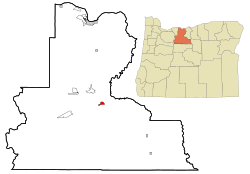
| County | Wasco |
| Incorporated | 1922 |
| Area | |
| • Total | 1.45 sq mi (3.75 km2) |
| • Land | 1.40 sq mi (3.61 km2) |
| • Water | 0.05 sq mi (0.14 km2) |
| Elevation | 1,227 ft (374 m) |
| Population
(2020)
|
|
| • Total | 427 |
| • Density | 306.09/sq mi (118.15/km2) |
| Time zone | UTC-8 (Pacific) |
| • Summer (DST) | UTC-7 (Pacific) |
| ZIP code |
97037
|
| Area code(s) | 541 |
| FIPS code | 41-46500 |
| GNIS feature ID | 2411052 |

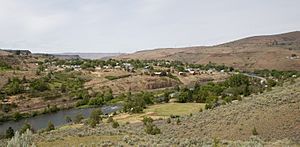
Maupin is a small city in Oregon, United States. It's found in Wasco County. Maupin sits right on the Deschutes River. Many people in Maupin work in jobs linked to the river. Popular activities here include fishing and rafting. In 2020, about 427 people lived in Maupin.
Contents
History of Maupin
Maupin is named after a pioneer named Howard Maupin. He had a farm and a ferry boat service in this area in the late 1800s.
The town was first called Hunts Ferry. This was after another ferry owner on the Deschutes River. Later, William H. Staats, who founded the town, changed the name to Maupin Ferry. Around 1909, the city's name was shortened to just Maupin.
Exploring Maupin's Geography
Maupin covers a total area of about 1.45 square miles (3.75 square kilometers). Most of this area, about 1.4 square miles (3.61 square kilometers), is land. A small part, about 0.05 square miles (0.14 square kilometers), is water.
You can get to Maupin by road using U.S. Route 197. This road crosses the Deschutes River right in town. It's one of the few places where you can cross the river north of Madras.
Maupin's Climate and Weather
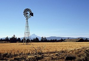
Maupin has warm and dry summers. The average monthly temperatures do not go above 71.6°F (22°C). Because it's in the high desert, the nights get cool after the warm days.
Maupin's climate is called a "warm-summer Mediterranean climate." This means it has mild, wet winters and hot, dry summers.
Maupin's Population and People
| Historical population | |||
|---|---|---|---|
| Census | Pop. | %± | |
| 1920 | 198 | — | |
| 1930 | 240 | 21.2% | |
| 1940 | 267 | 11.3% | |
| 1950 | 312 | 16.9% | |
| 1960 | 381 | 22.1% | |
| 1970 | 428 | 12.3% | |
| 1980 | 495 | 15.7% | |
| 1990 | 456 | −7.9% | |
| 2000 | 411 | −9.9% | |
| 2010 | 418 | 1.7% | |
| 2020 | 427 | 2.2% | |
| U.S. Decennial Census | |||
In 2010, there were 418 people living in Maupin. These people lived in 199 households. About 113 of these were families. The city had about 299 people per square mile (115 people per square kilometer).
Most people in Maupin were White (95.7%). A small number were Native American (0.7%), Asian (0.2%), or Pacific Islander (0.2%). About 1.2% of the population was Hispanic or Latino.
The average age in Maupin was about 56 years old. About 15% of the people were under 18 years old. About 32% were 65 years or older. The population was almost evenly split between males (51%) and females (49%).
Education in Maupin
Students in Maupin attend schools in the South Wasco County School District. This district has two schools, both located in Maupin.
- Maupin Grade School
- South Wasco County Junior/Senior High School
See also
 In Spanish: Maupin para niños
 | Isaac Myers |
 | D. Hamilton Jackson |
 | A. Philip Randolph |

