
Maxwelton, Queensland facts for kids
Quick facts for kids MaxweltonQueensland |
|||||||||||||||
|---|---|---|---|---|---|---|---|---|---|---|---|---|---|---|---|

Stockmen droving cattle near Maxwelton, 1986
|
|||||||||||||||

Maxwelton
Location in Queensland
|
|||||||||||||||
| Population | 32 (2021 census) | ||||||||||||||
| • Density | 0.00907/km2 (0.0235/sq mi) | ||||||||||||||
| Postcode(s) | 4822 | ||||||||||||||
| Area | 3,526.4 km2 (1,361.6 sq mi) | ||||||||||||||
| Time zone | AEST (UTC+10:00) | ||||||||||||||
| Location |
|
||||||||||||||
| LGA(s) | Shire of Richmond | ||||||||||||||
| State electorate(s) | Traeger | ||||||||||||||
| Federal Division(s) | Kennedy | ||||||||||||||
|
|||||||||||||||
Maxwelton is a small outback town and area in central north Queensland, Australia. It is located in the Shire of Richmond. In 2021, only 32 people lived in Maxwelton.
Contents
Maxwelton's Location
Maxwelton is in a flat area, with the Flinders River forming its northern border. The town itself is in the northern part of this area.
The Flinders Highway passes just south of the town. This highway connects Townsville to Cloncurry.
The Great Northern railway also runs through Maxwelton. This railway line goes from Townsville to Mount Isa. There are a few railway stops in the Maxwelton area:
- Nonda railway station
- Maxwelton railway station (serving the town)
- Talmoi railway station (a former station)
- Gemoka railway station
Other small, mostly abandoned towns are also found in the Maxwelton area:
- Nonda is in the north-west.
- Hulbert is an abandoned town in the far north.
- Talmoi is a small area around the former Talmoi railway station.
- Bundock is an abandoned town in the north-east.
A Look Back at Maxwelton's History
Maxwelton has a long history, starting with cattle grazing and becoming a railway town.
Early Days and Naming
In 1863, a horse breeder named Wellington Cochrane Bundock started grazing cattle in the area. This was the beginning of the Richmond Downs pastoral run.
Before railways, large teams of bullocks carried wool from Cloncurry to the east coast. Cobb & Co stage coaches also delivered mail through the area in 1871. Many hotels were built along the Flinders River route, but most are now just ruins.
Maxwelton started as a small railway stop. It got its name from Maxwelton Station, one of the first large cattle properties in the 1800s.
The towns of Bundock and Hulbert were planned in 1899 and officially named in 1900. Bundock was named after Wellington Cochrane Bundock. It was a stopping point for cattle drovers between Maxwelton and Richmond.
The town of Nonda first appeared on maps in 1907. Its name comes from an Aboriginal word for the "plum" tree, Parinari nonda.
The Railway Arrives
The site for Maxwelton town was chosen in 1908. It was a good spot where the new railway line met the road from McKinlay to the Camp Hotel.
Work on the Great Northern Railway began in Townsville in 1879. By February 1908, the railway had reached Julia Creek, passing through Maxwelton.

Post Office and Communication
Maxwelton's Post Office started as a small receiving office in 1880. It closed and reopened several times before becoming an official Post Office at the railway station in 1910.
In 1970, it was one of the last places in Australia to use a manual telephone exchange. The Post Office agency finally closed in 1990.
Schools and Community Life
The area around Talmoi railway station was named by Queensland Railways in 1912. Talmoi is an Aboriginal word meaning place to camp.
Maxwelton Provisional School opened in 1923 and became Maxwelton State School in 1925. It closed in 1926, reopened in 1927, and then closed for good in 1989. The old school building is now a house.


Nonda State School was open from 1925 to 1975.
Gemoka railway siding was named in 1925. Gemoka is an Aboriginal word meaning cattle camp.
Water and Floods
Maxwelton is on a low flood plain. The biggest flood recorded was in 1917. Water backed up for miles from the Flinders River and Alick Creek. A bridge called Hulberts Bridge was finished in 1926.
In 1929, an artesian bore was drilled to get water for the town. Before this, water had to be brought from a bore a few miles away.
Maxwelton During World War II
During World War II, a site near Talmoi was used by the Royal Australian Air Force (RAAF) to store military supplies. This location was chosen because it had water, storage sheds, and was on the railway line, making it easy to transport items. It was also far from other towns for safety.
After the war, in 1946, the RAAF safely removed all the stored materials from the site. Some of the igloo-shaped storage buildings can still be seen there today.
In 1989, Maxwelton was in the news when old military materials were found, reminding people of similar discoveries elsewhere.
Town Life in the Past
In the past, Maxwelton was a busy little town. It had a café, a butcher shop, a dance hall, a pub, a post office, and a school.
In 1960, the town had 72 people, and the one-teacher school had 17 students. The teachers often stayed at the local hotel. There was also a public shower building, fed by hot water directly from the artesian bore.
A swimming pool was built by locals in 1960. It was a simple earthen dam with a sand base, but it was a popular spot for everyone to cool down in summer.
Many people in town worked for the railway. Two trains passed through each day, bringing in most of the town's supplies. A shopping trip to Richmond could take a whole day.
The Maxwelton School eventually closed because there were not enough children. However, in the past, it had as many as 35 students. The first school building was built in 1925.
For over 60 years, the annual Maxwelton races have been held at the town's racecourse. These races are a big event for the community.
Population of Maxwelton
- In 2016, the population of Maxwelton was 22 people.
- In 2021, the population of Maxwelton was 32 people.
Education in Maxwelton
There are no schools in Maxwelton today. The closest government school is Richmond State School, which offers primary school and secondary school up to Year 10.
Because of the long distances in the outback, Richmond State School might not be easy for all students in Maxwelton to attend. Other options for schooling include distance education (learning from home) or boarding schools.
Images for kids
-
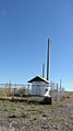
Telecommunications shed, 2019
,_Maxwelton,_2019.jpg)
