Meall a' Chrasgaidh facts for kids
Quick facts for kids Meall a' Chrasgaidh |
|
|---|---|

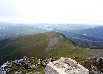
Meall a' Chrasgaidh seen from the shattered trig point on Sgurr nan Clach Geala.
|
|
| Highest point | |
| Elevation | 934 m (3,064 ft) |
| Prominence | 115 m (377 ft) |
| Listing | Munro |
| Naming | |
| English translation | Hill Of The Crossing |
| Language of name | Gaelic |
| Geography | |
| Location | Ross and Cromarty, Highland, Scotland |
| Parent range | Fannichs, Northwest Highlands |
| OS grid | NH184733 |
| Topo map | OS Landranger 20, OS Explorer 436 |

Meall a' Chrasgaidh is a cool mountain in Scotland. It's part of the Fannich mountain group. You can find it about 21 kilometers (13 miles) southeast of Ullapool.
About Meall a' Chrasgaidh
This mountain is right in the middle of the Fannichs. It's also one of the easiest to reach. Main roads like the A832 and A835 run close by to the north.
Meall a' Chrasgaidh sits on a ridge that goes from north to south. Two other famous Scottish mountains, called Munros, are on this ridge too. These are Sgurr nan Clach Geala and Sgurr nan Each. Hikers often climb Meall a' Chrasgaidh along with them.
The mountain is mostly rounded and covered in grass. It reaches a height of 934 meters (3,064 feet). This makes it the 242nd highest Munro in Scotland. A Munro is a Scottish mountain that is over 3,000 feet (914.4 meters) tall.
The name Meall a' Chrasgaidh means "Hill of the Crossing" in Gaelic. This name comes from a special spot to the south of the summit. It's an 819-meter (2,687-foot) col, which is like a low point between two mountains. This col is a main crossing point in the Fannich group. It helps people travel north to south between Loch a’ Bhraoin and Loch Fannich. It also connects the east and west sides of the mountains.
Mountain Shape and Rocks
Meall a' Chrasgaidh has three main ridges. The northwest and northeast ridges go down towards the River Droma valley. These are often used by climbers coming from the main roads in the north.
The south ridge connects to the important 819-meter col. This col is a bit boggy and has a small lochan (a tiny lake) in it. This col links Meall a' Chrasgaidh to the two tallest peaks in the Fannichs. These are Sgurr nan Clach Geala and Sgurr Mòr.
The steepest parts of the mountain are on its eastern side. Here, rocky slopes drop down to Loch a’ Mhadaidh. These slopes are not too steep, so they can be used for scrambling (a mix of hiking and easy climbing). This eastern side is where the mountain looks its best.
The western and southern slopes are not as steep. They are mostly covered in grass and some heather. Near the top, you can see exposed rocks made of mica and quartz schist. These are shiny, layered rocks that make up the whole mountain. All the water from Meall a' Chrasgaidh flows west towards the coast of Scotland. It goes through the River Broom and Loch Broom before reaching the sea at Ullapool.
How to Climb and What You See
People usually climb Meall a' Chrasgaidh from the north. They often combine it with climbing other hills in the Fannich range. There are two main places to start your climb from the north.
One starting point is a parking area on the A832 road, near Loch a’ Bhraoin. From there, you follow a path next to the Allt Breabaig stream for about two kilometers. Then you climb up the northwest ridge.
The other route starts at the west end of Loch Droma, on the A835 road. You follow the Allt a’ Mhadaidh stream west for about six kilometers. This takes you to Loch Mhadaidh, which is below the mountain's eastern side. From here, you can climb the grassy and rocky ground above the loch. This leads you to the 819-meter col. From the col, you can reach the summit by following the south ridge. If you want to climb other mountains in the group, you can go down the south ridge to that same 819-meter col.
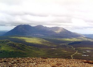
At the top of Meall a' Chrasgaidh, you'll find a cairn (a pile of stones) about 5 feet (1.5 meters) high. The view to the south and southeast is partly blocked by the two highest Fannich mountains, Sgurr nan Clach Geala and Sgurr Mòr. They look very impressive from here! However, in other directions, you get amazing views. You can see An Teallach very clearly, about 15 kilometers (9 miles) to the northwest, across a wild moorland. To the north, you can see the hills of Coigach and Assynt.
 | Emma Amos |
 | Edward Mitchell Bannister |
 | Larry D. Alexander |
 | Ernie Barnes |

