Meyers, California facts for kids
Quick facts for kids
Meyers, California
|
|
|---|---|

Meyers along U.S. Route 50 in a map of El Dorado County
|
|
| Country | United States |
| State | California |
| County | El Dorado |
| Elevation | 6,352 ft (1,936 m) |
| Time zone | UTC-8 (Pacific (PST)) |
| • Summer (DST) | UTC-7 (PDT) |
| ZIP code |
96150
|
| Area code(s) | 530 |
| Official name: Yank's Station | |
| Reference #: | 708 |
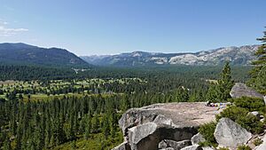
Meyers is a small town in El Dorado County, California. It is located in the beautiful Sierra Nevada mountains. You can find Meyers along U.S. Route 50. It is about 6 miles (10 km) south of South Lake Tahoe. The town sits high up at 6,352 feet (1,936 meters) above sea level. Meyers began in 1851 as a stop for stagecoaches. It was also a trading post and a Pony Express station. Today, it is a popular place for travelers on Highways 50 and 89. It is also recognized as California Historical Landmark #708.
Contents
History
Meyers has a long and interesting history. It started as a busy stop for travelers.
Early Days as a Trading Post
In 1851, a man named Martin Smith opened a trading post. He also built an inn on the Placerville-Carson Road. This road was important for travel back then. Eight years later, in 1859, Ephraim "Yank" Clement and his wife Lydia bought the station. They made it much bigger. It became a three-story building with fourteen rooms. It also had a large stable and corrals for horses.
Meyers and the Pony Express
The station became a stop for the Pony Express. This was a fast mail service using horses. Riders would stop at Yank's Station to change horses. The Pony Express used this route until October 26, 1861. After a new wagon road was built, the Pony Express route changed slightly. It went from Mormon (Genoa) Station to Friday's Station. Then it followed the south shore of Lake Tahoe. It stopped at Yank's Station Toll House near Meyers. From there, it continued to Strawberry Station.
Changes and Growth
The station was a busy place. It had a trading post, a hotel, and was a stagecoach stop. In 1873, George Henry Dudley Meyers bought the property. The station was rebuilt and continued to be a successful hotel and store for many years. Sadly, on November 25, 1938, a fire destroyed the building.
A post office opened south of the station in 1904. It closed in 1957 but reopened in 1958. By 1916, it was near the Lincoln Highway. This was one of the first roads across America. In 1962, the post office was renamed Tahoe Paradise. By 1896, a railroad connected Meyers to Bijou.
Climate
Meyers has a mountain climate. It experiences warm summers and cold, snowy winters.
| Climate data for Meyers, California (1981–2010) | |||||||||||||
|---|---|---|---|---|---|---|---|---|---|---|---|---|---|
| Month | Jan | Feb | Mar | Apr | May | Jun | Jul | Aug | Sep | Oct | Nov | Dec | Year |
| Record high °F (°C) | 65 (18) |
66 (19) |
71 (22) |
78 (26) |
86 (30) |
92 (33) |
97 (36) |
93 (34) |
88 (31) |
83 (28) |
72 (22) |
68 (20) |
97 (36) |
| Mean daily maximum °F (°C) | 41.8 (5.4) |
42.7 (5.9) |
46.7 (8.2) |
52.5 (11.4) |
61.4 (16.3) |
71.3 (21.8) |
79.7 (26.5) |
79.2 (26.2) |
72.8 (22.7) |
61.5 (16.4) |
49.8 (9.9) |
41.7 (5.4) |
58.4 (14.7) |
| Mean daily minimum °F (°C) | 17.5 (−8.1) |
18.5 (−7.5) |
22.9 (−5.1) |
26.8 (−2.9) |
32.5 (0.3) |
37.4 (3.0) |
41.9 (5.5) |
40.5 (4.7) |
34.9 (1.6) |
28.6 (−1.9) |
22.5 (−5.3) |
17.0 (−8.3) |
28.4 (−2.0) |
| Record low °F (°C) | −12 (−24) |
−20 (−29) |
−10 (−23) |
−1 (−18) |
12 (−11) |
23 (−5) |
29 (−2) |
28 (−2) |
21 (−6) |
15 (−9) |
−7 (−22) |
−12 (−24) |
−20 (−29) |
| Average precipitation inches (mm) | 7.13 (181) |
6.87 (174) |
6.51 (165) |
3.32 (84) |
2.49 (63) |
0.90 (23) |
0.29 (7.4) |
0.37 (9.4) |
0.56 (14) |
2.40 (61) |
3.59 (91) |
7.81 (198) |
42.24 (1,070.8) |
| Average snowfall inches (cm) | 43.5 (110) |
40.3 (102) |
37.7 (96) |
23.4 (59) |
4.0 (10) |
0.1 (0.25) |
0.0 (0.0) |
0.0 (0.0) |
0.1 (0.25) |
0.9 (2.3) |
24.3 (62) |
37.1 (94) |
211.4 (535.8) |
| Source: WRCC | |||||||||||||
What's in Meyers?
Meyers has several useful places for residents and visitors. You can find a grocery store called Holiday Market. There is also a hardware shop and lumber yard called Meeks. The town has many other restaurants and shops too. A California Highway Patrol station is located near the south end. There is also an insect inspection station and a post office. The closest big town is South Lake Tahoe. It is about 5 miles (8 km) north along U.S. Highway 50. This area is known locally as "The Y."
Fun Things to Do: Climbing
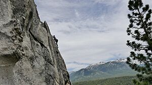
Meyers is a great spot for rock climbing.
Climbing Near Meyers
The famous Lovers Leap climbing area is only 20 minutes away. Meyers also has its own local climbing spots. One popular place is the Pie Shop on Sawmill Road.
The Pie Shop
The Pie Shop offers different types of climbing. There is a bouldering area right off the road. Bouldering involves climbing on large rocks without ropes. For those who like climbing with ropes, there is a sport and traditional climbing area. You can reach it after a short hike.
 | Aaron Henry |
 | T. R. M. Howard |
 | Jesse Jackson |


