South Lake Tahoe, California facts for kids
Quick facts for kids
South Lake Tahoe, California
|
||
|---|---|---|
| City of South Lake Tahoe | ||
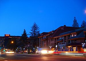
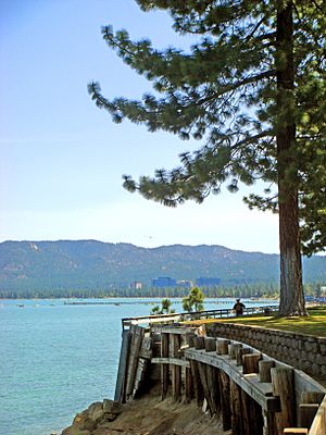
South Lake Tahoe near Heavenly Village
|
||
|
||
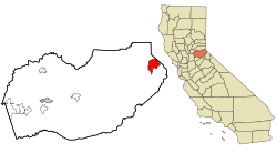
Location in El Dorado County and the state of California
|
||
| Country | United States | |
| State | ||
| County | El Dorado | |
| Incorporated | November 30, 1965 | |
| Government | ||
| • Type | Mayor-council | |
| Area | ||
| • Total | 16.60 sq mi (42.98 km2) | |
| • Land | 10.15 sq mi (26.30 km2) | |
| • Water | 6.44 sq mi (16.68 km2) 38.80% | |
| Elevation | 6,237 ft (1,901 m) | |
| Population
(2020)
|
||
| • Total | 21,330 | |
| • Density | 1,284.9/sq mi (496.28/km2) | |
| Time zone | UTC−8 (Pacific (PST)) | |
| • Summer (DST) | UTC−7 (PDT) | |
| ZIP code |
96150
|
|
| Area code(s) | 530 | |
| FIPS code | 06-73108 | |
| GNIS feature IDs | 1659822, 2411938 | |
| Climate | Dsb | |
South Lake Tahoe is a city in California, United States. It is located in the Sierra Nevada mountains, in El Dorado County. The city is the largest in El Dorado County.
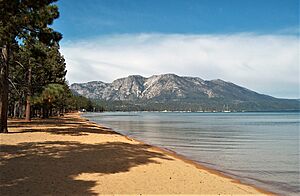
In 2020, about 21,330 people lived there. South Lake Tahoe is on the southern edge of Lake Tahoe. It stretches about 5 miles (8 km) along U.S. Route 50. This road is also known as Lake Tahoe Boulevard.
The eastern part of the city is close to the Nevada state line. This area is popular for tourists. It has many restaurants, hotels, and the Heavenly Mountain Resort. Casinos are just across the state line in Stateline, Nevada. The western part of the city is mostly for homes. It is centered around "The Y," where US 50 and State Route 89 meet.
Contents
Geography of South Lake Tahoe
South Lake Tahoe covers a total area of about 16.6 square miles (42.98 square kilometers). About 10.2 square miles (26.30 square kilometers) of this is land. The rest, 6.4 square miles (16.68 square kilometers), is water.
The city is located high up in the mountains. Its elevation is about 6,237 feet (1,901 meters) above sea level.
Population and People
| Historical population | |||
|---|---|---|---|
| Census | Pop. | %± | |
| 1970 | 12,921 | — | |
| 1980 | 20,681 | 60.1% | |
| 1990 | 21,586 | 4.4% | |
| 2000 | 23,609 | 9.4% | |
| 2010 | 21,403 | −9.3% | |
| 2020 | 21,330 | −0.3% | |
| U.S. Decennial Census | |||
The 2010 United States Census counted 21,403 people living in South Lake Tahoe. Most residents, about 73.5%, were White. Other groups included African American, Native American, Asian, and Pacific Islander people. About 31.1% of the population identified as Hispanic or Latino.
In 2020, the population slightly decreased to 21,330 people. This shows a small change from the 2010 numbers.
Education in South Lake Tahoe
The schools in South Lake Tahoe are part of the Lake Tahoe Unified School District. This district serves the city and nearby areas.
The district has four elementary schools:
- Bijou Community School
- Sierra House Elementary School
- Tahoe Valley Elementary School
- Lake Tahoe Environmental Science Magnet School
There is one middle school, South Tahoe Middle School. The high school is South Tahoe High School.
In 2004, two elementary schools, Al Tahoe and Meyers, closed due to budget cuts. However, Meyers Elementary School reopened a year later as the Lake Tahoe Environmental Science Magnet School.
South Lake Tahoe is also home to Lake Tahoe Community College. This college offers higher education for students. The city also hosts the Tahoe Prep Hockey Academy.
History of South Lake Tahoe
South Lake Tahoe became an official city in 1965. It was formed by joining several smaller communities. These included Al Tahoe, Bijou, Stateline, and Tahoe Valley. A post office was set up in 1967.
Gambling started in the Lake Tahoe area in 1944. Harvey's Wagon Wheel Saloon and Gambling Hall opened in Nevada. This was one of the first places for gaming. More places to stay were needed as competition grew.
By the 1950s, roads were kept clear all year. This made it easier for people to live there permanently. When the 1960 Winter Olympics were held nearby, Lake Tahoe became famous. It was known as a top skiing spot in the western United States.
In 2012, Lakeview Commons Park was given a new name. The Washoe Tribe suggested the name Tahnu Leweh. In their language, it means "all the people's place." This name was a gift to the area, symbolizing peace and goodness.
In August 2021, everyone in the city had to leave their homes. This was because of a large wildfire called the Caldor Fire.
Getting Around South Lake Tahoe
South Lake Tahoe has a main highway, U.S. 50. This road connects the area to Sacramento, California, and Carson City, Nevada. Sometimes, Highway 50 closes in winter because of bad weather.
The Lake Tahoe Airport is for smaller planes. For bigger planes and scheduled flights, the closest airport is Reno–Tahoe International Airport. This airport is in Reno, Nevada.
Local buses are run by the Tahoe Transportation District. El Dorado Transit also offers bus service. You can take a bus from South Lake Tahoe to Placerville and Sacramento.
Amtrak Thruway provides a daily bus connection. It goes to and from Sacramento Valley Station.
In 2024, the city started working on a new transit system. It is called South Tahoe Area Rapid Transit. This system will work with the existing Tahoe Transportation District services.
Landscape
Climate and Weather
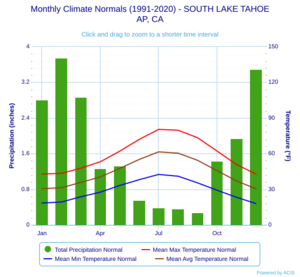
South Lake Tahoe has a snowy highland climate. Winters are cold with regular snowfall. Summers have warm or hot days and cool nights. The air is usually very dry.
The climate is sometimes called a dry-summer humid continental climate. This means it has cold winters and dry summers. August is usually the driest month, with very little rain. February gets the most rain and snow.
Winters can have a lot of snow. On average, South Lake Tahoe gets about 88 inches (224 cm) of snow each year. Some years have much more snow than others.
Temperatures can vary a lot. On average, there is only one day a year when the temperature reaches 90°F (32°C) or higher. This usually happens in July or August. It freezes almost every night for 223 days a year.
The highest temperature ever recorded was 99°F (37°C) in July 1988. The lowest was -29°F (-34°C) in December 1972 and February 1989.
| Climate data for South Lake Tahoe, California (Lake Tahoe Airport) (1991–2020 normals, extremes 1968–present) | |||||||||||||
|---|---|---|---|---|---|---|---|---|---|---|---|---|---|
| Month | Jan | Feb | Mar | Apr | May | Jun | Jul | Aug | Sep | Oct | Nov | Dec | Year |
| Record high °F (°C) | 66 (19) |
65 (18) |
71 (22) |
76 (24) |
84 (29) |
91 (33) |
99 (37) |
96 (36) |
94 (34) |
84 (29) |
71 (22) |
64 (18) |
99 (37) |
| Mean maximum °F (°C) | 54.4 (12.4) |
55.7 (13.2) |
61.4 (16.3) |
69.1 (20.6) |
76.9 (24.9) |
84.3 (29.1) |
88.8 (31.6) |
87.8 (31.0) |
83.7 (28.7) |
75.9 (24.4) |
64.9 (18.3) |
55.8 (13.2) |
89.7 (32.1) |
| Mean daily maximum °F (°C) | 42.8 (6.0) |
43.4 (6.3) |
47.8 (8.8) |
53.2 (11.8) |
62.1 (16.7) |
72.0 (22.2) |
80.4 (26.9) |
79.7 (26.5) |
73.4 (23.0) |
62.2 (16.8) |
50.9 (10.5) |
42.8 (6.0) |
59.2 (15.1) |
| Daily mean °F (°C) | 30.6 (−0.8) |
31.3 (−0.4) |
35.8 (2.1) |
40.4 (4.7) |
47.6 (8.7) |
55.1 (12.8) |
61.5 (16.4) |
60.4 (15.8) |
54.4 (12.4) |
45.7 (7.6) |
37.1 (2.8) |
30.4 (−0.9) |
44.2 (6.8) |
| Mean daily minimum °F (°C) | 18.4 (−7.6) |
19.3 (−7.1) |
23.7 (−4.6) |
27.6 (−2.4) |
33.2 (0.7) |
38.1 (3.4) |
42.5 (5.8) |
41.0 (5.0) |
35.4 (1.9) |
29.2 (−1.6) |
23.3 (−4.8) |
18.0 (−7.8) |
29.1 (−1.6) |
| Mean minimum °F (°C) | −1.3 (−18.5) |
1.7 (−16.8) |
6.5 (−14.2) |
16.4 (−8.7) |
23.9 (−4.5) |
28.4 (−2.0) |
33.8 (1.0) |
31.9 (−0.1) |
27.0 (−2.8) |
18.9 (−7.3) |
7.7 (−13.5) |
−0.9 (−18.3) |
−7.5 (−21.9) |
| Record low °F (°C) | −21 (−29) |
−29 (−34) |
−10 (−23) |
−1 (−18) |
7 (−14) |
21 (−6) |
25 (−4) |
24 (−4) |
19 (−7) |
9 (−13) |
−9 (−23) |
−29 (−34) |
−29 (−34) |
| Average precipitation inches (mm) | 2.81 (71) |
3.75 (95) |
2.87 (73) |
1.27 (32) |
1.32 (34) |
0.55 (14) |
0.39 (9.9) |
0.36 (9.1) |
0.28 (7.1) |
1.43 (36) |
1.94 (49) |
3.49 (89) |
20.46 (520) |
| Average snowfall inches (cm) | 24.1 (61) |
24.3 (62) |
20.9 (53) |
10.1 (26) |
2.0 (5.1) |
0.2 (0.51) |
0.0 (0.0) |
0.0 (0.0) |
0.2 (0.51) |
2.0 (5.1) |
9.7 (25) |
22.6 (57) |
116.1 (295.22) |
| Average precipitation days (≥ 0.01 in) | 8.6 | 8.7 | 10.0 | 8.4 | 7.4 | 2.4 | 2.1 | 1.5 | 2.3 | 5.4 | 7.5 | 10.8 | 75.1 |
| Average snowy days (≥ 0.1 in) | 6.7 | 6.3 | 5.7 | 3.5 | 1.0 | 0.2 | 0.0 | 0.0 | 0.1 | 0.4 | 3.5 | 6.4 | 33.8 |
| Source: NOAA | |||||||||||||
Major Fires Affecting South Lake Tahoe
The Angora Fire
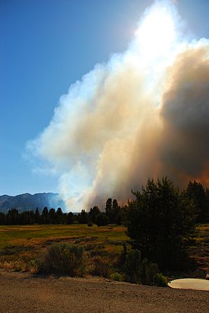
On June 24, 2007, a wildfire started near Meyers, just south of South Lake Tahoe. This fire was named the Angora Fire. It was the worst forest fire ever recorded in Lake Tahoe's history.
The fire quickly spread through the Angora area. It destroyed many homes and large parts of the forest. Roads were closed, and people had to leave their homes for safety. Hotels in the area helped by offering shelter to those who needed it.
On June 25, 2007, a state of emergency was declared. No one died in the fire. However, over 3,000 acres (12 square kilometers) of land were burned. More than 275 buildings, including 254 homes, were damaged or destroyed. The fire was fully put out by July 2.
The Caldor Fire
In August 2021, the entire city of South Lake Tahoe had to be evacuated. This was due to the large Caldor Fire that threatened the area.
See also
 In Spanish: South Lake Tahoe para niños
 | Bessie Coleman |
 | Spann Watson |
 | Jill E. Brown |
 | Sherman W. White |


