Middle Branch Chillisquaque Creek facts for kids
Quick facts for kids Middle Branch Chillisquaque Creek |
|
|---|---|

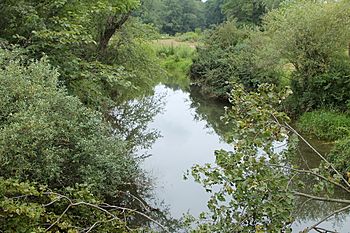
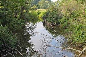
Middle Branch Chillisquaque Creek downstream of Lake Chillisquaque
|
|
| Physical characteristics | |
| Main source | valley in Madison Township, Columbia County, Pennsylvania 660 to 680 feet (200 to 210 m) |
| River mouth | Chillisquaque Creek in Derry Township, Montour County, Pennsylvania 522 ft (159 m) |
| Length | 5.2 mi (8.4 km) |
| Basin features | |
| Basin size | 9.64 sq mi (25.0 km2) |
The Middle Branch Chillisquaque Creek is a small stream in Pennsylvania, USA. It flows through parts of Columbia County and Montour County. This creek is about 5.2 miles (8.4 kilometers) long. It eventually joins the larger Chillisquaque Creek.
The creek's watershed, which is the area of land that drains into it, covers about 9.64 square miles (24.97 square kilometers). Many smaller streams, totaling about 14.35 miles (23.09 kilometers), also flow into this watershed. A special feature of the creek is Lake Chillisquaque, a large lake it flows through.
Contents
Where the Creek Flows
The Middle Branch Chillisquaque Creek starts in a valley in western Madison Township, Columbia County. From there, it flows southwest through the valley.
It then enters Anthony Township, Montour County. The creek continues southwest for a few miles before leaving the valley. It crosses under Pennsylvania Route 44, a main road. After this, the creek turns south and flows right through Lake Chillisquaque.
South of the lake, the creek moves through a flat area. It then leaves Anthony Township and enters Derry Township, Montour County. In Derry Township, the Middle Branch Chillisquaque Creek quickly meets the East Branch Chillisquaque Creek. When these two creeks join, they form the main Chillisquaque Creek.
The Middle Branch Chillisquaque Creek joins the main Chillisquaque Creek about 19.96 miles (32.12 kilometers) before the Chillisquaque Creek reaches its own end.
Water Health and Quality
The Middle Branch Chillisquaque Creek is an important part of the Chillisquaque Creek watershed. Sometimes, the creek experiences siltation, which means fine dirt and mud build up in the water. It has also been affected by changes to its natural flow, known as hydromodification and flow alteration.
The water temperature in the creek changes with the seasons. It can range from about 0 degrees Celsius (32 degrees Fahrenheit) in winter to 22 degrees Celsius (72 degrees Fahrenheit) in summer.
The water also contains different chemicals. The amount of alkalinity (which helps balance the water's acidity) can vary. The levels of nitrates and phosphates, which are nutrients, are quite high in the creek.
Creek's Land and Features
Near Pennsylvania Route 44, the Middle Branch Chillisquaque Creek is usually shallow, only a few inches to about a foot (30 centimeters) deep. However, sometimes it can be deeper, over 20 inches (50 centimeters).
The creek has many features that show how the land has changed. For example, there are 96 places where the land along the creek has eroded. This means the soil and rock have been worn away by the water. Many of these erosion spots are on the creek's banks.
Other features include 14 gravel bars (piles of gravel in the creek), 7 bridges crossing the water, 3 areas with riprap (rocks used to prevent erosion), and 2 pipes.
The land under the Middle Branch Chillisquaque Creek is owned by the public. Near where it joins the main Chillisquaque Creek, the water's elevation is about 522 feet (159 meters) above sea level. Closer to its beginning, the creek is much higher, between 860 feet (262 meters) and 880 feet (268 meters) above sea level.
The Creek's Watershed
The watershed of Middle Branch Chillisquaque Creek covers an area of about 6.94 square miles (17.97 square kilometers). This area includes all the land that drains water into the creek.
There are about 14.35 miles (23.09 kilometers) of streams within this watershed. Unfortunately, about 12.86 miles (20.69 kilometers) of these streams are not meeting water quality standards.
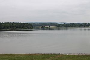
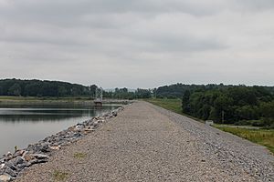
Lake Chillisquaque is a very important part of this watershed. It is a reservoir, which is a large artificial lake used to store water. It's the biggest lake in Montour County, covering 165 acres (67 hectares). The lake was created by a large earth-fill dam that is 2,000 feet (610 meters) long and 54 feet (16 meters) high. The Middle Branch Chillisquaque Creek is the most important stream that flows into Lake Chillisquaque.
History and Fun Facts
Lake Chillisquaque was built on the Middle Branch Chillisquaque Creek in 1972. Its first job was to provide cooling water for a nearby power plant.
Two bridges that are more than 20 feet (6 meters) long cross the creek. One was built in 1923 and is 43 feet (13.1 meters) long. The other was built in 1932 and is 28.9 feet (8.8 meters) long. Both of these bridges are made of concrete.
If you visit the Montour Preserve, you can walk on the Chillisquagi Trail, which crosses the Middle Branch Chillisquaque Creek.
The name Chillisquaque has an interesting history! It comes from a Native American word. It might mean "a place often visited by snowbirds" or it could mean "frozen duck."
Animals and Fish
Lake Chillisquaque is regularly stocked with fish by the Pennsylvania Fish and Boat Commission. This means they add fish to the lake so people can enjoy fishing. The Middle Branch Chillisquaque Creek itself is known as a warmwater fishery. This means its waters are suitable for fish that prefer warmer temperatures.
 | Misty Copeland |
 | Raven Wilkinson |
 | Debra Austin |
 | Aesha Ash |


