
Middle Level Navigations facts for kids
Quick facts for kids Middle Level Navigations |
|
|---|---|

The Mullicourt aqueduct where the Well Creek crosses the main drain
|
|
| Specifications | |
| Maximum boat length | 80 ft 0 in (24.38 m) |
| Maximum boat beam | 11 ft 0 in (3.35 m) |
| Locks | 6 |
| Status | Navigable |
| Navigation authority | Middle Level Commissioners |
| History | |
| Original owner | Bedford Level Commissioners |
| Geography | |
| Start point | Peterborough |
| End point | Salters Lode |
| Connects to | River Nene, River Great Ouse |
The Middle Level Navigations are a network of waterways in England. They are mainly used to drain land. This area is found in The Fens, between the River Nene and River Great Ouse. It lies between the cities of Peterborough and Cambridge. Most of this land is at or below sea level. People have tried to protect it from floods since 1480.
A Dutch engineer named Cornelius Vermuyden gave the Middle Level its name in 1642. He then built several channels to drain the land for farming. Water levels were always kept high enough for boats to travel. In 1754, Commissioners were set up to look after the waterways. They also collected money from boats carrying goods.
A new main drain was finished in 1848. This drain went to Wiggenhall St Germans. It helped drain the land better because its exit point was lower. Whittlesey Mere, the last big lake, was drained soon after. This was done using one of the first centrifugal pumps. This pump was shown at the Great Exhibition in 1851.
Boat traffic on the waterways started to slow down after a railway opened in March in 1846. It dropped a lot in the early 1900s. The last regular commercial boat was Shellfen. This tanker delivered fuel to pumping stations until 1971.
As the land was drained, it kept sinking. So, in 1934, a pumping station replaced the old gravity drain at Wiggenhall St Germans. This station had three large diesel pumps. Its power was increased in 1951 and again in 1969–70. In 1998, the station ran for over 50 hours non-stop. This led to a new, even bigger pumping station being built. It was finished in 2010 and became the second largest in Europe. Most of the Middle Levels drainage now depends on pumping. The Commissioners manage over 100 pumping stations in the area.
People became interested in using the Middle Levels for fun boat trips in 1949. The first big volunteer effort happened in 1972. Volunteers worked to fix Well Creek, which reopened in 1975. Since then, locks have been made longer. This allows modern narrowboats to use them. The old locks were built for Fen Lighters, which were only 49 feet (15 m) long. In 2006, soldiers from the Royal Engineers helped make the southern waterways easier to reach. They raised a low Bailey bridge. The Middle Level Commissioners manage the system. They are the fourth largest navigation authority in Great Britain.
Contents
History of the Middle Levels
The Middle Levels of the Fens cover about 270 square miles (700 km2). Much of this land is at or below sea level. People started trying to protect it from floods in 1480. They also wanted to make it good for farming.
Early Drainage Efforts
In 1480, John Morton, the Bishop of Ely, built a 12-mile (19 km) straight channel. It ran from Stanground to Guyhirne. This channel gave the River Nene a more direct path to the sea. Before, the river took a longer route through Benwick and March. Morton's Leam, as it was called, was 40 feet (12 m) wide and 4 feet (1.2 m) deep. Many prisoners of war from the Hundred Years' War helped dig it.
In 1605, Sir John Popham, a top judge, started a drainage plan near Upwell. This plan was stopped in 1608. But his 5.6-mile (9.0 km) channel, Popham's Eau, still exists. It runs from the old River Nene near March to Well Creek at Nordelph.
Building the Waterway Network
A big step forward happened in 1630. Cornelius Vermuyden, a Dutch engineer, was hired to drain the Fens. He worked for the Earl of Bedford and others. The Old Bedford River was dug from Earith to Salters Lode. This was a distance of 21 miles (34 km). It drained the land enough for summer grazing.
In 1642, Vermuyden wrote a paper about draining the Fens. He suggested dividing the Fens into three areas: the North Level, the South Level, and the Middle Level in between. The Middle Level stretched from Morton's Leam to the Bedford River. An Act of Parliament was passed in 1649. Work began under Vermuyden's guidance. The New Bedford River was built next to the Old one. This helped protect the Middle Levels area.
Soon after, the Forty Foot, Twenty Foot, and Sixteen Foot Rivers were dug. These channels carried water from the area to Salters Lode and Welches Dam. The Middle Level also included 26 miles (42 km) of the old River Nene. It had ancient man-made waterways like King's Dyke and Whittlesey Dyke. These connect Stanground to Floods Ferry. To the north is Well Creek. Most of Well Creek was a natural waterway. The last part to Salters Lode Lock follows a drainage channel built in the early 1500s.
The main purpose of these waterways was drainage. But water levels were also kept high enough for boats. We don't have many records of how much traffic there was, especially in the early days.
Within the Middle Level, there were four large lakes, or meres. The biggest was Whittlesey Mere. People used it for boating fun. Celia Fiennes described it in 1697. She said it was 6 miles (9.7 km) long and 3 miles (4.8 km) wide. She also noted it could be dangerous because of sudden strong winds.
To keep the route open between Salters Lode Sluice on the Great Ouse and Stanground Sluice on the River Nene, another law was passed in 1754. This law created Commissioners to manage the waterways. They could charge 3d per ton for goods entering the system. Farm products went through Salters Lode to King's Lynn. Coal, timber, and groceries came the other way. Pleasure boats did not have to pay tolls. Also, some farm products like manure and certain animal feeds were free.
George Walpole, 3rd Earl of Orford wrote about his boat trip around the Fens in 1774. He traveled with nine boats. A single horse named Hippopotamus pulled them when there wasn't enough wind for sailing. Carpenters had to lift or remove bridges that were too low for the boats. The trip lasted 22 days. Walpole only saw one group of lighters (barges) that held them up at Salters Lode.
In 1796, the Wisbech Canal opened. This canal connected Well Creek at Outwell to the River Nene at Wisbech. It followed the path of an old waterway called the Wellstream. At Outwell, Well Creek also meets the old course of the River Nene.
Modern Pumping Stations

Draining the light, peaty soils caused the land to shrink even more. Land levels kept falling. By the late 1920s, simply letting water flow out by gravity was not enough to prevent floods. So, they started using pumps to drain the land.
A new sluice (a gate to control water flow) and pumping station were built at St Germans. This was finished in 1934. The pumping station had three large pumps. Each pump could move 840 tons of water per minute. This is like 1,234 million liters per day. The new station was paid for with a grant. The condition was that three-quarters of the workers had to be from the local area.
The station's pumping power was increased in 1951. Another pump was added. In 1969–70, two of the old engines were replaced with electric motors.
From 1977 to 1983, more improvements were made. A pumping station was built at Tebbits Bridge. This stopped boats from going along that channel to the southern Middle Levels. A new lock was built at Lodes End to offer another route. The banks of the Old River Nene were raised. Clay was used to help hold the water. Major improvements were also made to the Forty Foot, Twenty Foot, and Sixteen Foot rivers. This helped keep water levels high enough for boats. All the bridges on the Sixteen Foot River were taken down and rebuilt. This made the channels wider, as the old narrow bridges slowed water flow during heavy rain. The St Germans pumping station was also upgraded again. These changes have made it harder to navigate in the lower southwest area. However, they have greatly improved flood protection.
The Tebbitt's Bridge pumping station has six large pumps. Each pump can move 260 million liters of water per day. Three pumps are powered by electric motors and work automatically. The other three are powered by diesel engines and are controlled by hand. There is also a backup generator in case the electricity goes out. When all six pumps are working, the station can pump 18 tons of water per second.
In April 1998, the St Germans pumping station ran at full power for over 50 hours. It was pumping 71 tons of water per second. This led to the decision to build a brand new station. The new station would be 40% more powerful. Work started in December 2006. The new pumping station is the second largest in Europe. It has a glass wall so visitors can see the pumps. The new station started working on April 22, 2010. The old station was then taken down. A special opening ceremony was held on April 20, 2011. Lord James Russell opened the station. He is a descendant of the Earl of Bedford, who started draining the Fens in the 1600s. There are over one hundred smaller pumping stations throughout the system. They help keep water levels right and prevent flooding.
Restoring the Waterways

People in the local area started wanting to restore the Middle Levels for boating fun in 1949. The Fenlands Branch of the Inland Waterways Association was formed. They decided to focus on the Middle Levels. At the time, the waterways were full of weeds and mud.
Salters Lode lock was rebuilt in 1963. But it was still very hard to travel along Well Creek. In 1964, two groups, the East Anglian Waterways Association and the Middle Level Watermans Club, started asking for it to be dredged. The first big volunteer work party happened in 1972. The Well Creek Trust organized a project called 'Fenatic'. They drained the creek to clear out rubbish. It was reopened for boats in 1975.
When the waterways were first built, they used traditional Fen Lighters. These boats were 46 by 11 feet (14.0 by 3.4 m). The locks were built to fit these boats. However, there has been a plan to make the locks bigger. This allows standard narrowboats to use the waterways. Lodes End lock was 65 feet (20 m) long when it was built. The lock at Marmount Priory was made longer to 92 feet (28 m). Ashline lock was extended to 90 feet (27 m). Stanground lock was made 80 feet (24 m) long. Horseway lock was made 60 feet (18 m) long. The new Ashline lock reopened on April 1, 1999.
Salter's Lode lock has three sets of gates. One is a guillotine gate at the tidal end. The other two are mitre gates. These allow boats up to 62 feet (19 m) long to enter the River Ouse. This happens when the river level is higher than Well Creek. Longer boats could sometimes pass straight through at certain tides. But the lock has been made longer to 80 feet (24 m). This was done by adding a third set of mitre gates. These gates face away from the river. They can only be used when the river level is lower than the Creek. Welches Dam Lock is still only 47 feet (14 m) long. It is still sized for Fen Lighters.
Access to the southern parts of the Levels got better in 2006. Soldiers from the 53rd Field Squadron of the Royal Engineers raised a Bailey bridge at Ramsey Hollow. This bridge used to be very low and blocked boats. The soldiers raised it by 3 ft (0.9 m). The Inland Waterways Association helped pay for the extra materials. This reconstruction opened up a 33-mile (53 km) cruising route on the Levels.
The Middle Levels Today

The Middle Level Commissioners manage the waterways. They are in charge of about 120 miles (190 km) of waterway. Around 100 miles (160 km) of this can be used by boats. The Commissioners also look after six locks and many pumping stations. They are the fourth largest navigation authority in Great Britain.
The Middle Level Navigations often act as a shortcut for boaters. They connect the River Nene at Peterborough to the River Great Ouse at Salters Lode Lock. The suggested route goes through Stanground Sluice. Then it follows King's Dyke to Ashline Lock. After that, it goes along Whittlesey Dike to Flood's Ferry junction. From there, the route follows the old course of the River Nene. It passes through the twin villages of Outwell and Upwell. The abandoned Wisbech Canal used to connect here back to the new River Nene. The last part to Salters Lode lock is along Well Creek. Boats pass over the Middle Level Main Drain on Mullicourt Aqueduct.
Another route, via Horseway sluice and the Old Bedford River, cannot be used. The lock at Welches Dam was closed in 2006 because it was unsafe. Also, reeds have grown thick in the channel. Very low water levels between Horseway sluice and Welches Dam lock often stopped boats. However, this route might be improved in the future. It is part of the Fens Waterways Link project. This project plans to improve the route through the Middle Levels from Stanground to Salters Lode and to Welches Dam.
Points of Interest Along the Waterways
| Point | Coordinates (Links to map resources) |
OS Grid Ref | Notes |
|---|---|---|---|
| St Germans pumping station | 52°42′12″N 0°21′02″E / 52.7033°N 0.3505°E | TF589143 | main outfall |
| Salters Lode Lock | 52°35′23″N 0°20′25″E / 52.5898°N 0.3403°E | TF586016 | access to River Great Ouse |
| Mullicourt Aqueduct | 52°36′09″N 0°15′32″E / 52.6025°N 0.2590°E | TF530029 | crosses main drain |
| Marmount Priory Lock | 52°35′22″N 0°11′43″E / 52.5894°N 0.1953°E | TF488013 | |
| Horseway Sluice | 52°27′41″N 0°06′42″E / 52.4614°N 0.1118°E | TL435869 | unusable in 2013 |
| Ashline Lock | 52°33′03″N 0°07′30″W / 52.5509°N 0.1250°W | TL272964 | |
| Stanground Sluice | 52°33′36″N 0°13′06″W / 52.5601°N 0.2182°W | TL208972 | access to River Nene |
| Lodes End Lock | 52°28′08″N 0°06′25″W / 52.4689°N 0.1070°W | TL286873 | |
| Tebbits Bridge pumping station | 52°30′19″N 0°09′54″W / 52.5054°N 0.1649°W | TL246913 |
Images for kids
-
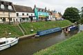
Moorings on the Old River Nene at March

