
Middleville, New York facts for kids
Quick facts for kids
Middleville, New York
|
|
|---|---|
|
Village
|
|

Looking north toward Middleville as New York State Route 169 ends.
|
|

Middleville, New York
Location in New York

Middleville, New York
Location in the United States
|
|
| Country | United States |
| State | New York |
| County | Herkimer |
| Towns | Fairfield, Newport |
| Area | |
| • Total | 0.82 sq mi (2.11 km2) |
| • Land | 0.77 sq mi (1.98 km2) |
| • Water | 0.05 sq mi (0.13 km2) |
| Elevation | 597 ft (182 m) |
| Population
(2020)
|
|
| • Total | 407 |
| • Density | 532.03/sq mi (205.41/km2) |
| Time zone | UTC-5 (Eastern (EST)) |
| • Summer (DST) | UTC-4 (EDT) |
| ZIP code |
13406
|
| Area code(s) | 315 |
| FIPS code | 36-47108 |
| GNIS feature ID | 0957158 |
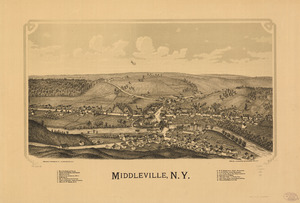
Middleville is a small village located in Herkimer County, New York, United States. In 2020, the village had a population of 407 people.
Middleville is special because it sits on both sides of West Canada Creek. This creek forms the border between two towns: Newport and Fairfield. The village is about 8.5 miles (13.7 km) north of Herkimer and about 17 miles (27 km) east of Utica.
History of Middleville
People first started settling in the Middleville area around 1806. They bought land and began building homes and businesses. The village officially became a village (this is called incorporated) in 1890. This happened ten years after the railroad came to the area, which helped the community grow.
Two old bridges in Middleville are very important historically. They are the Lalino Stone Arch Bridge and the Route 29 Stone Arch Bridge. Both of these bridges are listed on the National Register of Historic Places. This means they are recognized as important historical sites.
Geography and Location
Middleville is located in the middle part of Herkimer County. Its exact coordinates are 43°8′18″N 74°58′10″W. The village covers a total area of about 0.82 square miles (2.1 square kilometers). Most of this area is land, with a small part being water.
The West Canada Creek flows right through the center of Middleville. This creek is a tributary of the Mohawk River, meaning it flows into the Mohawk River. Another smaller creek, Maltanner Creek, also joins West Canada Creek within the village.
Several important roads meet in Middleville. These include New York State Route 28, New York State Route 29, and New York State Route 169. Route 29 starts here and goes east to Dolgeville. Route 169 also starts here and goes southeast to Little Falls. Route 28 goes south to Herkimer village and north to Poland.
Population Changes
| Historical population | |||
|---|---|---|---|
| Census | Pop. | %± | |
| 1880 | 533 | — | |
| 1900 | 567 | — | |
| 1910 | 625 | 10.2% | |
| 1920 | 790 | 26.4% | |
| 1930 | 760 | −3.8% | |
| 1940 | 612 | −19.5% | |
| 1950 | 647 | 5.7% | |
| 1960 | 648 | 0.2% | |
| 1970 | 725 | 11.9% | |
| 1980 | 647 | −10.8% | |
| 1990 | 624 | −3.6% | |
| 2000 | 550 | −11.9% | |
| 2010 | 512 | −6.9% | |
| 2020 | 407 | −20.5% | |
| U.S. Decennial Census | |||
The population of Middleville has changed over the years. In 1880, there were 533 people living in the village. The population grew to its highest point in 1920, with 790 residents. Since then, the number of people living in Middleville has slowly decreased. In 2020, the population was 407.
In 2000, there were 550 people living in Middleville. About 31.8% of the homes had children under 18 living there. The average age of people in the village was 43 years old.
See also
 In Spanish: Middleville (Nueva York) para niños
