Millwood, Washington facts for kids
Quick facts for kids
Millwood
|
|
|---|---|
 |
|

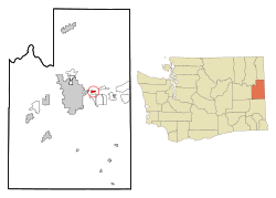
Location of Millwood, Washington
|
|
| Country | United States |
| State | Washington |
| County | Spokane |
| Area | |
| • Total | 0.70 sq mi (1.82 km2) |
| • Land | 0.70 sq mi (1.80 km2) |
| • Water | 0.01 sq mi (0.01 km2) |
| Elevation | 1,972 ft (601 m) |
| Population
(2010)
|
|
| • Total | 1,786 |
| • Estimate
(2019)
|
1,800 |
| • Density | 2,586.21/sq mi (998.38/km2) |
| Time zone | UTC-8 (Pacific (PST)) |
| • Summer (DST) | UTC-7 (PDT) |
| ZIP code |
99212
|
| Area code | 509 |
| FIPS code | 53-45985 |
| GNIS feature ID | 1512466 |
| Website | millwoodwa.us |
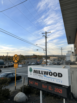
Millwood is a small city in Spokane County, Washington, in the United States. In 2010, about 1,786 people lived there. It's like a neighborhood of the bigger city of Spokane. The city of Spokane Valley surrounds Millwood on three sides. The Spokane River flows along the northern edge of the city. Millwood is also home to the Millwood Historic District, which is a special place listed on the National Register of Historic Places.
Contents
History of Millwood
Millwood officially became a city on October 26, 1927. It got its name from a local sawmill.
The area was first called "Woodard's" around 1900. This was because the Woodard family owned the land near the Spokane-Coeur d'Alene Electric Railway. Later, the Inland Empire Paper Company built a paper mill here. They wanted to change the town's name to "Milltown."
Railway officials didn't agree unless the Woodard family said yes. So, they found a middle ground. They combined "mill" from the paper mill with the first four letters of "Woodard." This is how the name "Millwood" came to be.
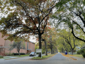
The Rosebush House is in the middle of Millwood. It is one of the best-preserved old homes in the city. This house is also listed on the U.S. National Register of Historic Places.
Geography and Location
Millwood is located at 47°41′8″N 117°17′3″W / 47.68556°N 117.28417°W. It covers a total area of about 0.73 square miles (1.89 square kilometers). Most of this area, about 0.70 square miles (1.81 square kilometers), is land. A small part, about 0.03 square miles (0.08 square kilometers), is water.
The city is mostly flat because it sits in the Spokane Valley. However, the land gently slopes down towards the north. The Spokane River forms the northern border of the town. The ground drops about 20 feet down to the river bank there.
Major Roads and Transportation
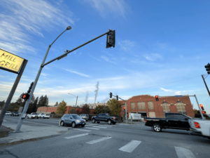
Two important roads go through Millwood. Argonne Road cuts through the city. It crosses the Spokane River, which is the only river crossing for cars for several miles. Trent Avenue, also known as Washington State Route 290, marks the southern edge of the city.
A shopping center is located where Argonne Road and Trent Avenue meet. The Argonne exit for Interstate 90 is about half a mile south of Millwood.
West Valley High School is on the western border of Millwood. This school serves students from Millwood and nearby areas.
Climate in Millwood
Millwood has a climate known as a "warm-summer Mediterranean climate." This means the summers are warm but not extremely hot, and they are usually dry. The average monthly temperatures do not go above 71.6°F (22°C).
Population and People
| Historical population | |||
|---|---|---|---|
| Census | Pop. | %± | |
| 1930 | 493 | — | |
| 1940 | 717 | 45.4% | |
| 1950 | 1,240 | 72.9% | |
| 1960 | 1,776 | 43.2% | |
| 1970 | 1,770 | −0.3% | |
| 1980 | 1,717 | −3.0% | |
| 1990 | 1,559 | −9.2% | |
| 2000 | 1,649 | 5.8% | |
| 2010 | 1,786 | 8.3% | |
| 2020 | 1,881 | 5.3% | |
| U.S. Decennial Census | |||
2010 Census Information
According to the 2010 census, 1,786 people lived in Millwood. There were 751 households, which are groups of people living together. The average number of people in each household was about 2.37.
The average age of people in Millwood was 40.1 years old.
- About 22.6% of residents were under 18 years old.
- About 7.3% were between 18 and 24 years old.
- About 27.5% were between 25 and 44 years old.
- About 29.6% were between 45 and 64 years old.
- About 13% were 65 years old or older.
The population was almost evenly split between males and females. About 49.8% were male and 50.2% were female.
See also
 In Spanish: Millwood (Washington) para niños
 | John T. Biggers |
 | Thomas Blackshear |
 | Mark Bradford |
 | Beverly Buchanan |


