Mission Valley, San Diego facts for kids
Quick facts for kids
Mission Valley, San Diego
|
|
|---|---|
| Mission Valley | |

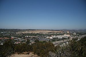
Central Mission Valley viewed from University Heights Park
|
|
| Country | |
| State | |
| County | |
| City | |
Mission Valley is a wide river valley in San Diego, California. The San Diego River flows through it, heading west to the Pacific Ocean. For planning, the City of San Diego divides it into two neighborhoods: Mission Valley East and Mission Valley West.
This valley was the site of the first Spanish settlement in California. This happened way back in 1769. Today, Mission Valley is a major place for shopping and fun in San Diego. You can also find many apartments and condos here.
Contents
History of Mission Valley
The San Diego River valley was first called Emat Kuseyaay by the Kumeyaay people. The Spanish later named it La Cañada de San Diego. "Cañada" means gully or glen in Spanish. In the 1860s, its name changed to Mission Valley. This new name honored Mission San Diego de Alcalá.
Early Inhabitants and Spanish Settlement
For over 10,000 years, the Mission Valley area was home to the Kumeyaay Indians. They had many villages here, like Nipaquay (Nipawai), Haiir, and Cosoy (Kosa'aay).
The first Spanish settlement in what is now California was built here. It included the Presidio of San Diego and Mission San Diego de Alcalá. Both were started in 1769, right next to the Kumeyaay village of Cosoy. The Presidio and Mission were at the west end of Mission Valley. This area is now known as Old Town.
In 1774, the Mission was moved. It went to its current spot at the east end of Mission Valley. This move was made to get better access to fresh water for drinking and farming.
Growth and Development Over Time
Until the 1940s, Mission Valley was mostly undeveloped. It had dairy farms and other farms. The city of San Diego was mainly south of the valley. After World War II, the city started to grow into the valley. The last dairy farms in the valley closed in the early 1960s.
Another early activity in Mission Valley was digging for sand and gravel. A large quarry on the north side of the valley operated for most of the 1900s. The quarry stopped working around 2000. Now, it's the site of a new mixed-use development called Civita.
Development of Mission Valley really began in 1953. That's when the first hotel was built in what is now Hotel Circle. In 1958, the city council approved building San Diego's first big shopping center. The Mission Valley Center (now Westfield Mission Valley) opened in 1961. Many other large shopping malls followed.
In the late 1950s and early 1960s, the U.S. 80 freeway was built. This road, now Interstate 8, goes right through Mission Valley. It made the area even easier to develop.
Sports and Entertainment Venues
Westgate Park, a baseball stadium, was built in Mission Valley in 1957. It was home to the San Diego Padres, who were a minor league team then. In 1967, San Diego Stadium opened. The Padres moved there and became a major league team the next year. Westgate Park was torn down in 1969. The Fashion Valley Mall was built in its place. San Diego Stadium was demolished in 2021. Snapdragon Stadium was built there in 2022.
Where is Mission Valley?
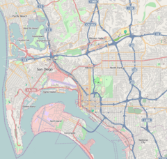
Mission Valley stretches from Interstate 5 in the west to Interstate 15 in the east. The exact line between Mission Valley East and West is State Route 163.
Getting Around Mission Valley
Mission Valley is a key route for Interstate 8. Interstate 5 crosses the valley at its western end. Both I-8 and I-5 are major roads for San Diego. They help people travel east-west and north-south.
At the Jack Schrade Interchange, Interstate 805 crosses Mission Valley and connects with Interstate 8. Interstate 15 and State Route 163 also cross Mission Valley and connect with Interstate 8.
The Green Line of the San Diego Trolley system also runs through Mission Valley. The main place for buses is the Fashion Valley Transit Center and Mall. Other trolley stations in the valley include:
- Morena/Linda Vista
- Hazard Center
- Mission Valley Center
- Rio Vista
- Fenton Parkway
- Stadium
Fun Things to Do in Mission Valley
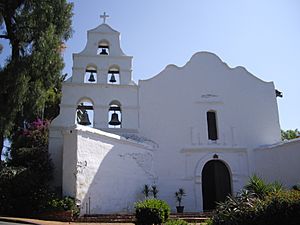
Toward the eastern end of Mission Valley, you'll find Mission San Diego de Alcalá. The valley is named after this historic mission. Overlooking the valley at the southwest end is Presidio Park. At the bottom of Presidio Hill is Old Town San Diego State Historic Park. This was the very first site of the town of San Diego. All three of these places are listed on the National Register of Historic Places.
Shopping and Hotels
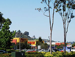
Three big shopping malls in Mission Valley are Fashion Valley Mall, Hazard Center Mall, and Westfield Mission Valley. Many other businesses are also in the area. These include smaller shopping centers, car dealerships, and schools. The roads next to Interstate 8 west of Highway 163 are called Hotel Circle North and Hotel Circle South. This is because so many hotels and motels are located there. The roads east of Highway 163 are called Camino del Rio North and Camino del Rio South.
Sports and Other Attractions
The recently built Snapdragon Stadium is in Mission Valley East. It's near where I-8 and I-15 meet. At the very end of Mission Valley, close to the ocean, you'll find SeaWorld, Mission Bay, and other fun San Diego attractions.
 | Bayard Rustin |
 | Jeannette Carter |
 | Jeremiah A. Brown |


